September 2018
|
National Parks visited: Seven
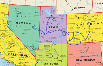
Great Sand Dunes NP in Colorado Black Canyon of the Gunnison NP in Colorado Mesa Verde NP in Colorado Arches NP in Utah Canyonlands NP in Utah Capital Reef NP in Utah Great Basin NP in Nevada |
Indian Country and Southwest US Road Trip
9-Day Road Trip starts in Denver, CO and ends in Salt Lake City, UT
After an exhilarated 2100 miles of driving, crisscrossed 5 states: Colorado, Utah, Nevada, Arizona, New Mexico, and visited 7 national parks: Great Sand Dunes NP, Black Canyon of the Gunnison NP, Mesa Verde NP, Arches NP, Canyonlands NP, Capital Reef NP, Great Basin NP, we came home in awe of what we saw. This land is like no other, vast and wild, diverse in natural beauty, fascinating in Native American history. From magnificent Colorado mountain views to the vast desert of the west with breath taken sceneries in between, we were totally impressed. On top of what we experienced, traveling in September gave us additional advantages of less crowded parks, not as scorching hot as in the summer months, and most of all, the spectacular view of fall foliage.
As Ray Bradbury said “Stuff your eyes with wonder, live as if you’d drop dead in ten seconds. See the world. It’s more fantastic than any dream made or paid for in factories.”
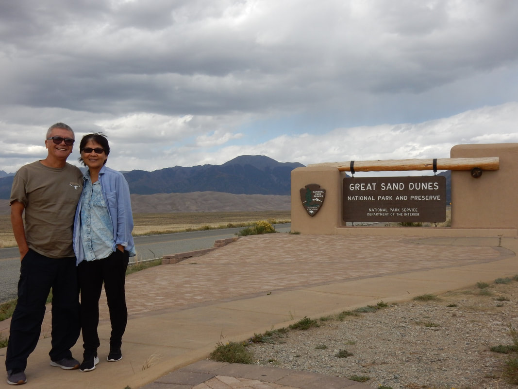
Day01 – Great Sand Dunes National Park, Colorado
Overnight: Alamosa, CO
Driving Distance:
Denver to Colorado Springs: 1 h 13 min (70.8 mi) via I-25 S
Colorado Springs to Great Sand Dunes NP: 2 h 38 min (169.2 mi) via I-25 S and US-160 W
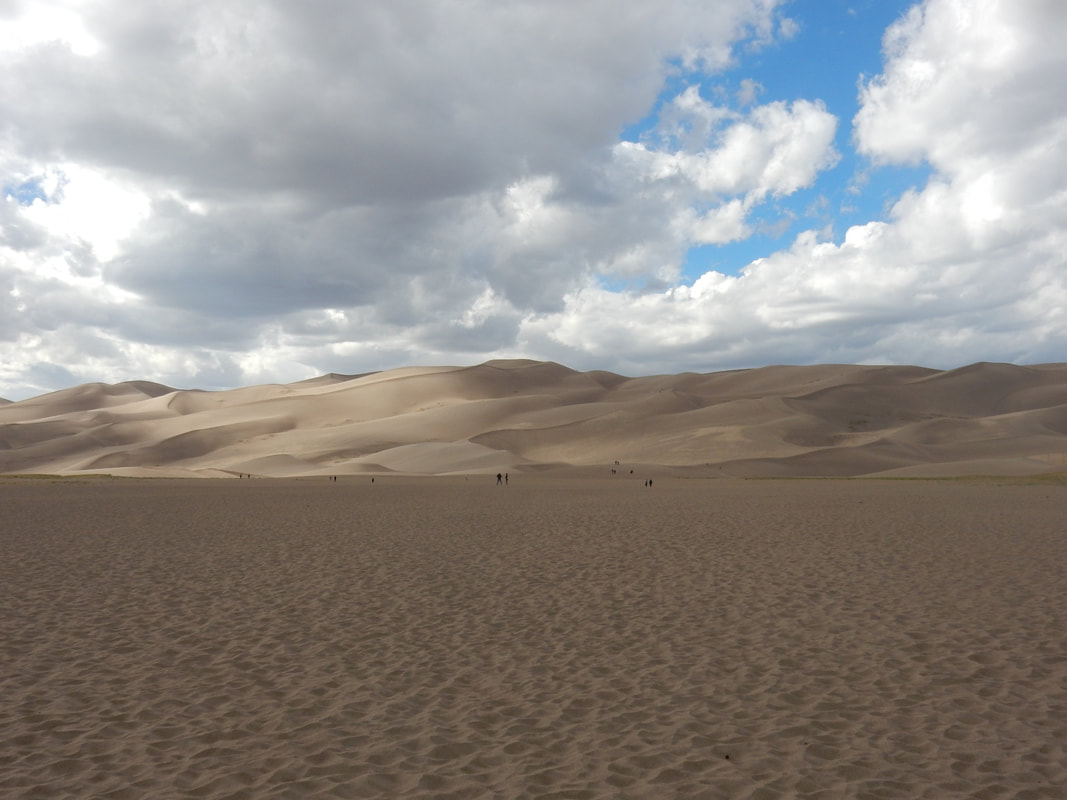
“Great Sand Dunes National Park and Preserve is in southern Colorado. It’s known for huge dunes like the towering Star Dune, and for the seasonal Medano Creek and beach created at the base of the dunes. The backcountry Medano Pass Primitive Road winds through a canyon toward the Sangre de Cristo Mountains. Trails lead to forests, wetlands and alpine lakes like Medano Lake, which is home to trout and tundra wildlife.” Wikipedia
We arrived in Denver by air early in the morning then proceeded to pick up a rental SUV for our road trip. We had decided to return the rental car in Salt Lake City when we finished our road trip since the one-way rental is cheaper than returning the car at the original pick-up location for this particular trip. Heading south, we drove pass Colorado Springs, home of the U.S. Air Force Academy. It was quite an impressive view from the distance of the facility with giant airplane parks near it. We zigzagged thru the charming little town of Walsenburg on Interstate 25. We then took the CO 160 highway west, then CO 150 north to the park.
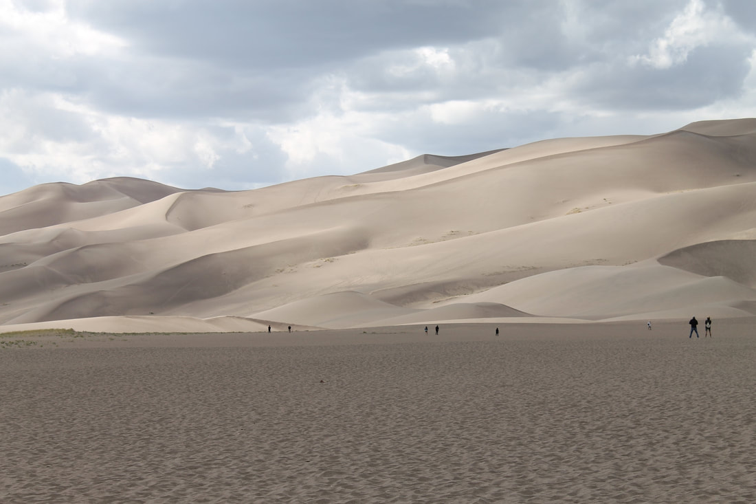
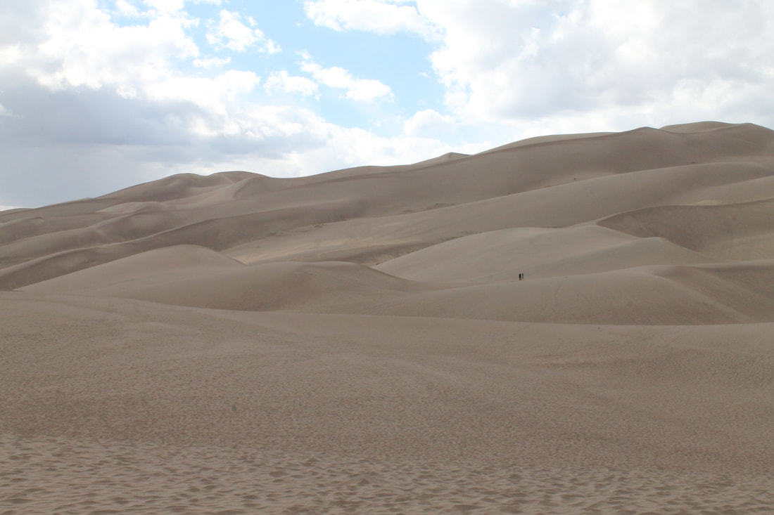
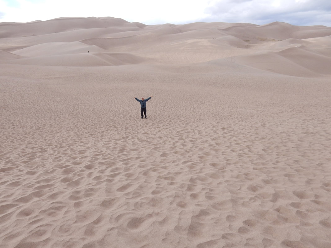
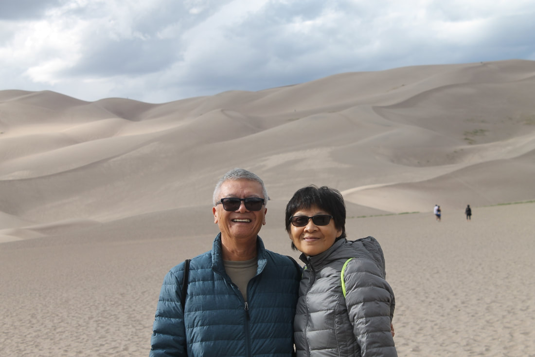
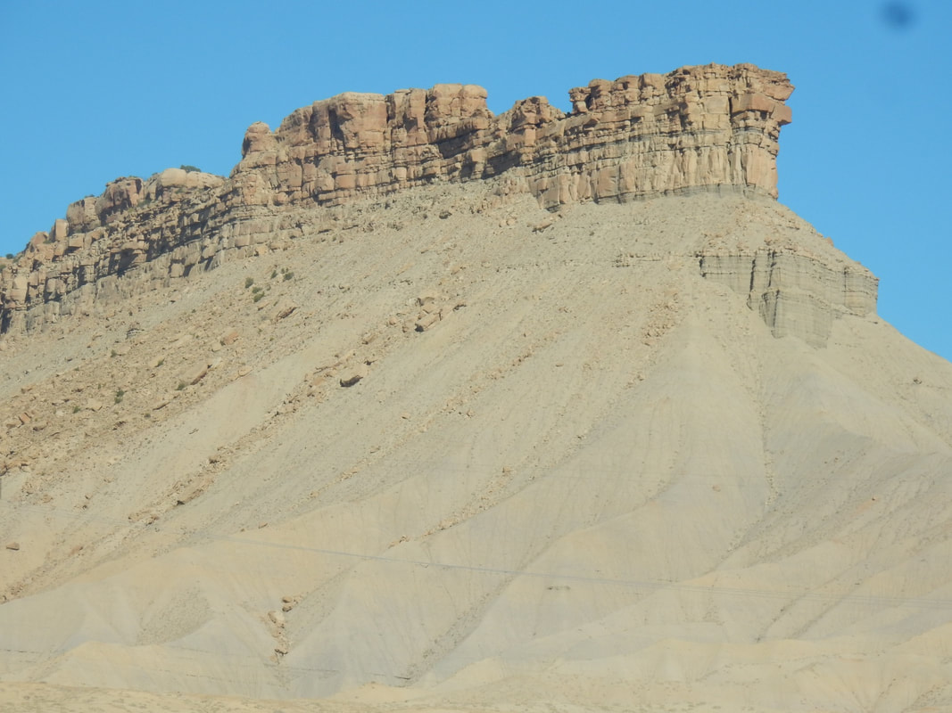
It was totally unexpected of what I thought of the terrain. I was shocked; all I can say was WOW. In front of us were the massive, spectacular sand dunes with the backdrop of Sangre de Cristo Mountains. As we drove into the park, the landscape slowly appeared before us, getting bigger and bigger like a slow motion movie. During certain time of the year when the Medano creek is full of water fed from the melting of mountain snow, it turns this area into a seasonal beach front. The dunes are created by the constant shifting of wind and relentless water. In the summer months, the temperature can be scotching here, so be aware.
We walked and enjoyed the magic dunes for couple of hours, saw people frolicking in the vast sand dunes; some enjoyed snowboarding on these steep sandy slopes.
Along the way, I noticed there were a lot of RVs, big ones, small ones, some big ones with extra car towed behind, one small one looked pretty beat-up but yet seemed to be full of spirit evidently with stickers all over the back of its window as to show other fellow travelers of where it had been.
I saw a hippy girl with a pick up truck converted into a camper with the North Carolina’s license plate. She dressed like the flower child of the 60s. I saw her lift up the gate in the back of the truck and pulled out a loaf of bread and a jar of peanut butter getting ready for her lunch; among them were sleeping bag, hiking boots, and camping gears. As one can tell, you don’t have to travel on a private jet to have fun. Just an old truck packed with bare necessities, yearning for the open road, full of adventurous spirit and that’s all it takes.
We spent half a day here at the park, just wandering around the sand dunes; it was hard on your feet walking on the steep slope of sliding sand but it was well worth it with the awesome view. Tonight I felt a little headache, a little unusual for me, and come to find out that Alamosa is about 7500 feet high in altitude. Yes, I can feel it. The high altitude got me, a little dizzy, a little lightheaded.
Tonight, we stayed in Alamosa, CO, a nice little town home of Adam State University, of about 3,700 students.
Day02 – Black Canyon of the Gunnison National Park, Colorado
Overnight: Montrose, CO
Driving Distance: Alamosa to Black Canyon of the Gunnison NP: 3h22min (184.3 mi) via CO-114W & US-50W
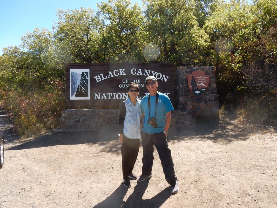
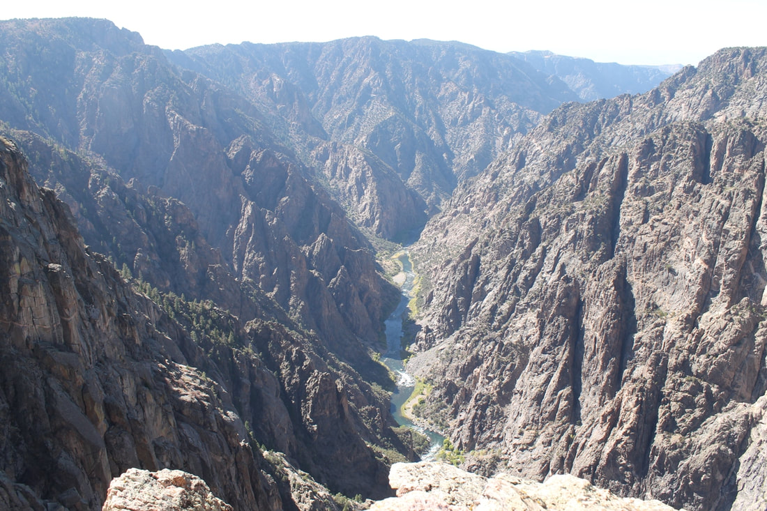
“Black Canyon of the Gunnison National Park is in western Colorado. It surrounds part of a deep, steep-walled gorge carved through Precambrian rock by the Gunnison River. Roads and trails along the north and south rims have views of the Black Canyon's dramatic drops and the striated Painted Wall cliff. The winding East Portal Road descends to the river. Wildlife includes mule deer, elk and golden eagles” Wikipedia
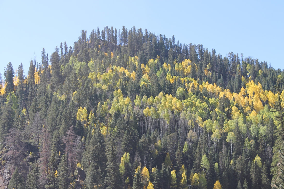
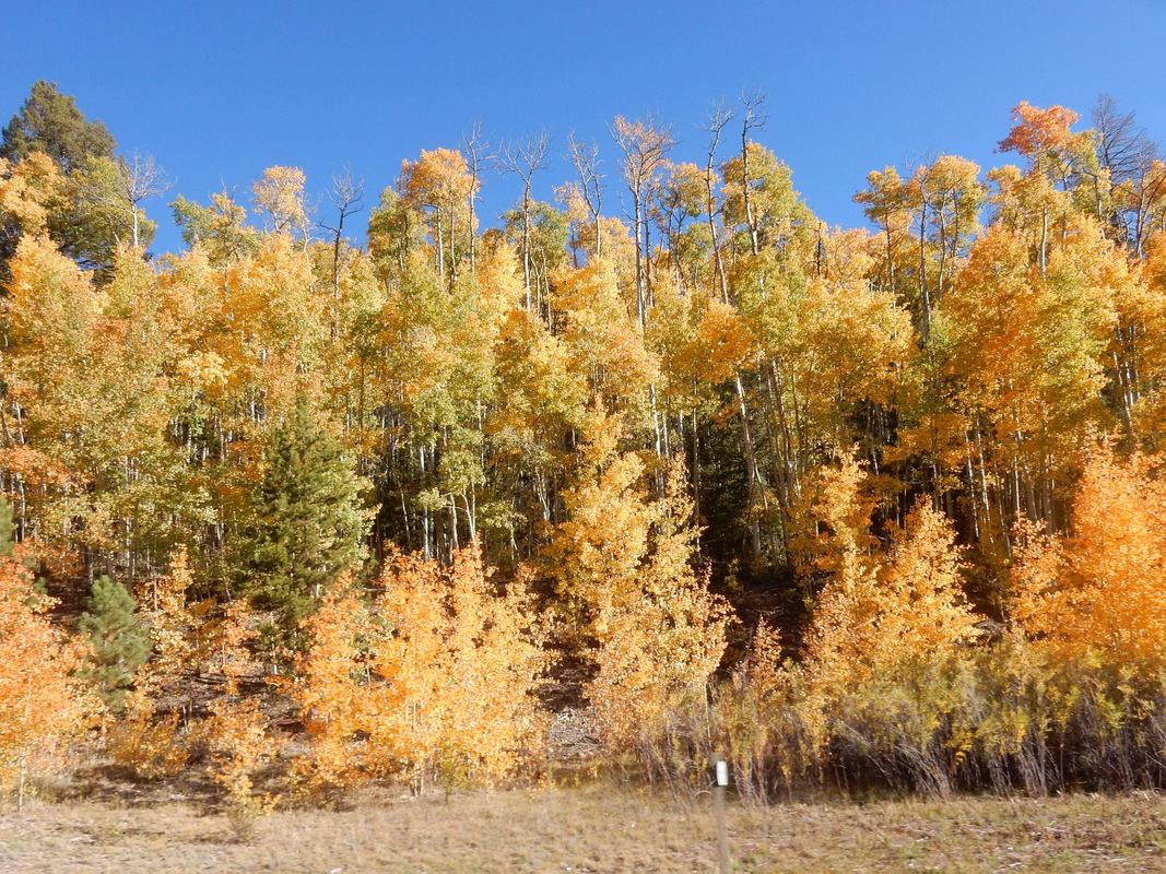
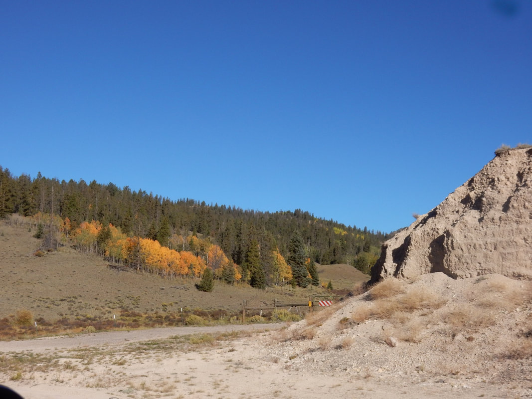
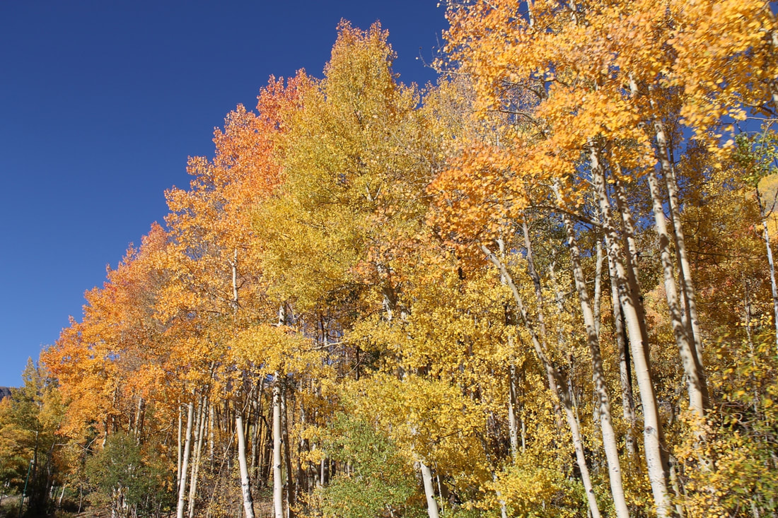
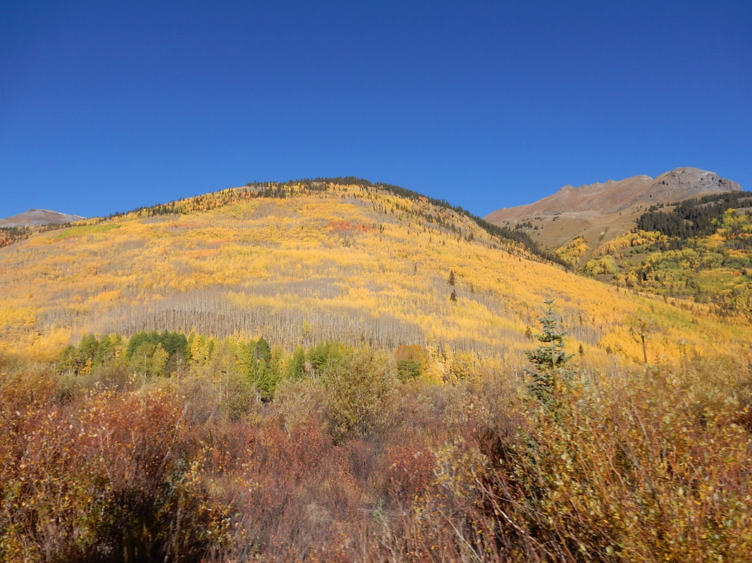
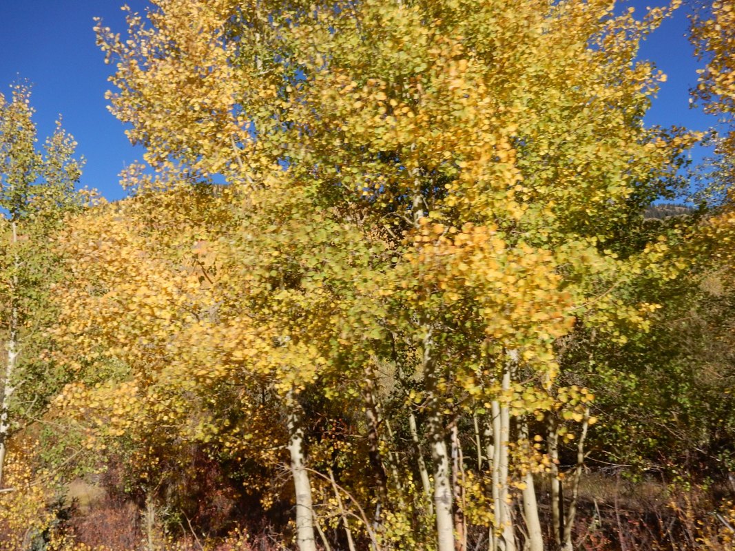
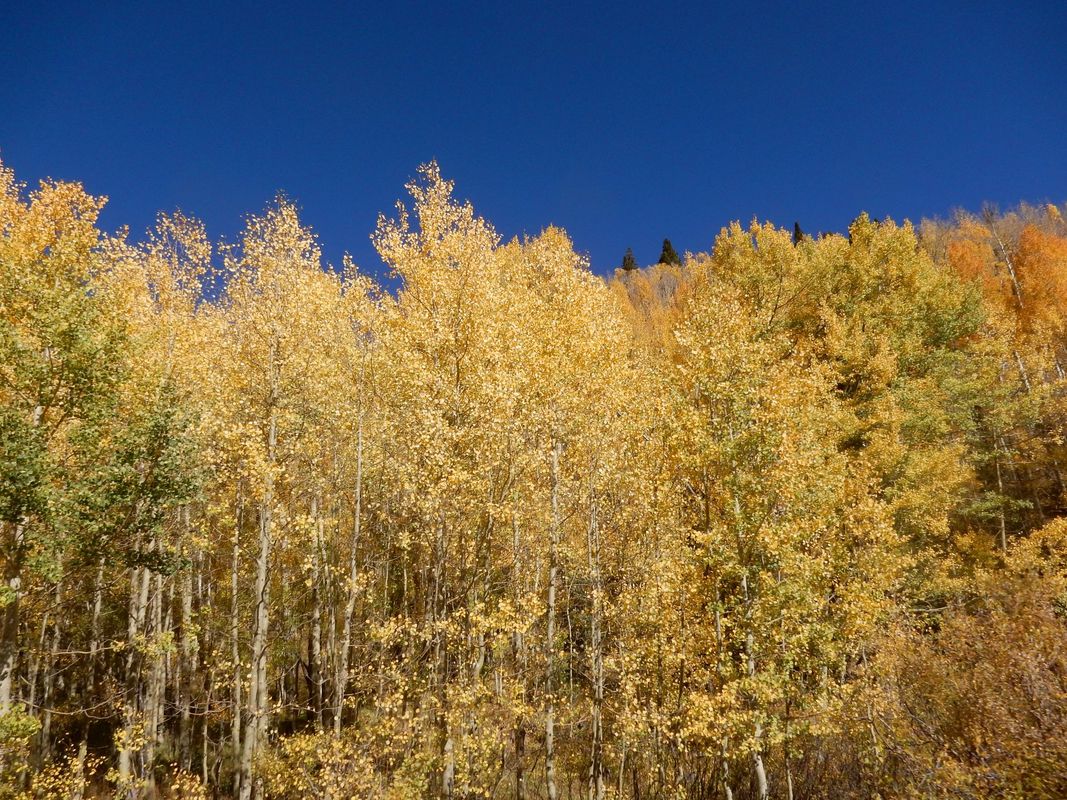
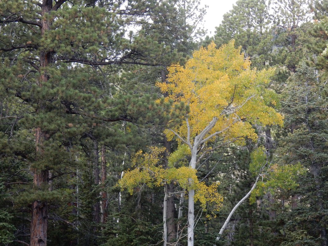
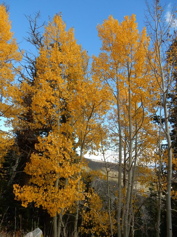
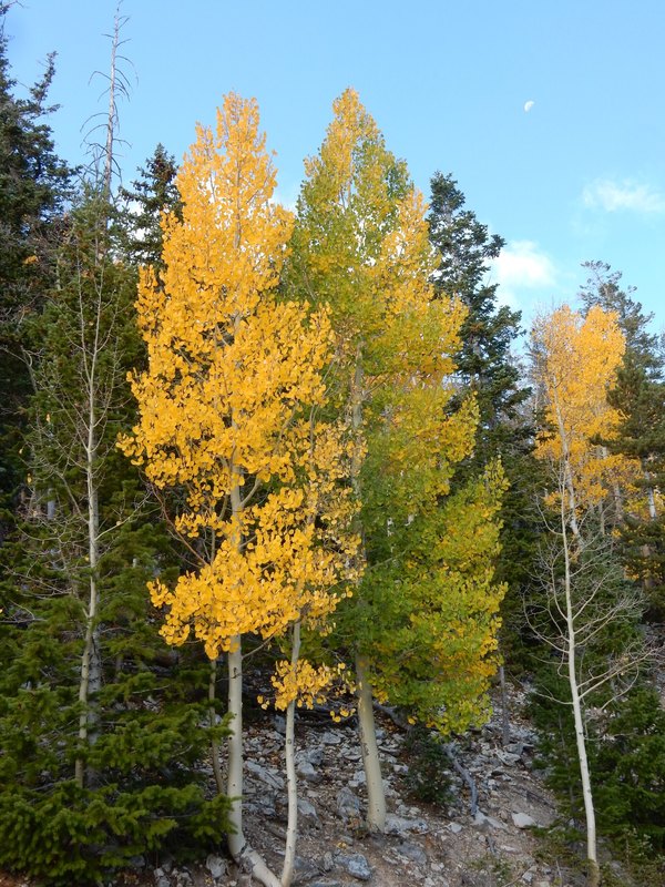
It was an easy driving day today. We left the hotel at around 7:30am. The morning air was crisp and cool with temperature around 40 degrees F. We drove north on US 285 then west on CO 114 passing thru part of Gunnison National Forest where group of Aspen trees dotting the landscape here and there with a glorious bright yellow color.
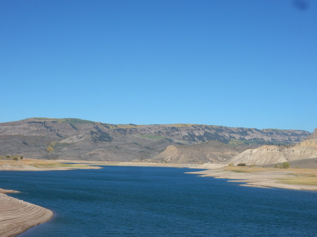
We then passed by the Curecanti National Recreation Area with blue lake, pristine water feeding from Gunnison River.
The beautiful clumps of Aspen trees in bright yellow color reminded us that fall is here. What a pleasant surprise! We stopped at multiple pull-out locations along the way to take pictures of the awesome view, yet somehow we managed to stop again and again at various road side pull-outs as though we have not had enough of these beautiful views.
We took a break in Gunnison, CO, home of the Western Colorado University and took a little driving tour around this small but cute campus.
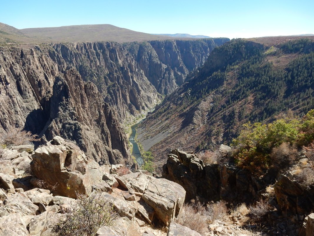
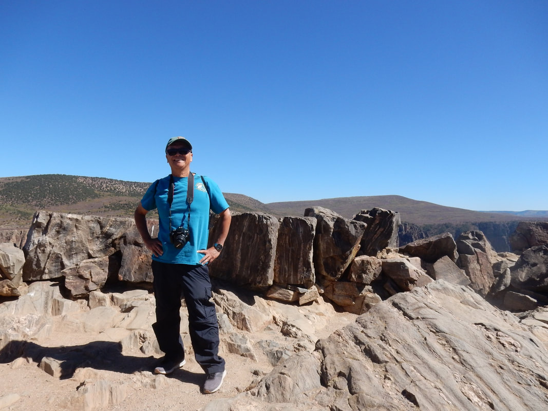
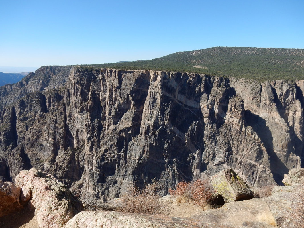
We got to Gunnison National Park around noon. What a beautiful place with multiple look-outs, and at each look-out it gives you a different view of the canyon which was gored by the flow of the Gunnison River, along with the forces of weathering, has sculpted this vertical wilderness of rock, water, and sky hundred of million years ago. We thoroughly enjoyed the spectacular views. We saw the soaring with strips of granite here and there on the wall turned it into the painted wall. We saw the steepest cliffs, we saw the oldest rock, and we saw the craggiest spires in North America. Here you can hike many trails in the park, scale the rock walls, or just relax and enjoy the awesome view of the canyon.
We make a practice of buying something at the gift shop inside the park as a way to help it financially so the park can be maintained for future generation to enjoy.
Overnight: Montrose, CO
Driving Distance: Alamosa to Black Canyon of the Gunnison NP: 3h22min (184.3 mi) via CO-114W & US-50W
“Black Canyon of the Gunnison National Park is in western Colorado. It surrounds part of a deep, steep-walled gorge carved through Precambrian rock by the Gunnison River. Roads and trails along the north and south rims have views of the Black Canyon's dramatic drops and the striated Painted Wall cliff. The winding East Portal Road descends to the river. Wildlife includes mule deer, elk and golden eagles” Wikipedia
It was an easy driving day today. We left the hotel at around 7:30am. The morning air was crisp and cool with temperature around 40 degrees F. We drove north on US 285 then west on CO 114 passing thru part of Gunnison National Forest where group of Aspen trees dotting the landscape here and there with a glorious bright yellow color.
We then passed by the Curecanti National Recreation Area with blue lake, pristine water feeding from Gunnison River.
The beautiful clumps of Aspen trees in bright yellow color reminded us that fall is here. What a pleasant surprise! We stopped at multiple pull-out locations along the way to take pictures of the awesome view, yet somehow we managed to stop again and again at various road side pull-outs as though we have not had enough of these beautiful views.
We took a break in Gunnison, CO, home of the Western Colorado University and took a little driving tour around this small but cute campus.
We got to Gunnison National Park around noon. What a beautiful place with multiple look-outs, and at each look-out it gives you a different view of the canyon which was gored by the flow of the Gunnison River, along with the forces of weathering, has sculpted this vertical wilderness of rock, water, and sky hundred of million years ago. We thoroughly enjoyed the spectacular views. We saw the soaring with strips of granite here and there on the wall turned it into the painted wall. We saw the steepest cliffs, we saw the oldest rock, and we saw the craggiest spires in North America. Here you can hike many trails in the park, scale the rock walls, or just relax and enjoy the awesome view of the canyon.
We make a practice of buying something at the gift shop inside the park as a way to help it financially so the park can be maintained for future generation to enjoy.
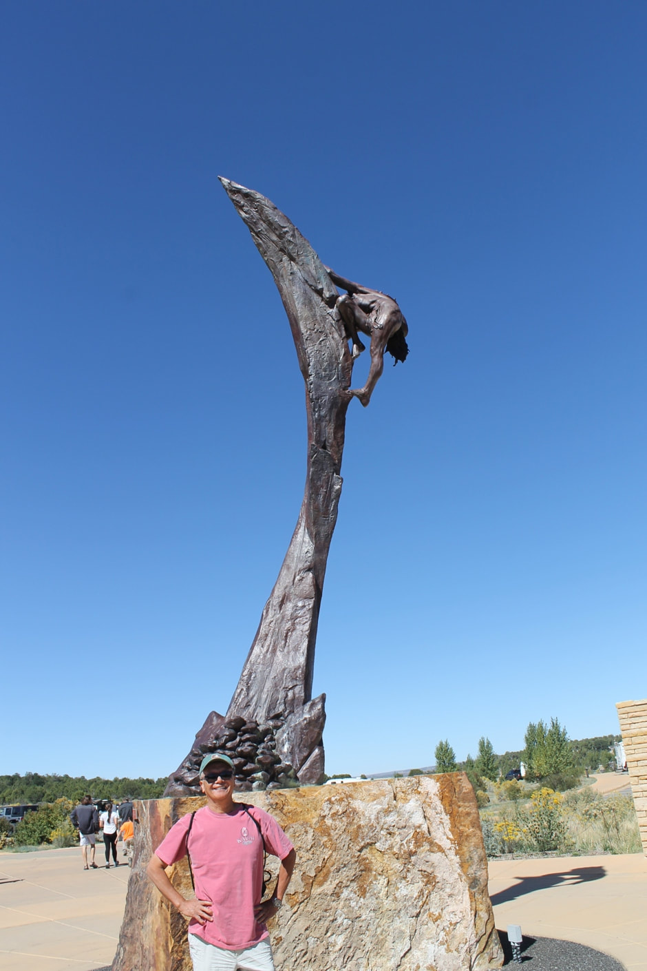
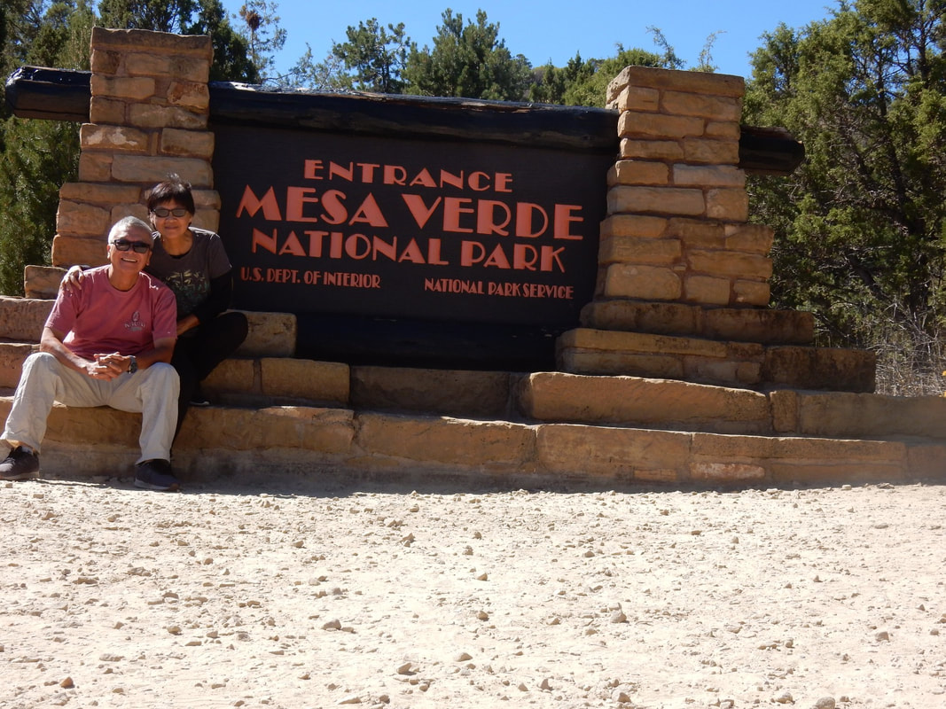
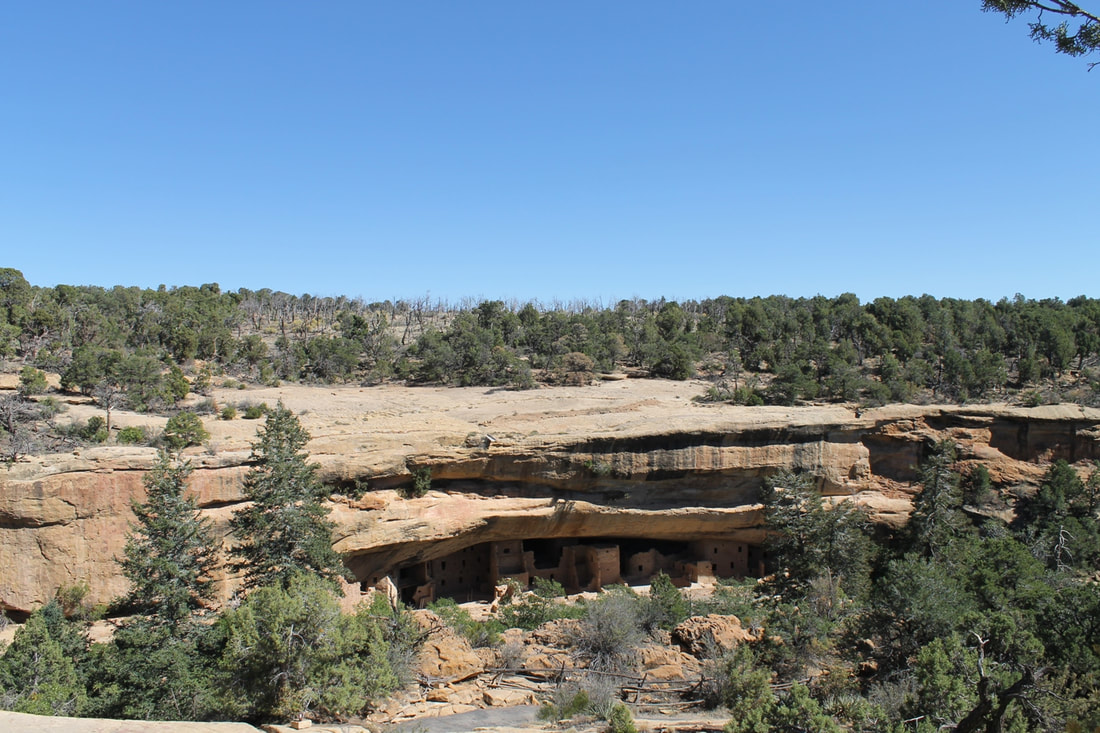
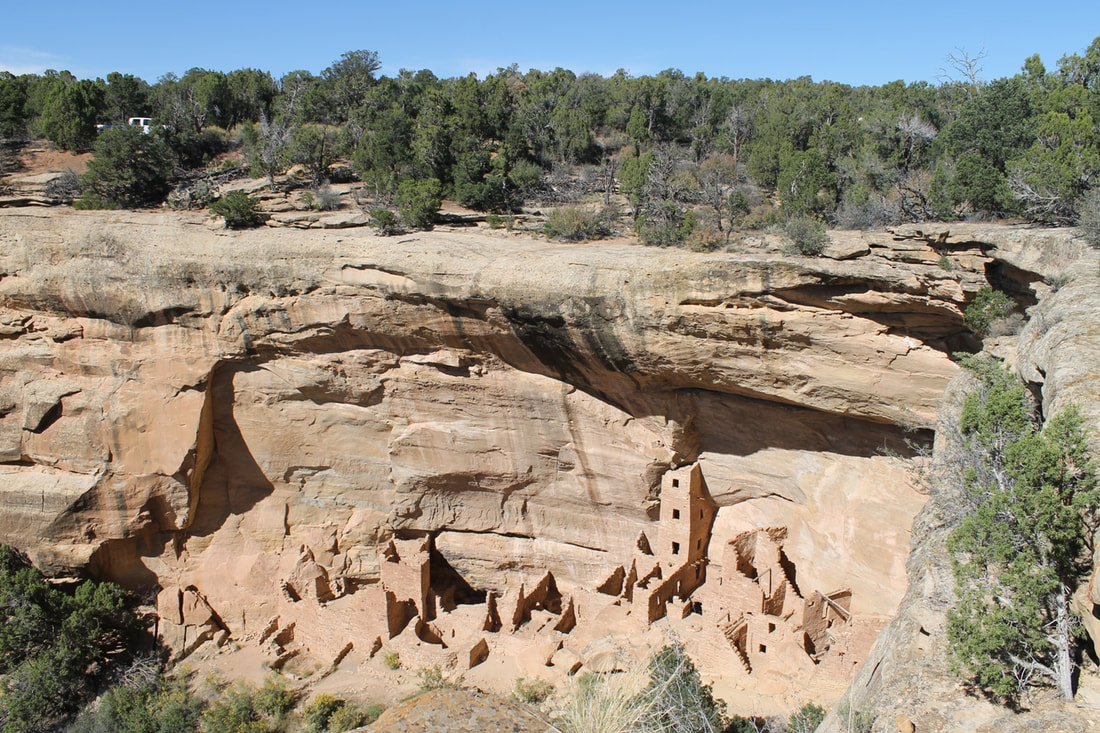
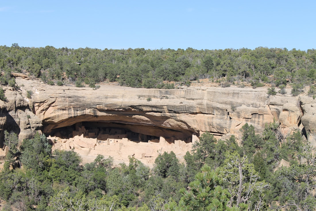
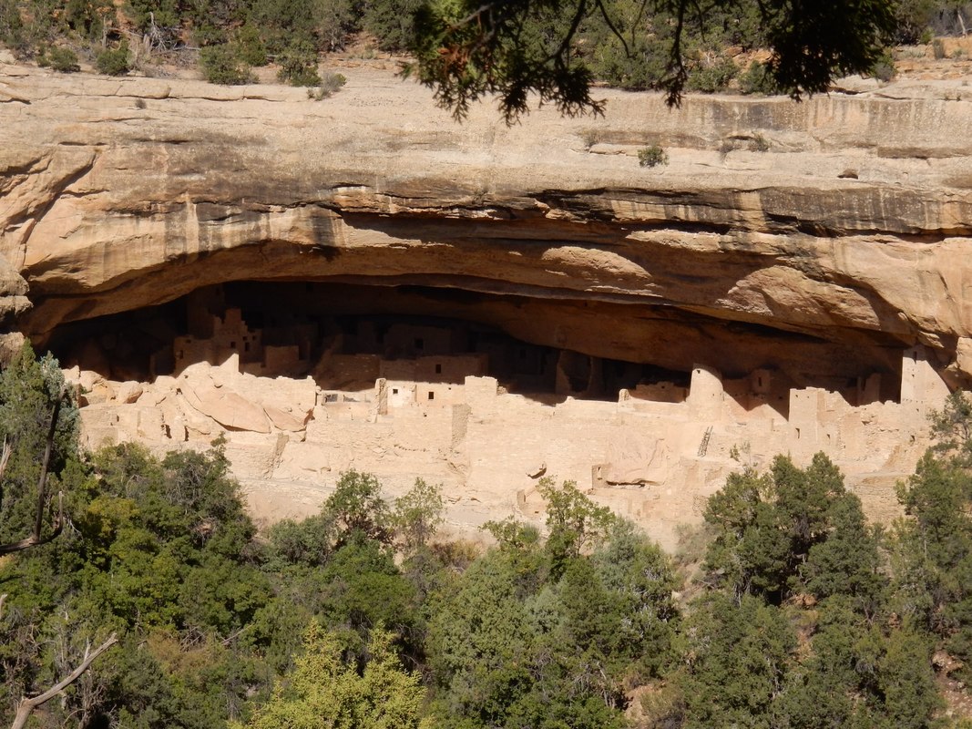
Day03 – Mesa Verde National Park, Colorado
Overnight: Cortez, CO
Driving Distance: Montrose to Cortez, CO: 2 h 42 min (135.0 mi) via CO-145 S
“Mesa Verde National Park is in southwest Colorado. It's known for its well-preserved Ancestral Puebloan cliff dwellings, notably the huge Cliff Palace. The Chapin Mesa Archeological Museum has exhibits on the ancient Native American culture. Mesa Top Loop Road winds past archaeological sites and overlooks, including Sun Point Overlook with panoramic canyon views. Petroglyph Point Trail has several rock carvings.” Wikipedia
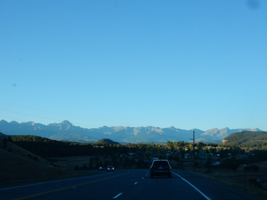
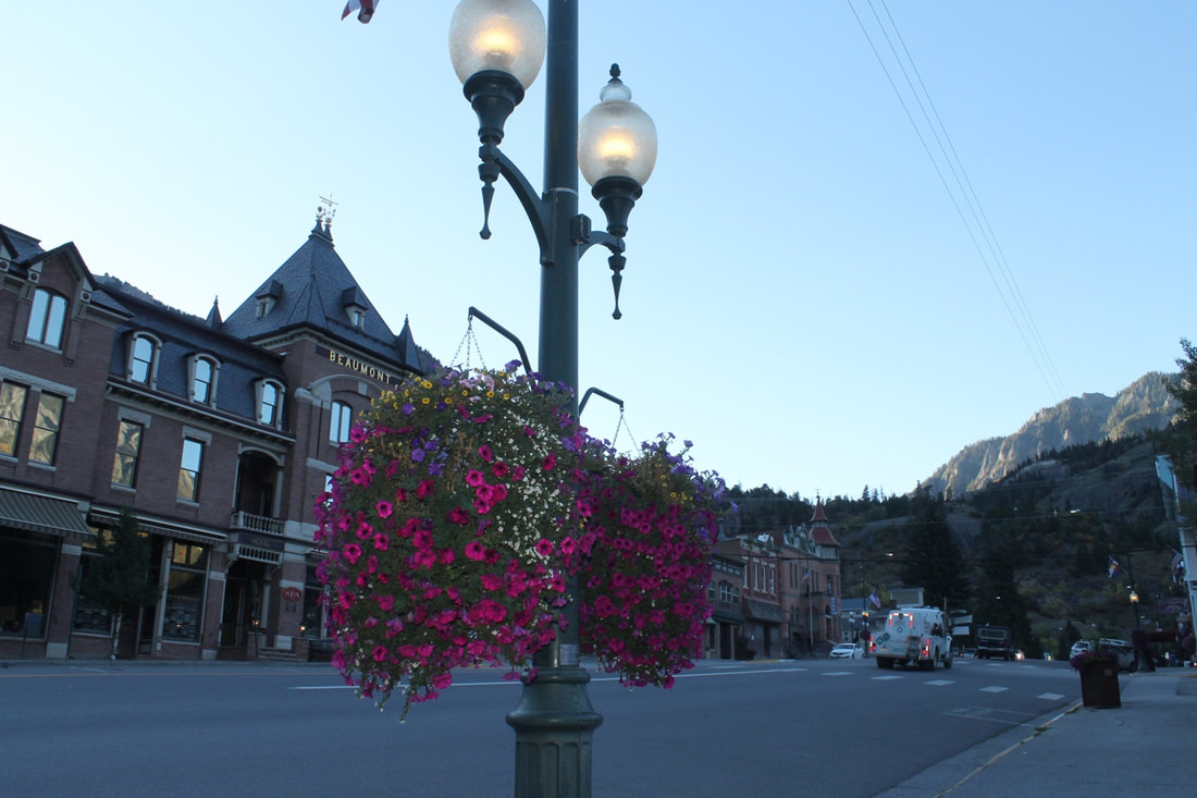
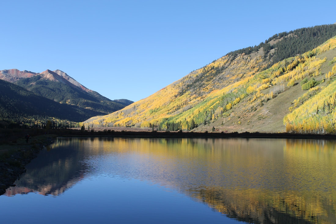
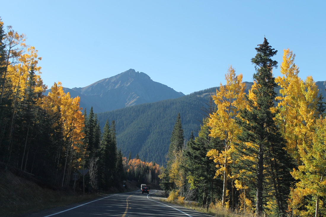
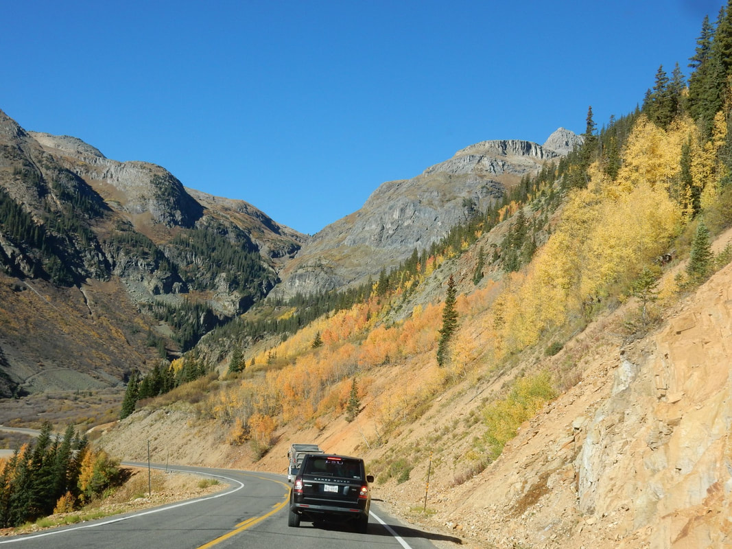
What a glorious morning! Traveling south on US 550 highway thru Ouray, Colorado which they coined it the Switzerland of America. It was a little cold this morning when we stopped in downtown Ouray for a walk. Beautiful flower baskets hanging from the street lamp posts adorned the downtown’s Main Street. The aroma of fresh coffee from a bakery permeated the air. The town situated quite high in altitude. I saw a t-shirt hanging in the shop that says “Dude, I think this whole town is high”.
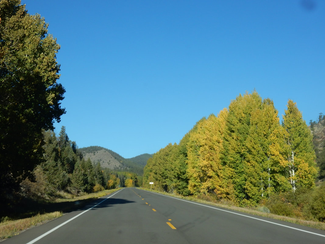
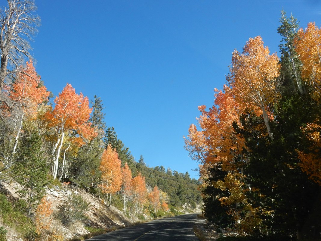
Driving on this stretch of the “million dollars highway” from Ouray to the mining town of Silverton is worth every penny particularly during this time of the year, the changing color of Aspen trees is in full display with its bright glorious yellow. The highway stretches for about 25 miles follow the US 550. It is part of the San Juan Skyway Scenic route. We stopped by one area that the mountain side was filled with Aspen trees and the reflection of itself on a little pond beside it created a spectacular view. Professional photographers and the not-so-professional one like us congregated on the side of the pond with big tripods and heavy duty cameras aiming, positioning for the right pose for this spectacular view. They were waiting for the sun to peak out at the right moment for that perfect picture of the mountain’s reflection on the surface of the pond. I must agree that this is one of the most breathtaking drives in the U.S.
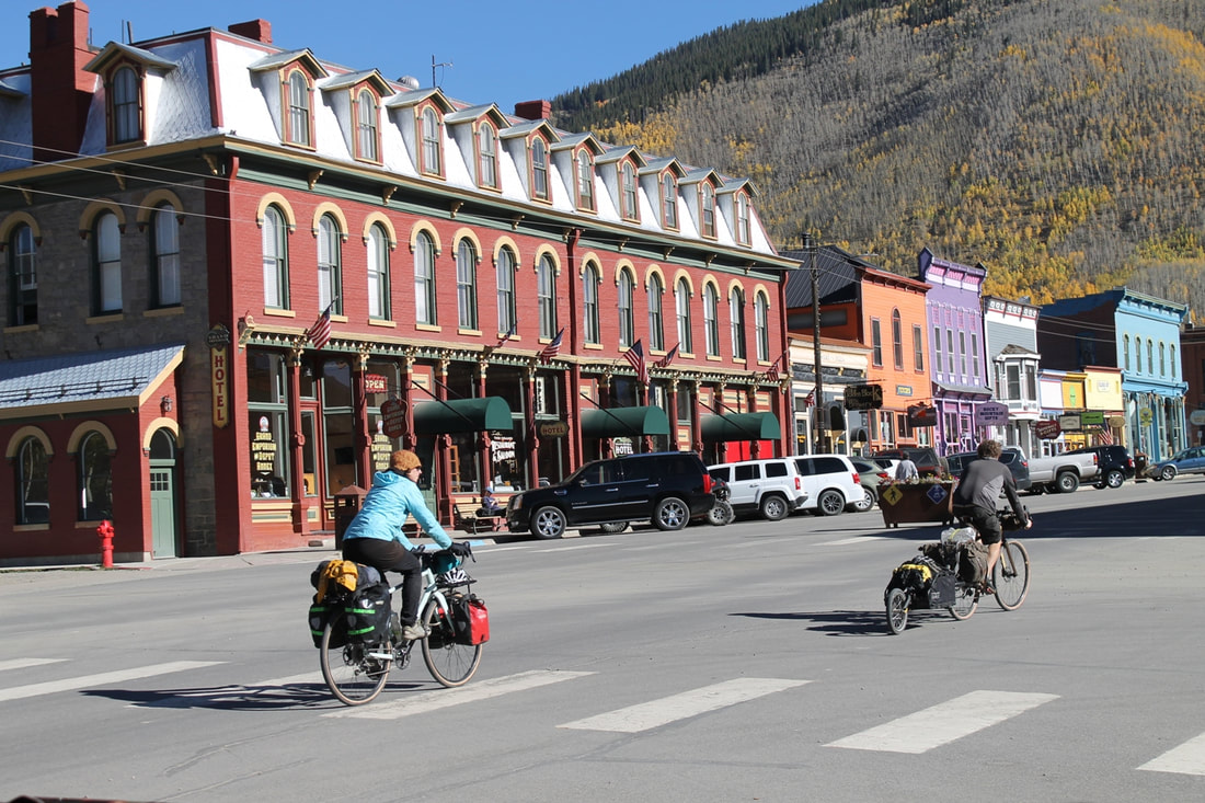
We stopped at Silverton, a little mining town in the old day and lingering a bit before moving on to Durango. This stretch of highway is beautiful, but come winter, I afraid it may be treacherous with these tight turns.
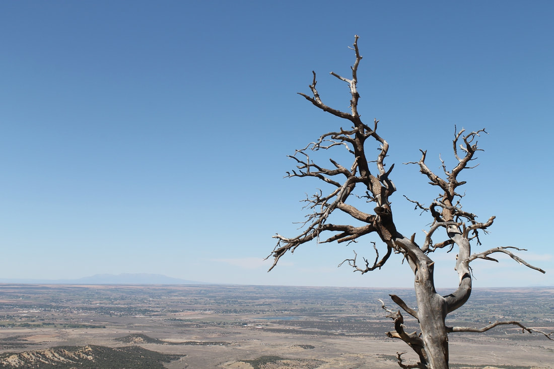
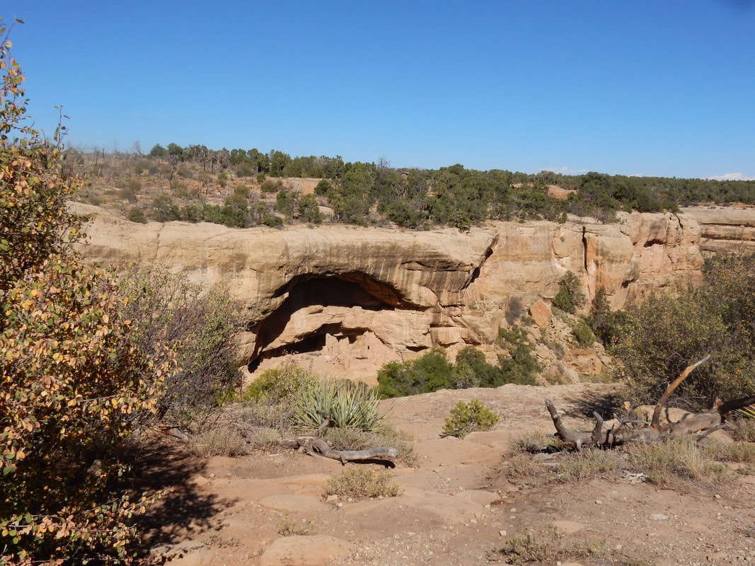
We had lunch in Durango then another 40 min. drive would put us in the park. Mesa Verde in Spanish for green table, where the Ancestral Pueblo people made this their home. The park contains quite a bit of history of the ancestral Pueblo Indians where they built their cliff dwellings under these giant cliffs. We drove the park loop and stopped at the Palace view point, where we saw the largest concentration of the well-preserved houses.
We spent two nights here in Cortez, CO. It is a popular stop for tourists, who stay here because of its central location among surrounding attractions, such as Mesa Verde, Monument Valley, Aztec ruins…etc.
Overnight: Cortez, CO
Driving Distance: Montrose to Cortez, CO: 2 h 42 min (135.0 mi) via CO-145 S
“Mesa Verde National Park is in southwest Colorado. It's known for its well-preserved Ancestral Puebloan cliff dwellings, notably the huge Cliff Palace. The Chapin Mesa Archeological Museum has exhibits on the ancient Native American culture. Mesa Top Loop Road winds past archaeological sites and overlooks, including Sun Point Overlook with panoramic canyon views. Petroglyph Point Trail has several rock carvings.” Wikipedia
What a glorious morning! Traveling south on US 550 highway thru Ouray, Colorado which they coined it the Switzerland of America. It was a little cold this morning when we stopped in downtown Ouray for a walk. Beautiful flower baskets hanging from the street lamp posts adorned the downtown’s Main Street. The aroma of fresh coffee from a bakery permeated the air. The town situated quite high in altitude. I saw a t-shirt hanging in the shop that says “Dude, I think this whole town is high”.
Driving on this stretch of the “million dollars highway” from Ouray to the mining town of Silverton is worth every penny particularly during this time of the year, the changing color of Aspen trees is in full display with its bright glorious yellow. The highway stretches for about 25 miles follow the US 550. It is part of the San Juan Skyway Scenic route. We stopped by one area that the mountain side was filled with Aspen trees and the reflection of itself on a little pond beside it created a spectacular view. Professional photographers and the not-so-professional one like us congregated on the side of the pond with big tripods and heavy duty cameras aiming, positioning for the right pose for this spectacular view. They were waiting for the sun to peak out at the right moment for that perfect picture of the mountain’s reflection on the surface of the pond. I must agree that this is one of the most breathtaking drives in the U.S.
We stopped at Silverton, a little mining town in the old day and lingering a bit before moving on to Durango. This stretch of highway is beautiful, but come winter, I afraid it may be treacherous with these tight turns.
We had lunch in Durango then another 40 min. drive would put us in the park. Mesa Verde in Spanish for green table, where the Ancestral Pueblo people made this their home. The park contains quite a bit of history of the ancestral Pueblo Indians where they built their cliff dwellings under these giant cliffs. We drove the park loop and stopped at the Palace view point, where we saw the largest concentration of the well-preserved houses.
We spent two nights here in Cortez, CO. It is a popular stop for tourists, who stay here because of its central location among surrounding attractions, such as Mesa Verde, Monument Valley, Aztec ruins…etc.
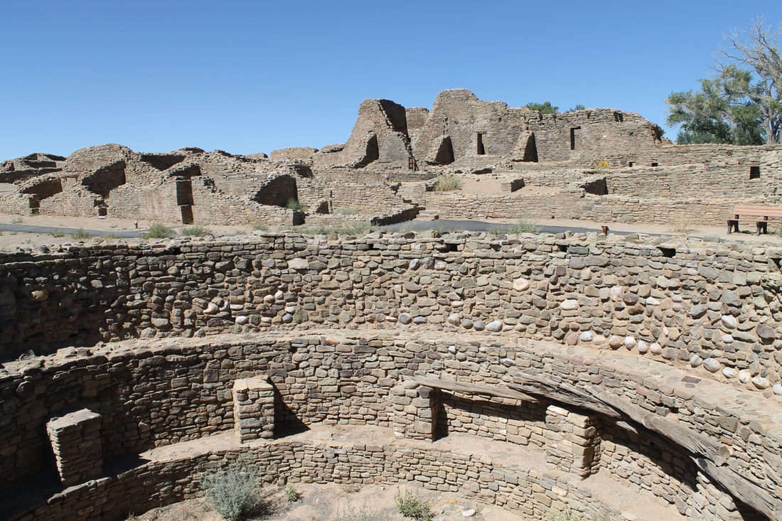
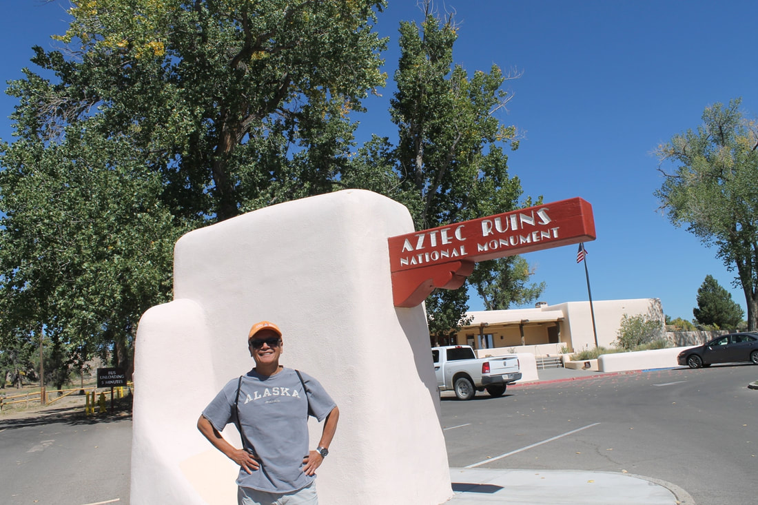
Day04 – Chimney Rock National Monument, Aztec Ruins National Monument, Four Corner States Monument.
Overnight: Cortez, CO
Driving Distance:
Cortez to Chimney Rock: 1 h 53 min (94.0 mi) via US-160 E
Chimney Rock to Aztec Ruins: 1 h 29 min (69.1 mi) via CO-151 W
Aztec Ruins to Four Corner States: 1 h 29 min (75.6 mi) via US-64 W
Four Corner States to Cortez: 41 min (39.3 mi) via US-160 E/US-491 N and US-160 E
Today, we drove a small loop around this southern Colorado, northern New Mexico area. Starting eastward we drove from Cortez to Chimney Rock National Monument in the southern part of Colorado. It was an interesting ruin, similar to what we saw and learned in Mesa Verde. The visitor’s booth is very minimal. We took the 40 minutes self-guided audio tour observing these ancient houses, kivas with the beautiful view of the surrounding mountains and valleys.
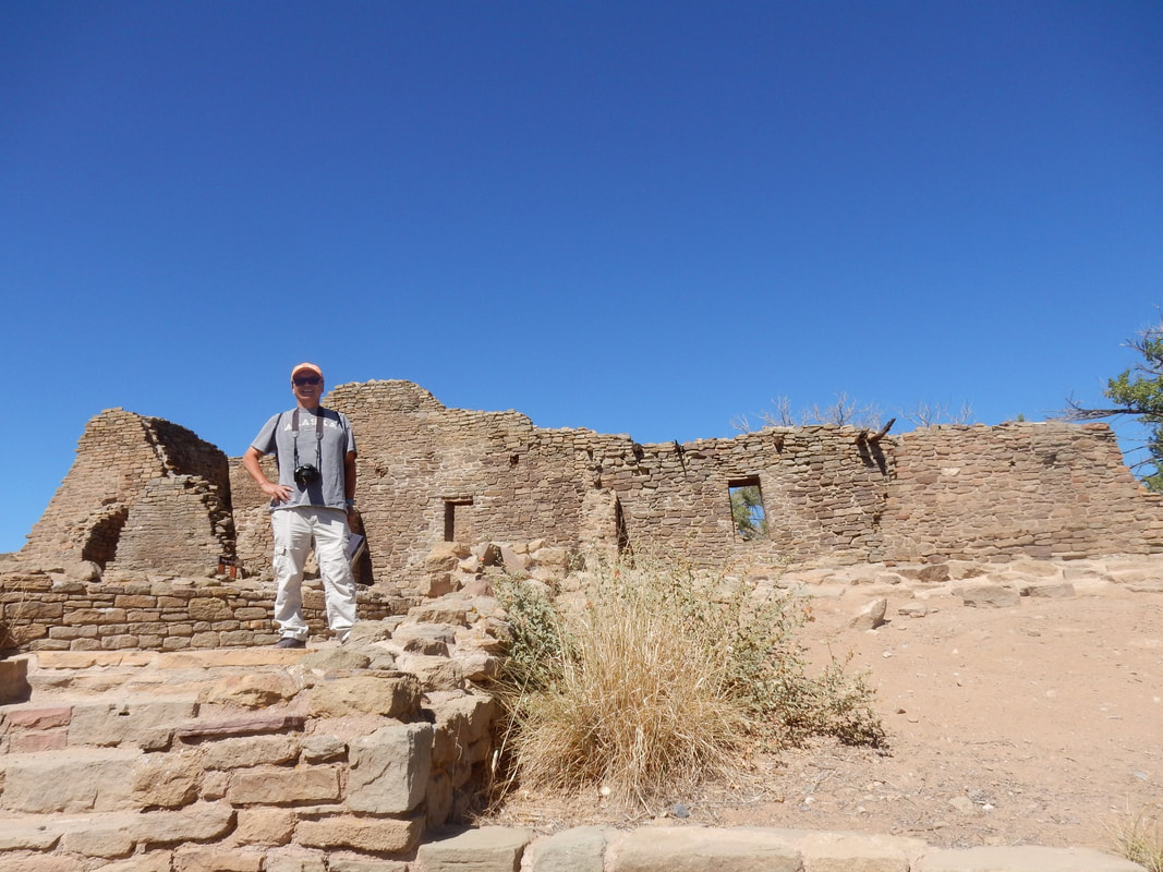
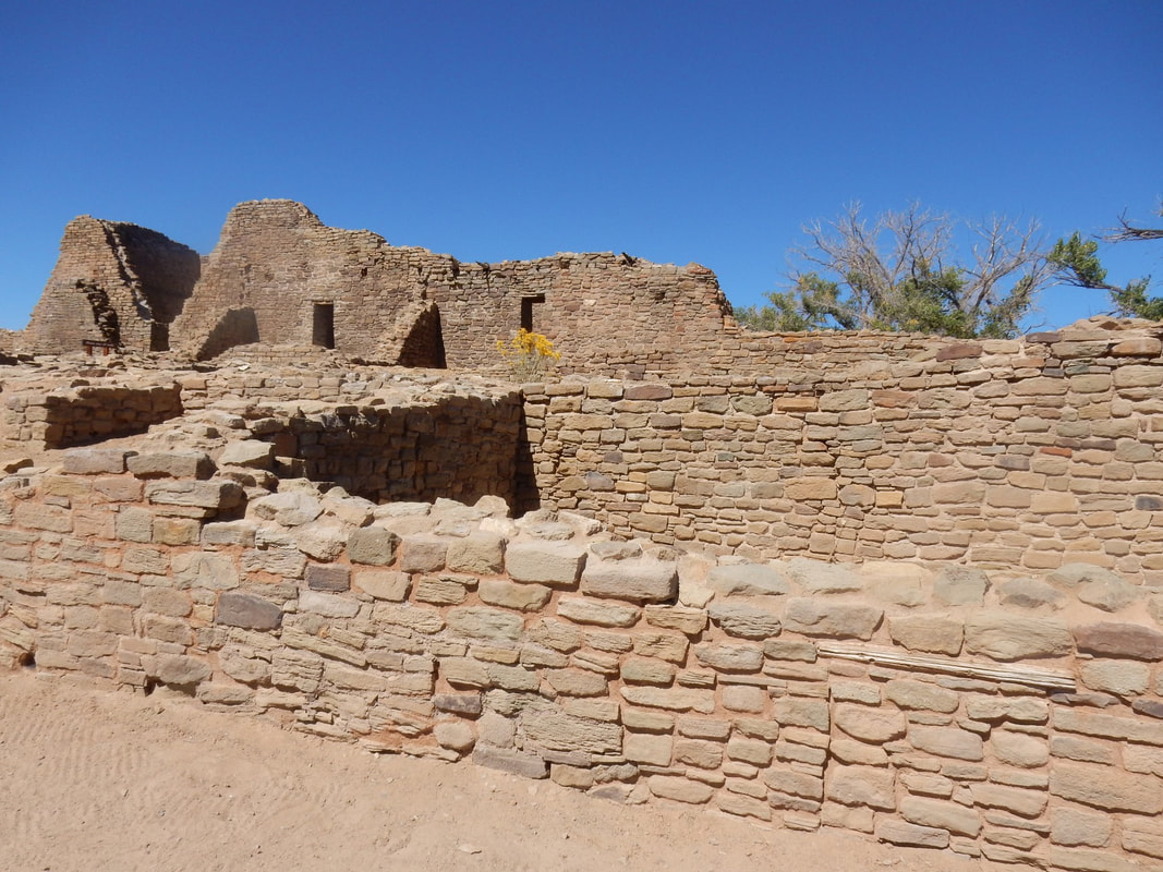
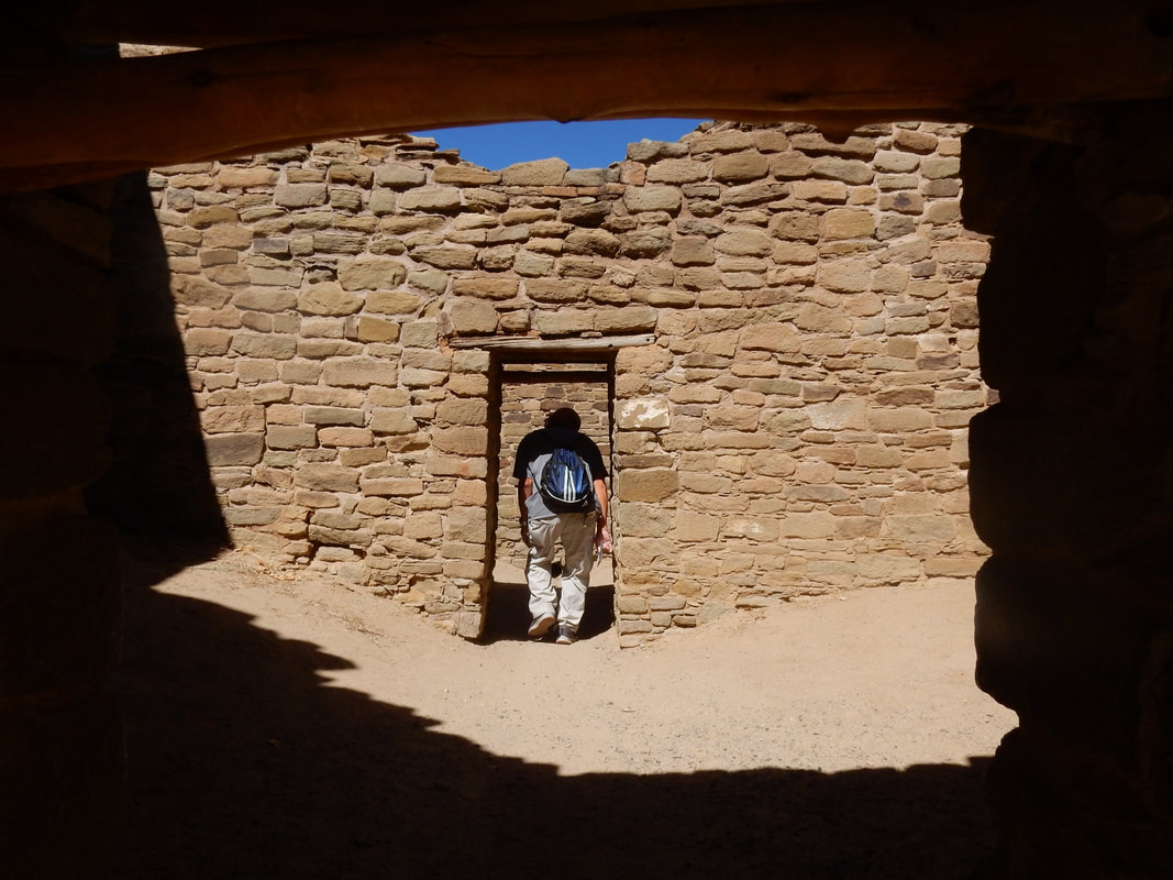
From here for about an hour and a half driving we headed southwest to Aztec Ruins National Monument in northern New Mexico. The facility is nicer and the place is bigger with a little museum. We got to walk close to the ruins and walked inside some of the rooms with low clearance doors. The architecture of these buildings was quite elaborate back then giving what the minimum tools they had to work with.
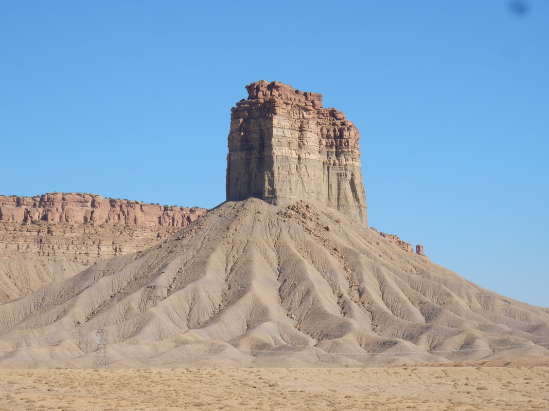
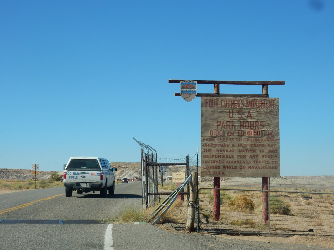
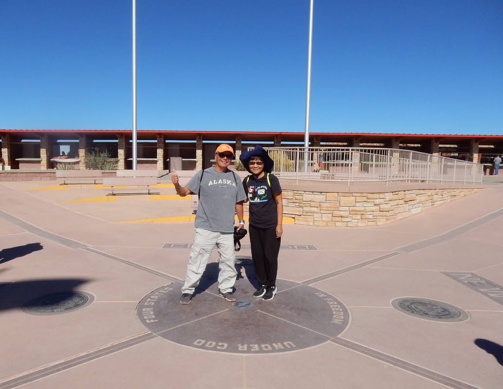
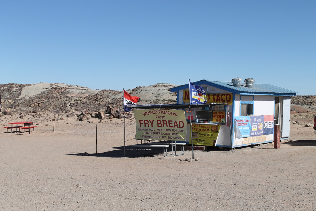
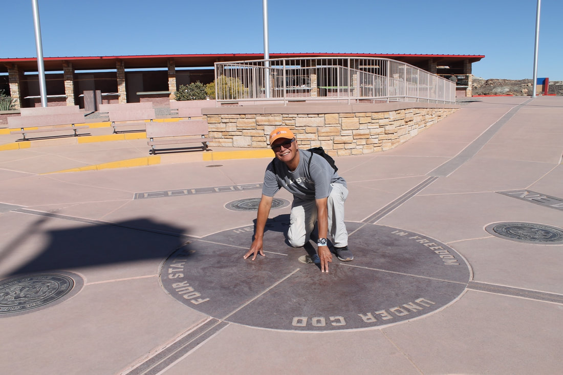
From Aztec ruins, we headed west to the Four Corners Monument. The landscape of this section of the country was quite flat. At the monument, there were stalls lining around the periphery selling Indian craft, there were stands selling famous fry bread. The main attraction here is that this is a point where people can touch 4 states at the same time, Colorado, New Mexico, Arizona, and Utah. This is only place in the whole country that can claim this feature.
We headed back to our hotel. Tonight we tried out the Native Indian food standard like blue mash, mutton rib, mutton stew, fry bread, pig feet with bean. I saw the buffet line lined up with the locals. I can say the food is packed with a lot of calories but I had to have small bites of everything just so that I can say I have tried them. Some is tastier than others.
The weather in late September was superb. We were quite lucky.
Overnight: Cortez, CO
Driving Distance:
Cortez to Chimney Rock: 1 h 53 min (94.0 mi) via US-160 E
Chimney Rock to Aztec Ruins: 1 h 29 min (69.1 mi) via CO-151 W
Aztec Ruins to Four Corner States: 1 h 29 min (75.6 mi) via US-64 W
Four Corner States to Cortez: 41 min (39.3 mi) via US-160 E/US-491 N and US-160 E
Today, we drove a small loop around this southern Colorado, northern New Mexico area. Starting eastward we drove from Cortez to Chimney Rock National Monument in the southern part of Colorado. It was an interesting ruin, similar to what we saw and learned in Mesa Verde. The visitor’s booth is very minimal. We took the 40 minutes self-guided audio tour observing these ancient houses, kivas with the beautiful view of the surrounding mountains and valleys.
From here for about an hour and a half driving we headed southwest to Aztec Ruins National Monument in northern New Mexico. The facility is nicer and the place is bigger with a little museum. We got to walk close to the ruins and walked inside some of the rooms with low clearance doors. The architecture of these buildings was quite elaborate back then giving what the minimum tools they had to work with.
From Aztec ruins, we headed west to the Four Corners Monument. The landscape of this section of the country was quite flat. At the monument, there were stalls lining around the periphery selling Indian craft, there were stands selling famous fry bread. The main attraction here is that this is a point where people can touch 4 states at the same time, Colorado, New Mexico, Arizona, and Utah. This is only place in the whole country that can claim this feature.
We headed back to our hotel. Tonight we tried out the Native Indian food standard like blue mash, mutton rib, mutton stew, fry bread, pig feet with bean. I saw the buffet line lined up with the locals. I can say the food is packed with a lot of calories but I had to have small bites of everything just so that I can say I have tried them. Some is tastier than others.
The weather in late September was superb. We were quite lucky.
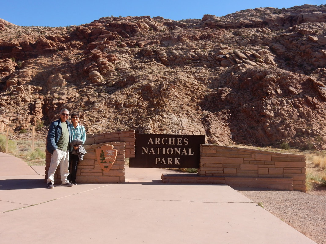
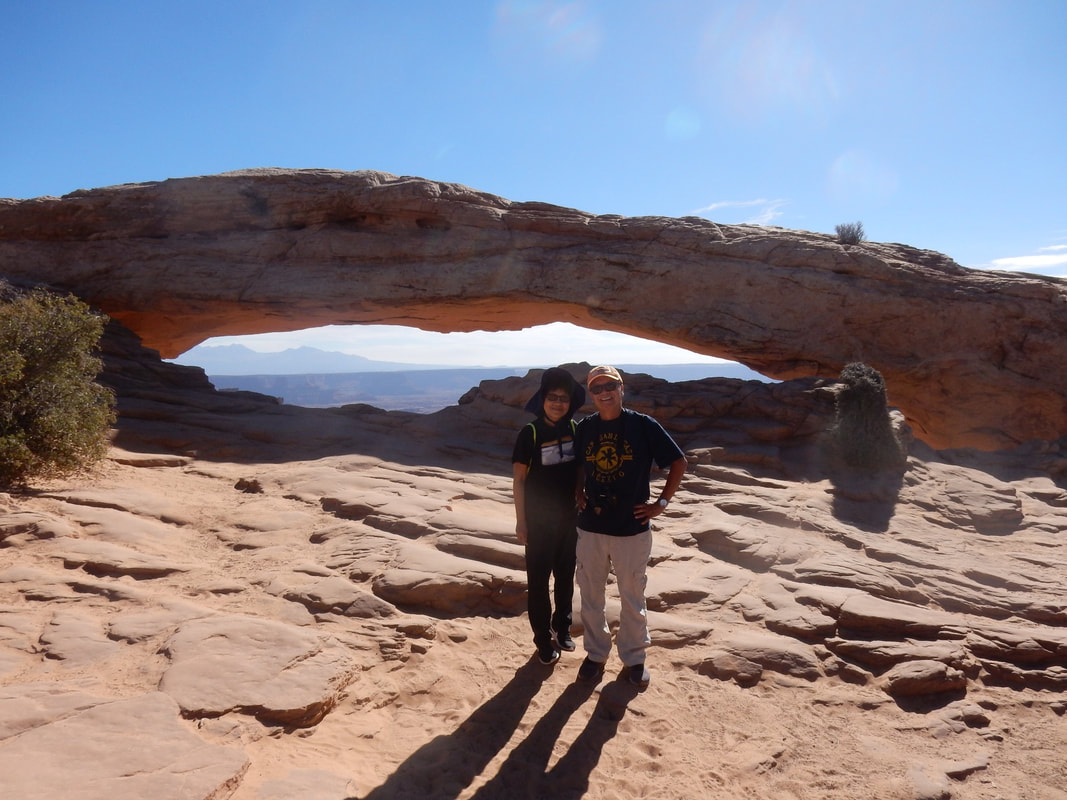
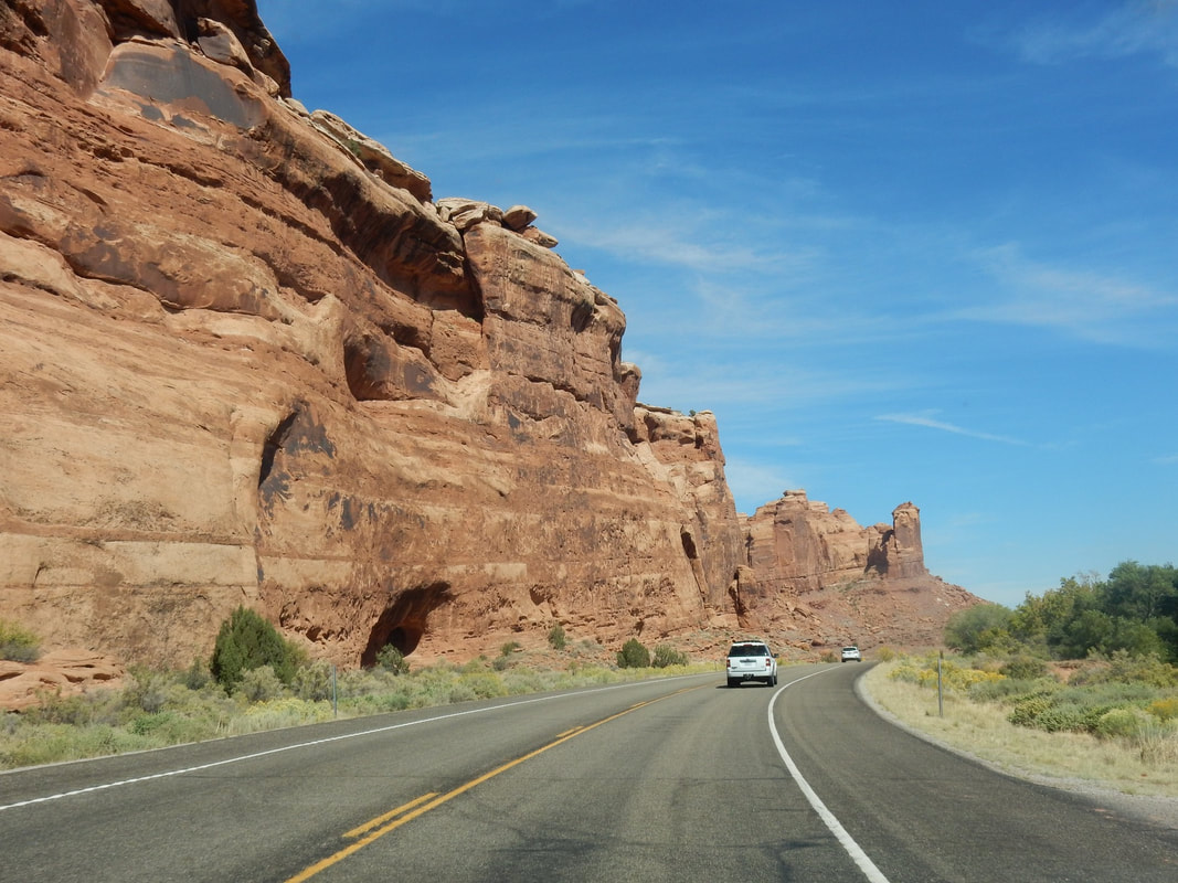
Day05 – Arches National Park, Utah
Overnight: Moab, UT
Driving Distance: Cortez to Moab: 1 h 55 min (114.3 mi) via US-491 N and US-191 N
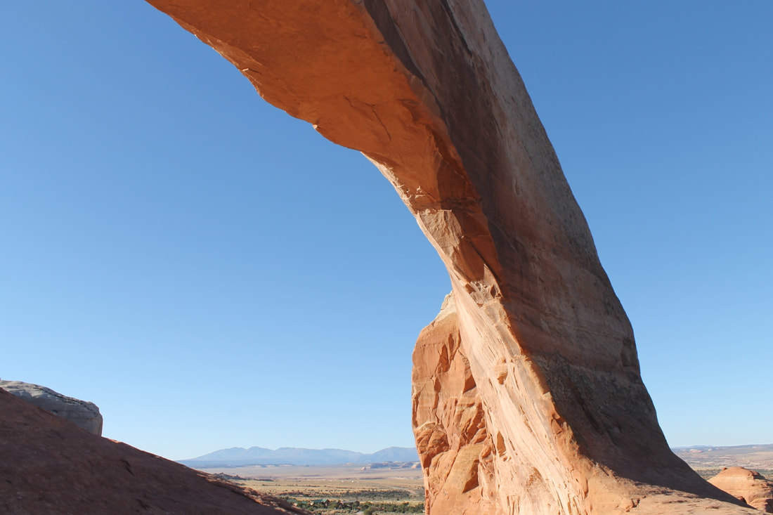
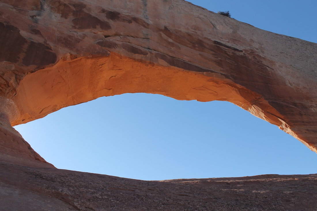
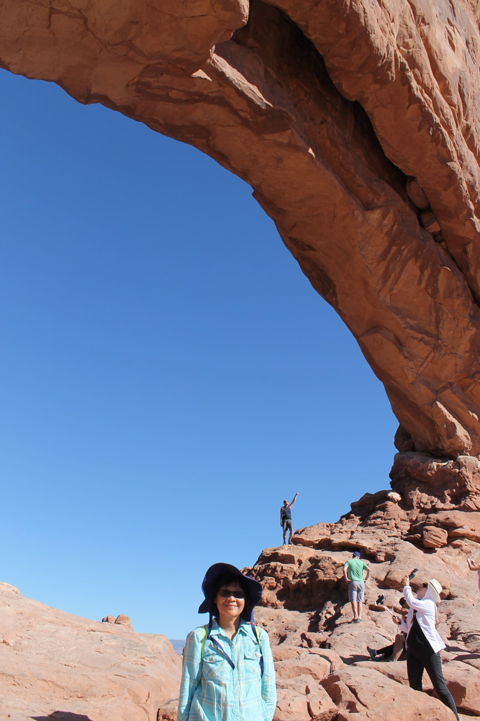
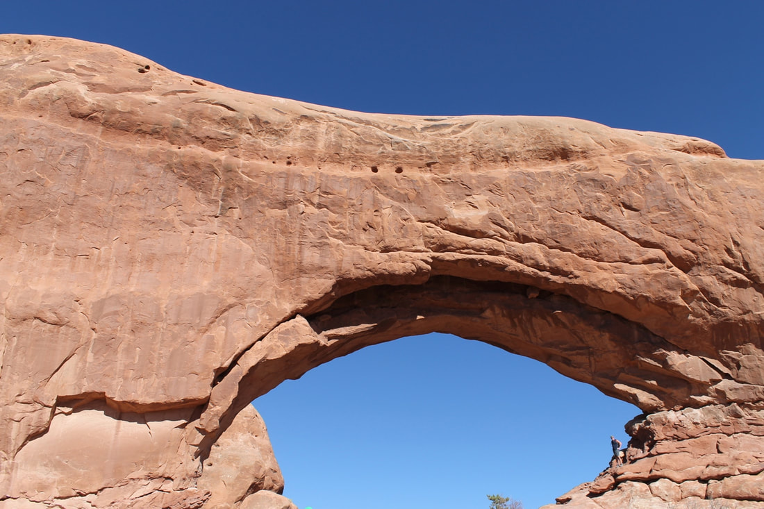
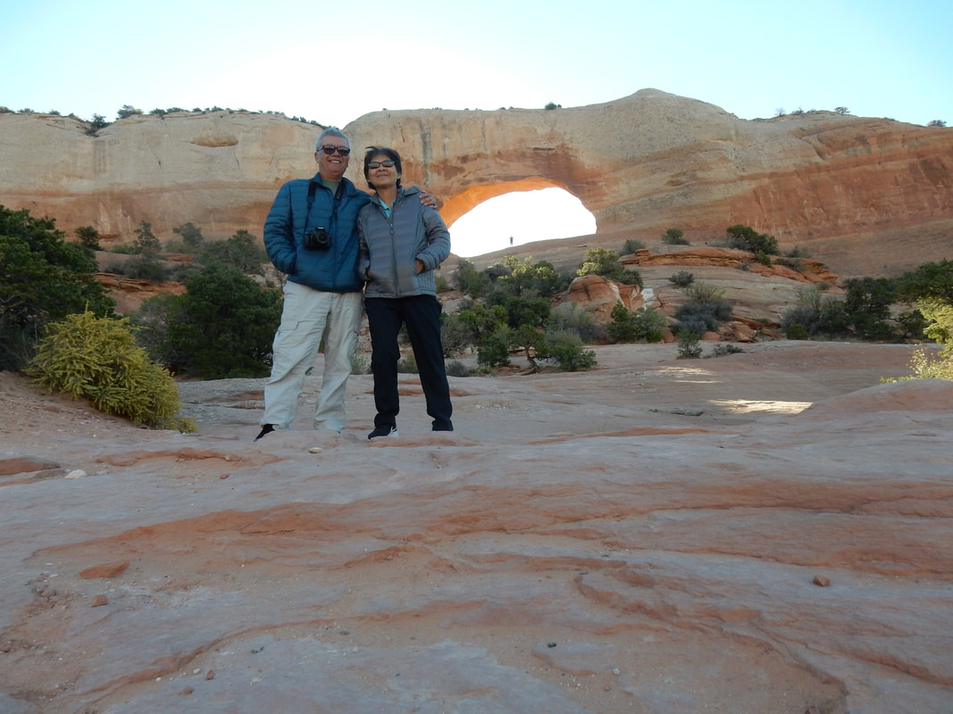
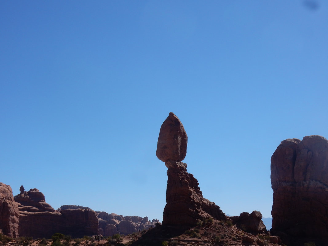
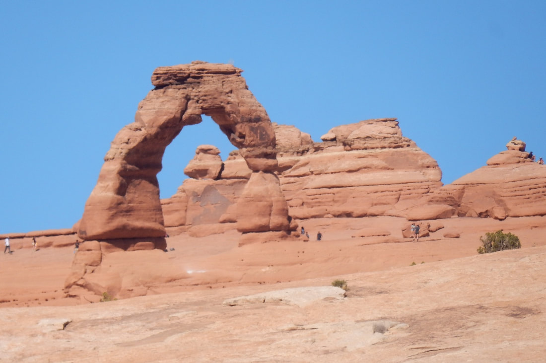
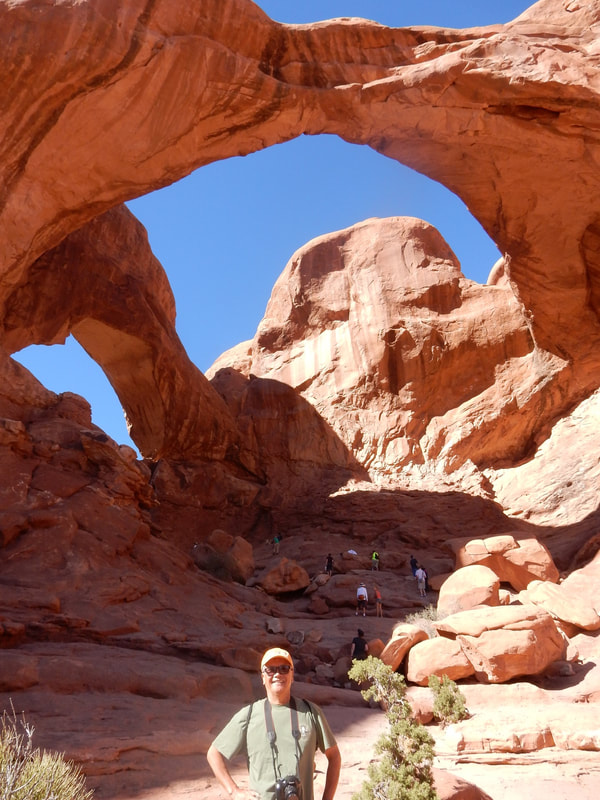
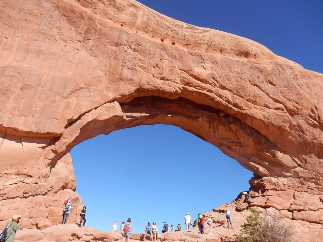
“Arches National Park lies north of Moab in the state of Utah. Bordered by the Colorado River in the southeast, it’s known as the site of more than 2,000 natural sandstone arches, such as the massive, red-hued Delicate Arch in the east. Long, thin Landscape Arch stands in Devils Garden to the north. Other geological formations include Balanced Rock, towering over the desert landscape in the middle of the park.” Wikipedia
We left Cortez around 8am this morning driving northwest toward Moab. It sure looks like Utah’s landscape on the way to Moab. Dry, flat, then red rocks everywhere.
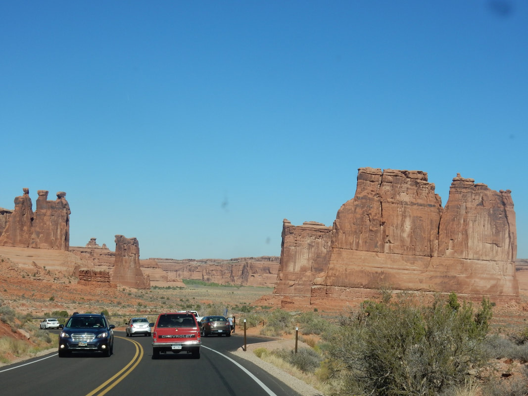
We got to the park at around 10:30am, already packed with tourists, long line waiting at the entrance to the park, that just to show how popular this place is. We met and overheard quite a few foreigners in the crowd. We met a couple bikers that came all the way from Czech Republic in leather jackets, leather pans, tattoos on their arms and proud of the outfit. There were two ladies from France we met at the NP sign in front of the park. They asked us to take a picture for them while posing. We conversed and learned that they’re also taking a road trip. I figured they’re thrilled to see “America, the beautiful” in a big American automobile, floating in comfort down the giant US highways…heheh.
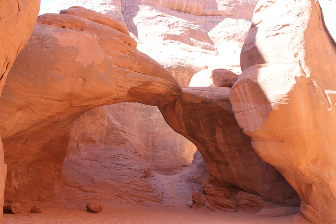
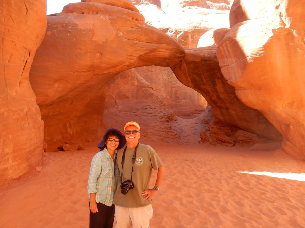
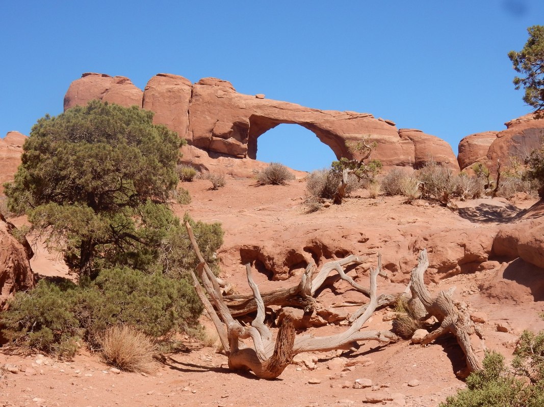
We’re at awe with the beautiful red rock scenery. The landscape with red rocks protrudes everywhere. These natural stone arches that created by the nature of wind and water are just awesome to take in, natural stone arches, soaring pinnacles…etc. Some of the arches are still being formed, while others are slowly in the process of being destroyed. What a wonderful masterpiece of nature!
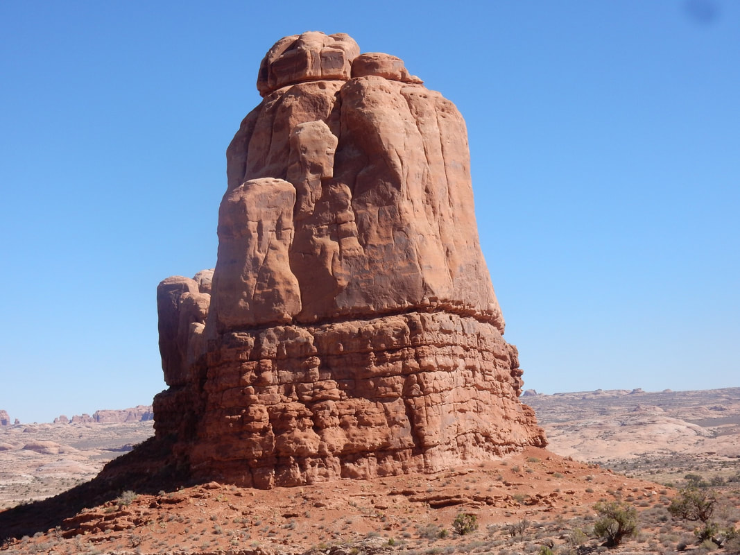
After checking out the visitor center we drove up to the plateau then from there about 40 min. drive to the end of the loop drive where in front of your eyes is a red rock wonderland. The contrasting colors, enhanced by the lighting of the sun during the day, the landforms are really unique. The park has over 2,000 natural stone arches, the densest concentration of natural stone arches, in addition to hundreds of soaring pinnacles, massive fins and giant balanced rocks. This red rock wonderland is just amazing.
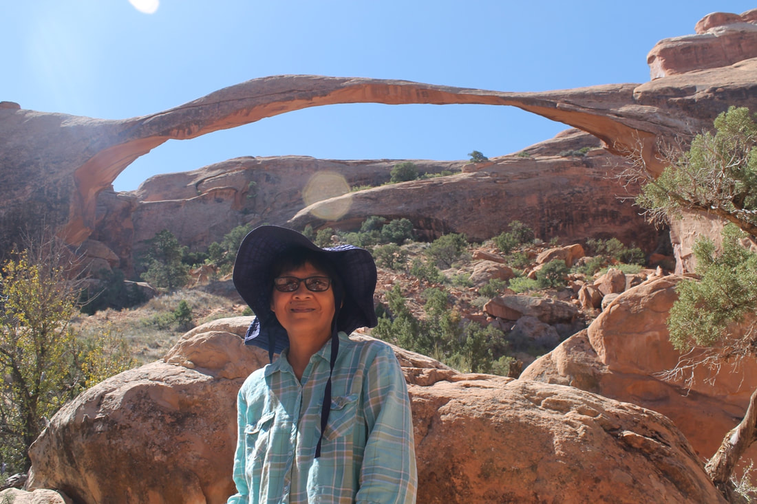
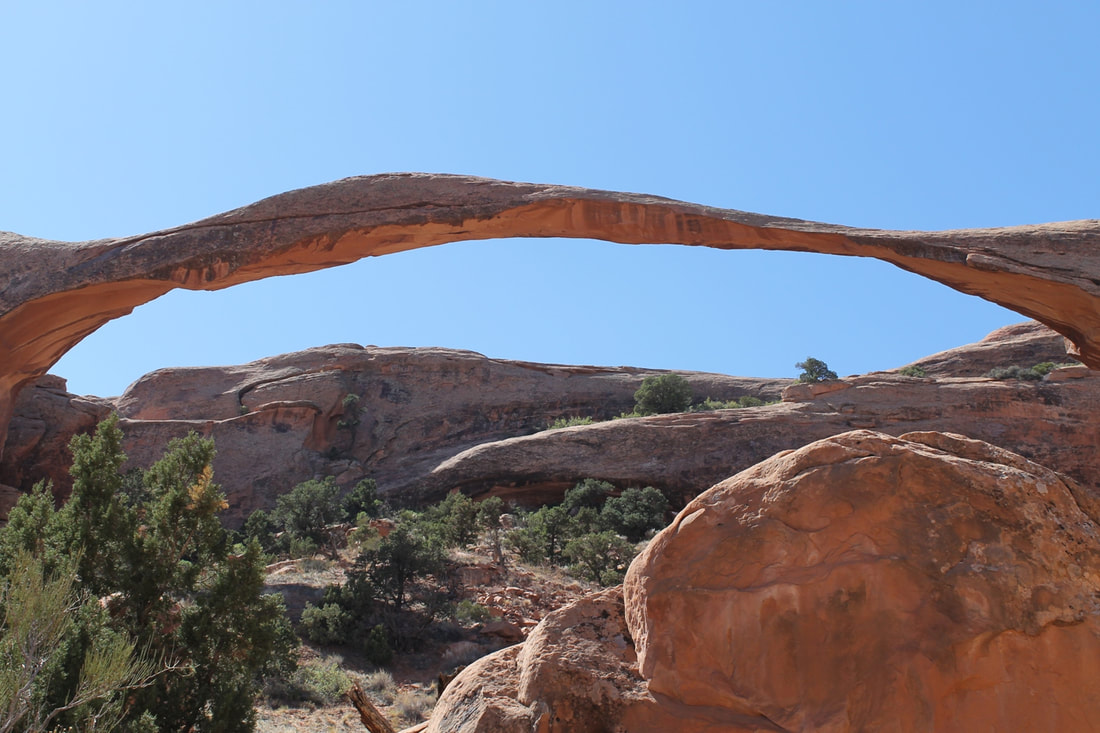
We hiked to the landscape arch. It said the trail is about a mile long, but thru these uneven dirt path and rocky slope to climb, we felt like mile and mile of walking. However, the view at the end was quite spectacular.
We saw two Globus Tour Buses, full of tourists. They’re being dropped off for viewing the Delicate Arch from the distance then quickly herded back on the bus by the tour guide for the next viewing location.
We had done so much walking today. At the end of the day we had walked a total of more than 6 miles, and climbed about 20 floors. By 4pm, we were all beaten up. But the weather was so perfect in the high seventy without a clump of cloud. The blue sky with red rocks, and arches, just made the picture so perfect that we forgot all about the walking that we had done.
The park roads were newly repaved, well maintained everywhere we went. It’s definitely something that we can be proud of sharing with our foreign visitors.
Overnight: Moab, UT
Driving Distance: Cortez to Moab: 1 h 55 min (114.3 mi) via US-491 N and US-191 N
“Arches National Park lies north of Moab in the state of Utah. Bordered by the Colorado River in the southeast, it’s known as the site of more than 2,000 natural sandstone arches, such as the massive, red-hued Delicate Arch in the east. Long, thin Landscape Arch stands in Devils Garden to the north. Other geological formations include Balanced Rock, towering over the desert landscape in the middle of the park.” Wikipedia
We left Cortez around 8am this morning driving northwest toward Moab. It sure looks like Utah’s landscape on the way to Moab. Dry, flat, then red rocks everywhere.
We got to the park at around 10:30am, already packed with tourists, long line waiting at the entrance to the park, that just to show how popular this place is. We met and overheard quite a few foreigners in the crowd. We met a couple bikers that came all the way from Czech Republic in leather jackets, leather pans, tattoos on their arms and proud of the outfit. There were two ladies from France we met at the NP sign in front of the park. They asked us to take a picture for them while posing. We conversed and learned that they’re also taking a road trip. I figured they’re thrilled to see “America, the beautiful” in a big American automobile, floating in comfort down the giant US highways…heheh.
We’re at awe with the beautiful red rock scenery. The landscape with red rocks protrudes everywhere. These natural stone arches that created by the nature of wind and water are just awesome to take in, natural stone arches, soaring pinnacles…etc. Some of the arches are still being formed, while others are slowly in the process of being destroyed. What a wonderful masterpiece of nature!
After checking out the visitor center we drove up to the plateau then from there about 40 min. drive to the end of the loop drive where in front of your eyes is a red rock wonderland. The contrasting colors, enhanced by the lighting of the sun during the day, the landforms are really unique. The park has over 2,000 natural stone arches, the densest concentration of natural stone arches, in addition to hundreds of soaring pinnacles, massive fins and giant balanced rocks. This red rock wonderland is just amazing.
We hiked to the landscape arch. It said the trail is about a mile long, but thru these uneven dirt path and rocky slope to climb, we felt like mile and mile of walking. However, the view at the end was quite spectacular.
We saw two Globus Tour Buses, full of tourists. They’re being dropped off for viewing the Delicate Arch from the distance then quickly herded back on the bus by the tour guide for the next viewing location.
We had done so much walking today. At the end of the day we had walked a total of more than 6 miles, and climbed about 20 floors. By 4pm, we were all beaten up. But the weather was so perfect in the high seventy without a clump of cloud. The blue sky with red rocks, and arches, just made the picture so perfect that we forgot all about the walking that we had done.
The park roads were newly repaved, well maintained everywhere we went. It’s definitely something that we can be proud of sharing with our foreign visitors.
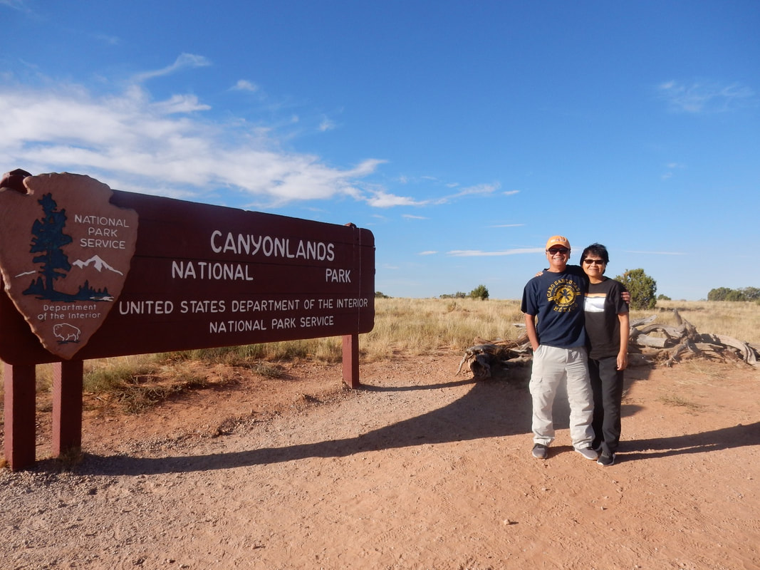
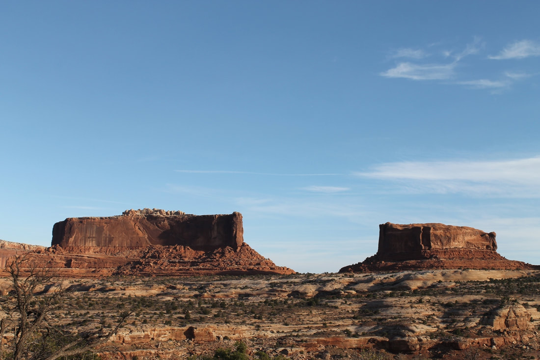
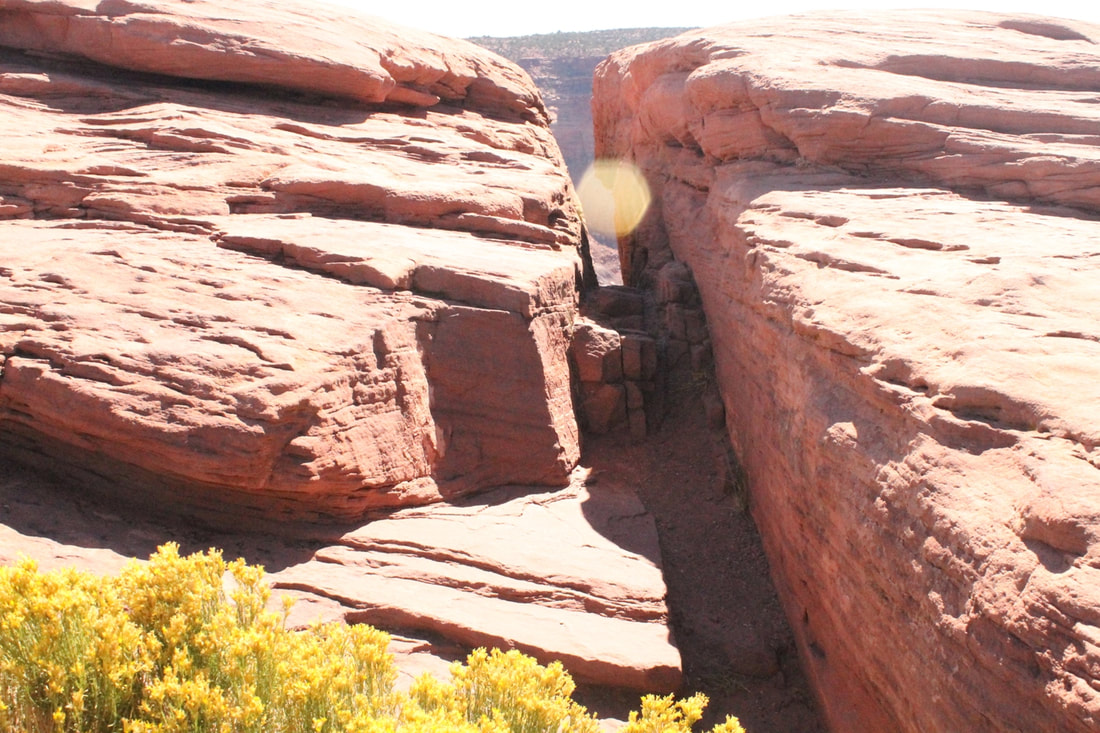
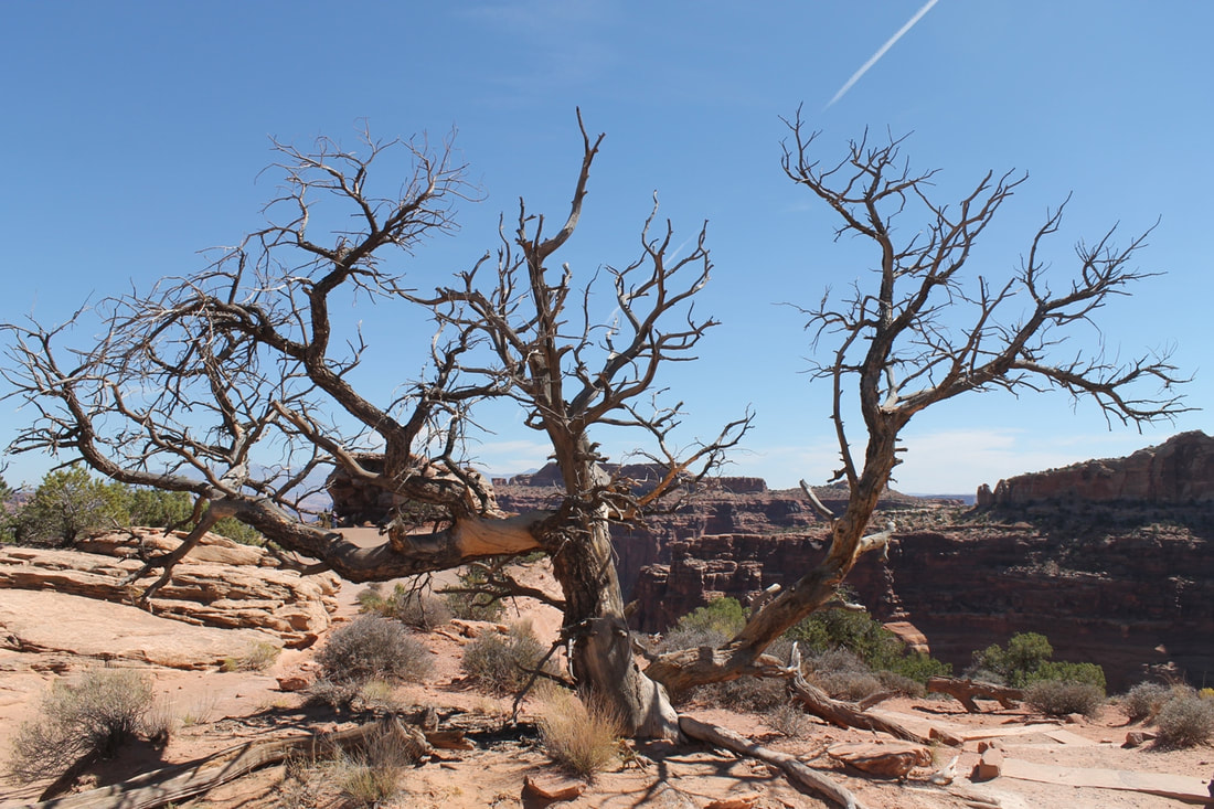
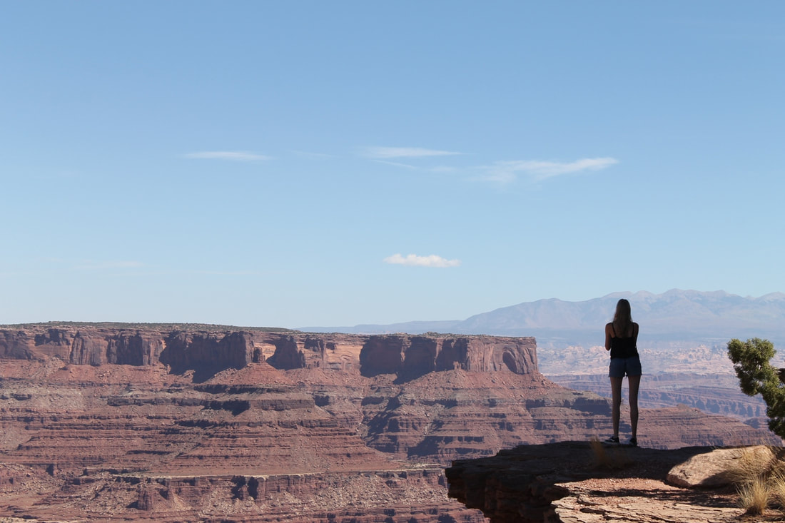
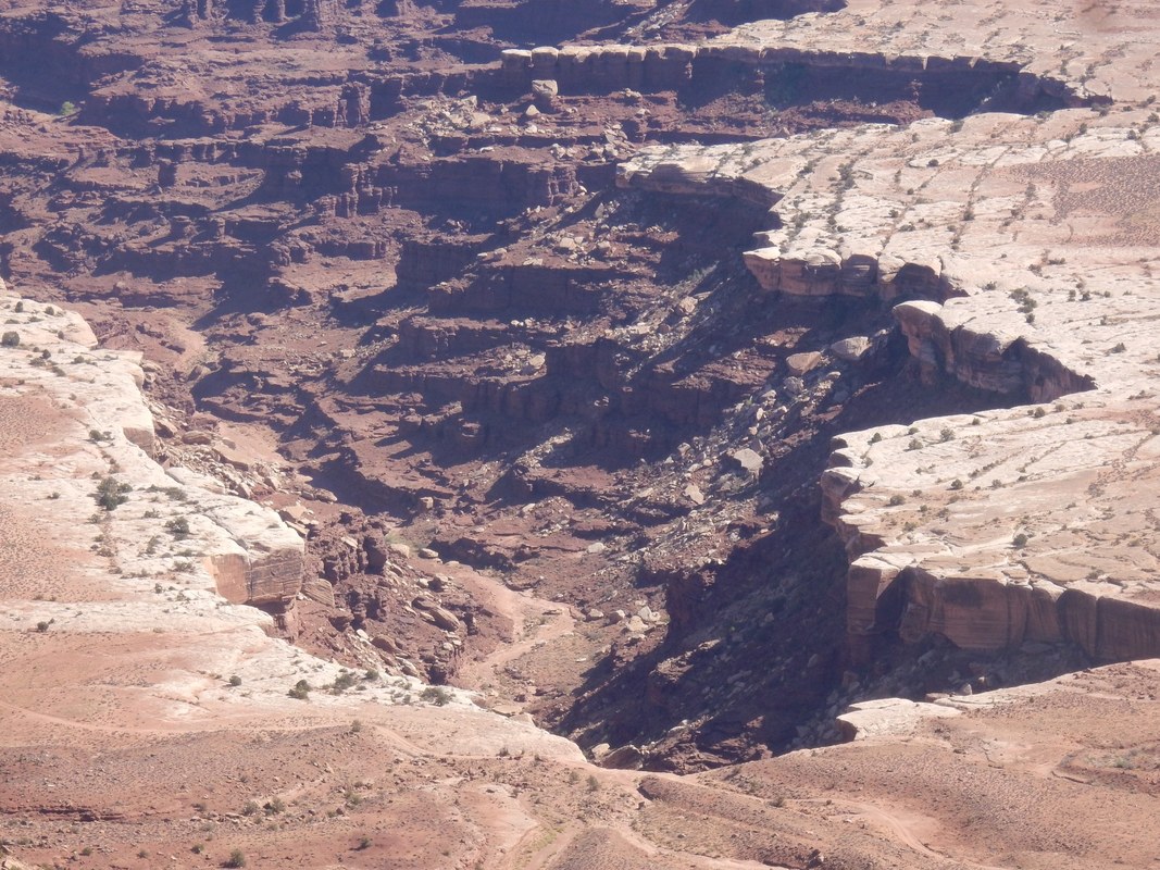
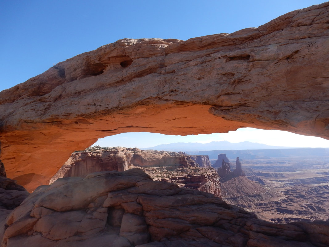
Day06 – Canyonlands National Park, Utah
Overnight: Moab, UT
Driving Distance: Moab to Canyonlands NP’s Island in the Sky Visitor Center: 30 min
“Canyonlands National Park in southeastern Utah is known for its dramatic desert landscape carved by the Colorado River. Island in the Sky is a huge, flat-topped mesa with panoramic overlooks. Other notable areas include the towering rock pinnacles known as the Needles, the remote canyons of the Maze and the Native American rock paintings in Horseshoe Canyon. Whitewater rapids flow through Cataract Canyon.” Wikipedia
We leisurely drove to the Canyonlands National Park this morning. It was only 30 min. drive from Moab to the Island in the Sky Visitor Center. It was quite an interesting story as how the park was established by the superintendent of the Arches NP; they called it ‘Campfire diplomacy’. The story had it that Bates Wilson, the superintendent of Arches NP at the time, led government officials on jeep tours which featured lengthy talks over campfires, Kentucky bourbon and hearty Dutch oven steak dinners led to the establishment of the Canyonlands NP.
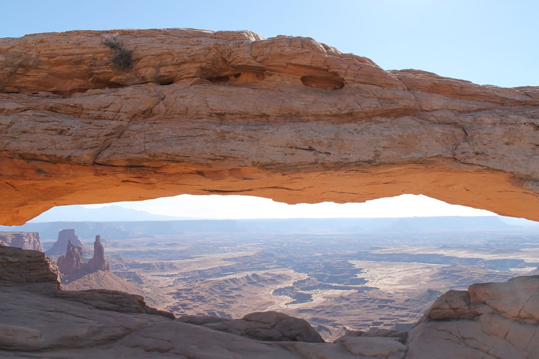
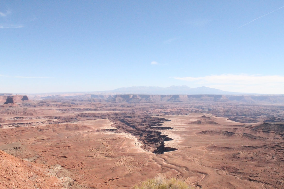
This spectacular park of rugged terrain divided into three sections by the natural boundary of two rivers; the Green river, and the Colorado river. Water and gravity cut flat layers of sedimentary rock into hundred of canyons, buttes, fins, arches, and spires. It was an awesome landscape that only nature can create. We were astonished by the spectacular views from the Green River Overlook that sits atop a massive mesa.
Imagine instead of miles and miles of rugged terrain with amazing views, here and there we allowed the installation of wind mills to farm wind power, then all of a sudden, it became ugly view of the landscape I am sure. Thus anything I can do to help preserve it I would do at any moment, even little act like staying on the trail, not straying away off the walking path that you may accidentally trample on the tiny living plants.
At every look-out you encountered a different view of the scenery. Some required a few hundred yards walking to get to it. We walked to the beautiful and iconic Mesa Arch. It offers quite a spectacular view of the canyon below thru its gigantic arch.
Overnight: Moab, UT
Driving Distance: Moab to Canyonlands NP’s Island in the Sky Visitor Center: 30 min
“Canyonlands National Park in southeastern Utah is known for its dramatic desert landscape carved by the Colorado River. Island in the Sky is a huge, flat-topped mesa with panoramic overlooks. Other notable areas include the towering rock pinnacles known as the Needles, the remote canyons of the Maze and the Native American rock paintings in Horseshoe Canyon. Whitewater rapids flow through Cataract Canyon.” Wikipedia
We leisurely drove to the Canyonlands National Park this morning. It was only 30 min. drive from Moab to the Island in the Sky Visitor Center. It was quite an interesting story as how the park was established by the superintendent of the Arches NP; they called it ‘Campfire diplomacy’. The story had it that Bates Wilson, the superintendent of Arches NP at the time, led government officials on jeep tours which featured lengthy talks over campfires, Kentucky bourbon and hearty Dutch oven steak dinners led to the establishment of the Canyonlands NP.
This spectacular park of rugged terrain divided into three sections by the natural boundary of two rivers; the Green river, and the Colorado river. Water and gravity cut flat layers of sedimentary rock into hundred of canyons, buttes, fins, arches, and spires. It was an awesome landscape that only nature can create. We were astonished by the spectacular views from the Green River Overlook that sits atop a massive mesa.
Imagine instead of miles and miles of rugged terrain with amazing views, here and there we allowed the installation of wind mills to farm wind power, then all of a sudden, it became ugly view of the landscape I am sure. Thus anything I can do to help preserve it I would do at any moment, even little act like staying on the trail, not straying away off the walking path that you may accidentally trample on the tiny living plants.
At every look-out you encountered a different view of the scenery. Some required a few hundred yards walking to get to it. We walked to the beautiful and iconic Mesa Arch. It offers quite a spectacular view of the canyon below thru its gigantic arch.
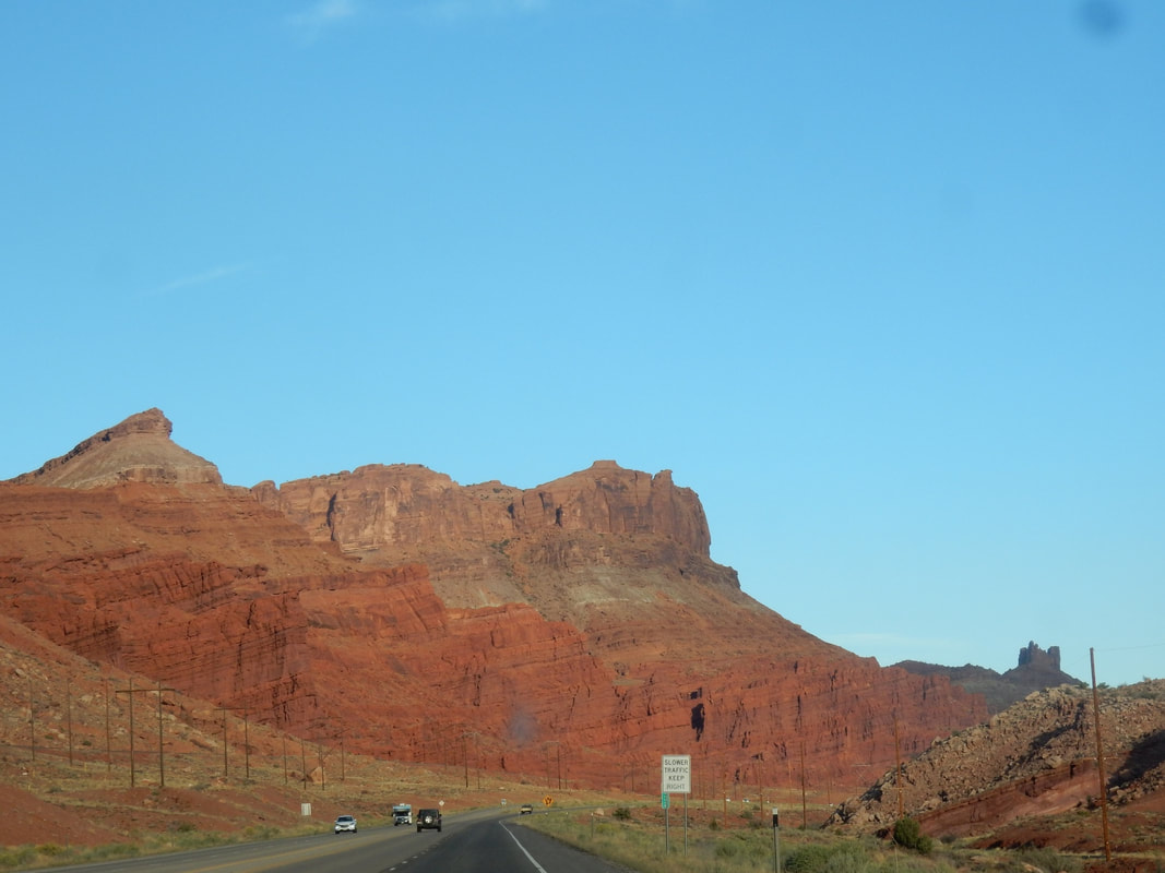
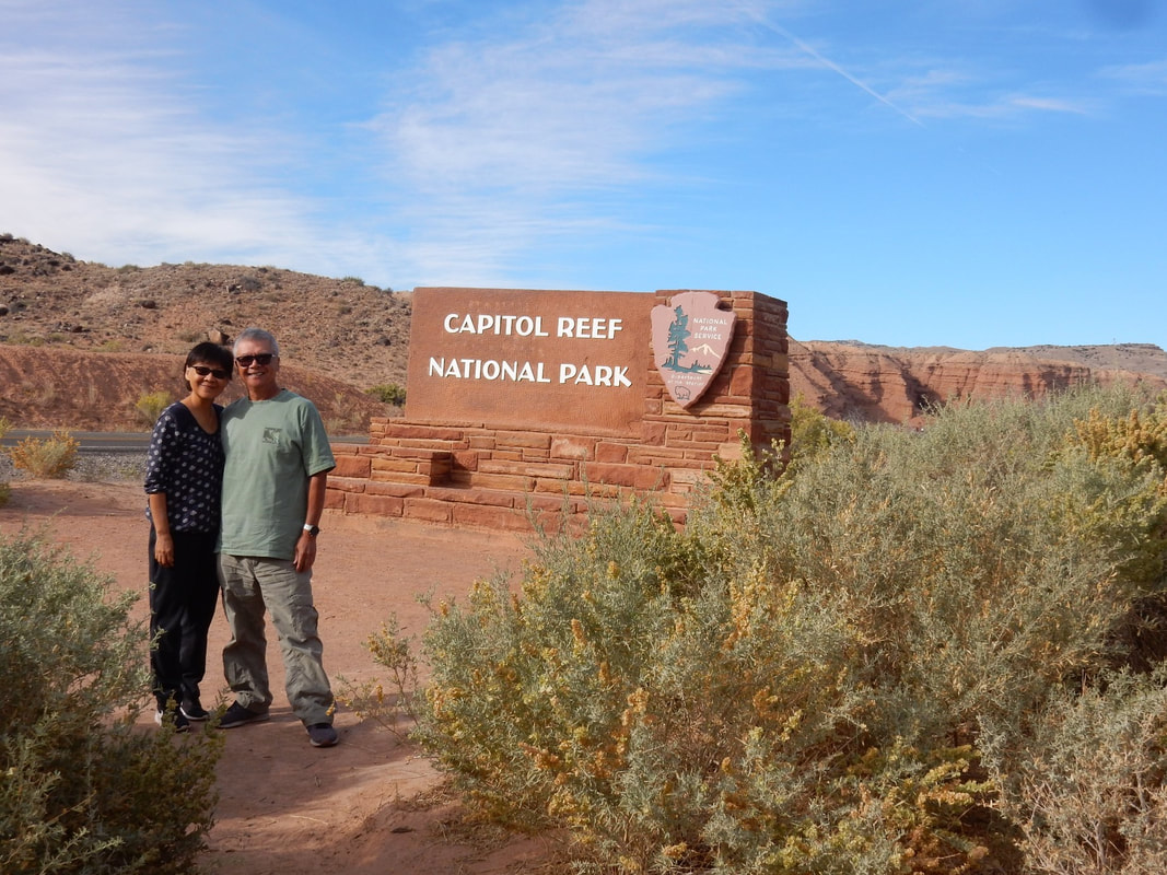
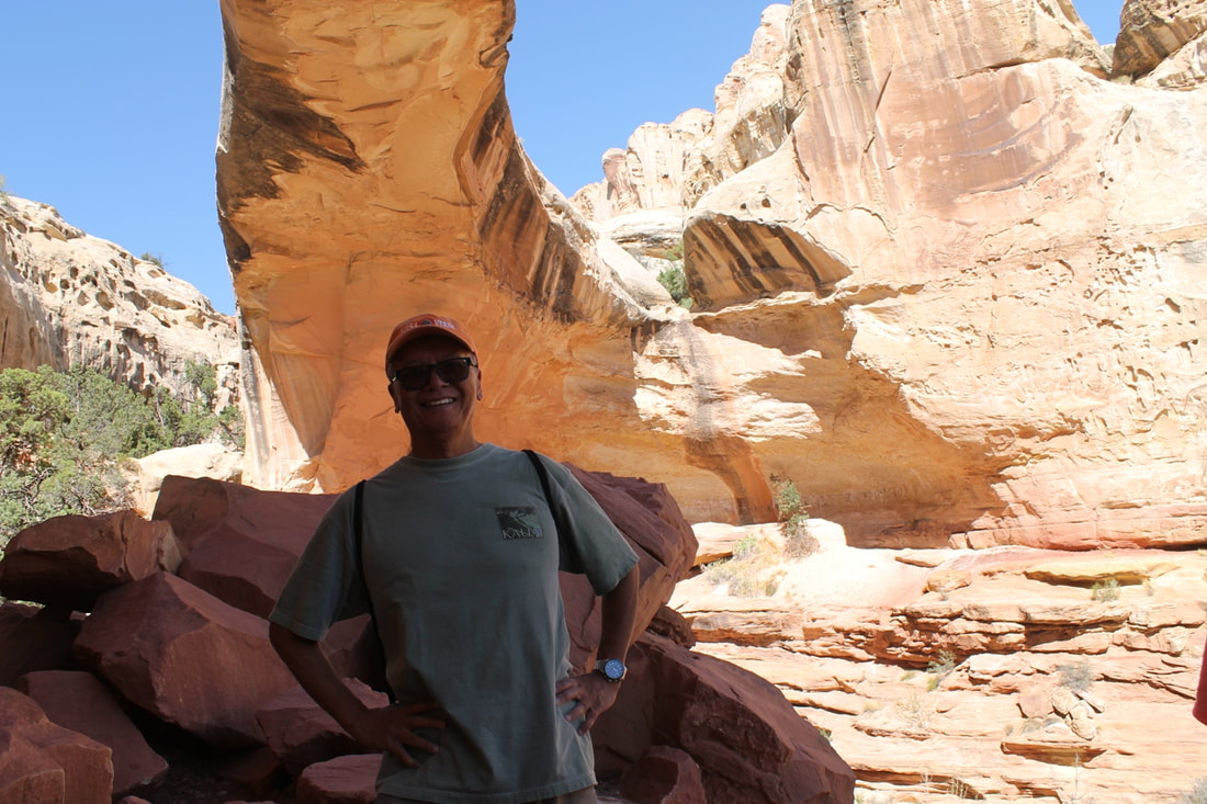
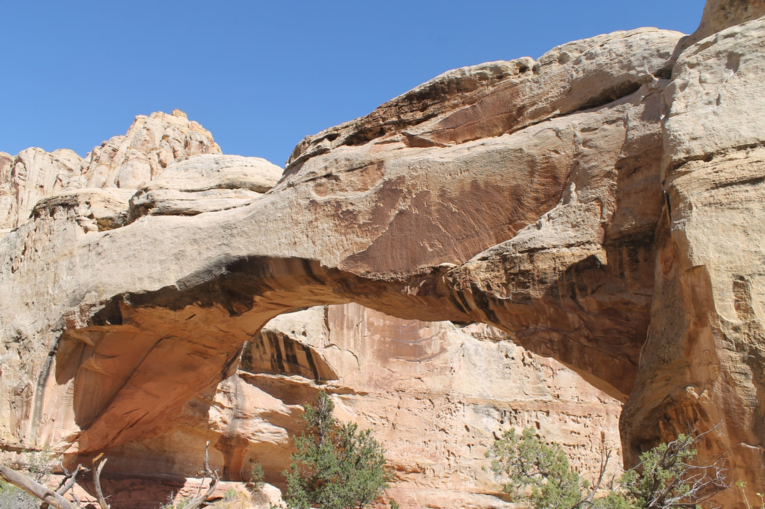
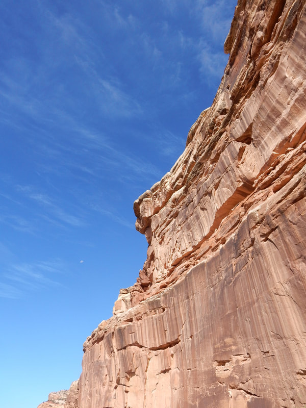
Day07 – Capitol Reef National Park, Utah
Overnight: Beaver, UT
Driving Distance: Moab to Beaver: 3 h 27 min (235.6 mi) via I-70 W
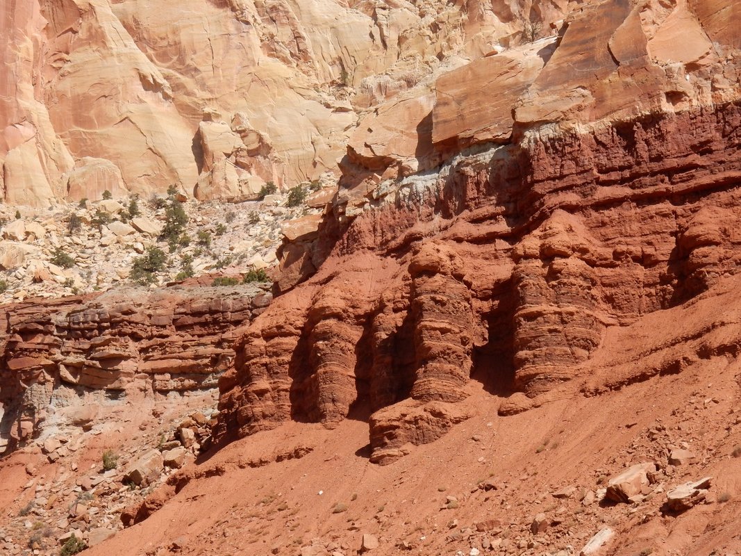
“Capitol Reef National Park is in Utah's south-central desert. It surrounds a long wrinkle in the earth known as the Waterpocket Fold, with layers of golden sandstone, canyons and striking rock formations. Among the park's sights are the Chimney Rock pillar, the Hickman Bridge arch, and Capitol Reef, known for its white sandstone domes. In the north are the towering monoliths of Cathedral Valley.” Wikipedia
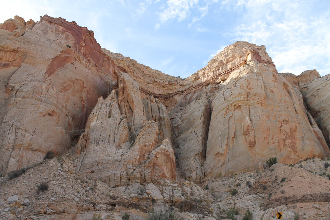
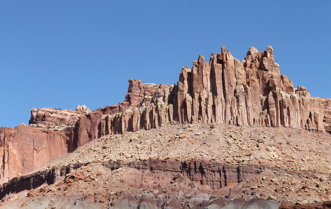
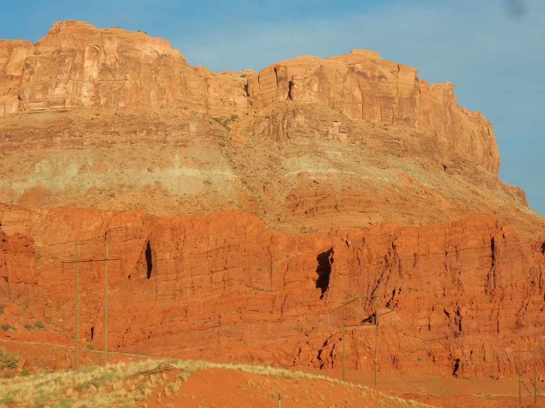
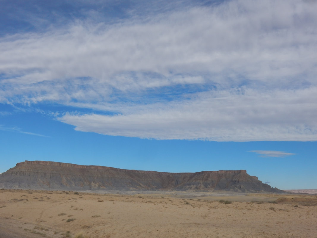
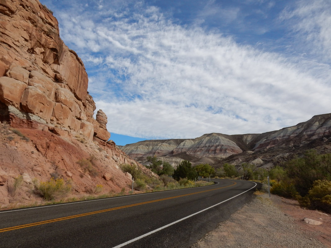
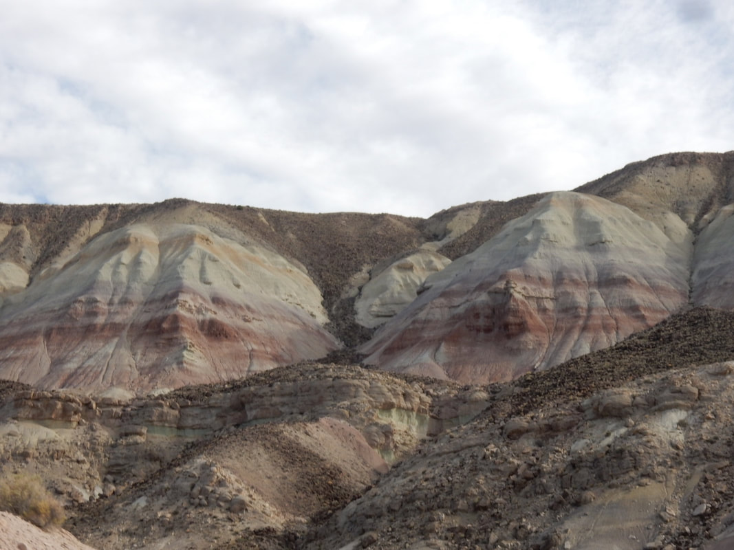
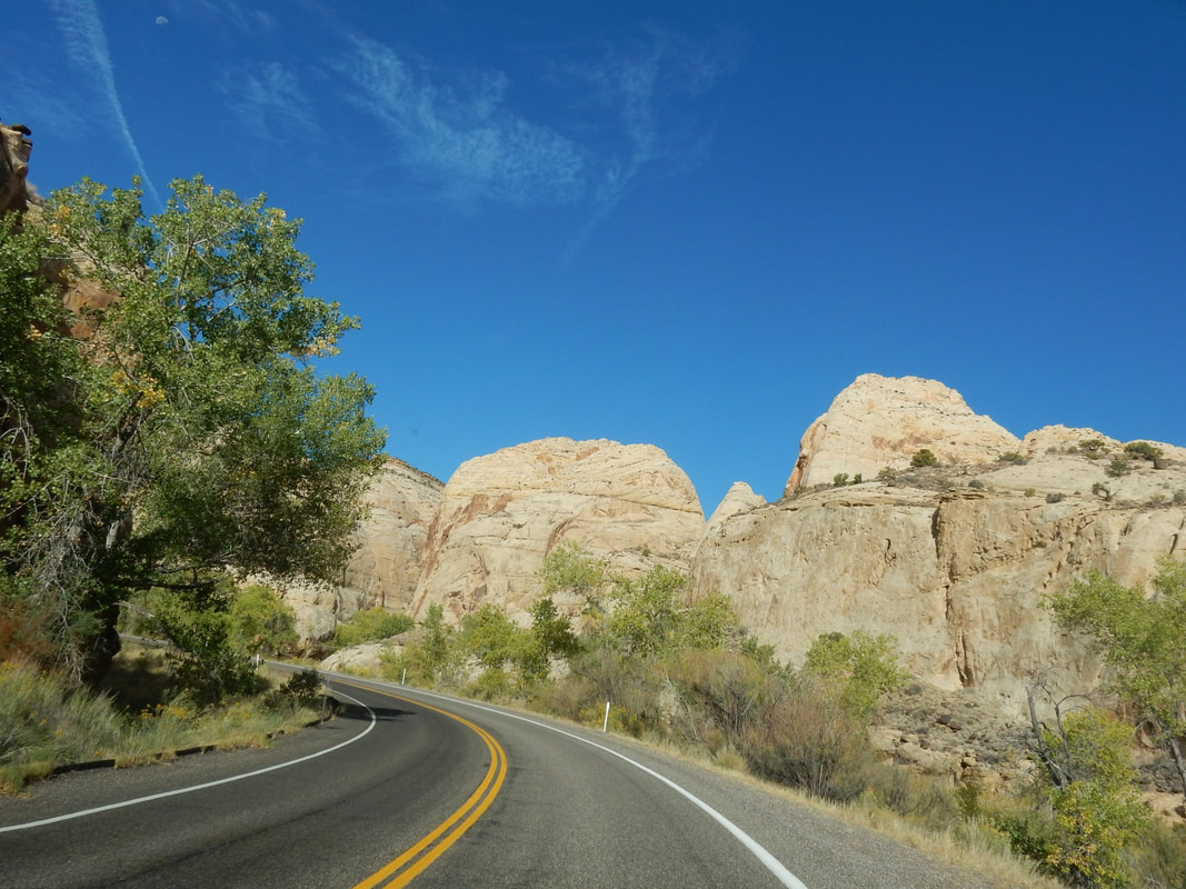
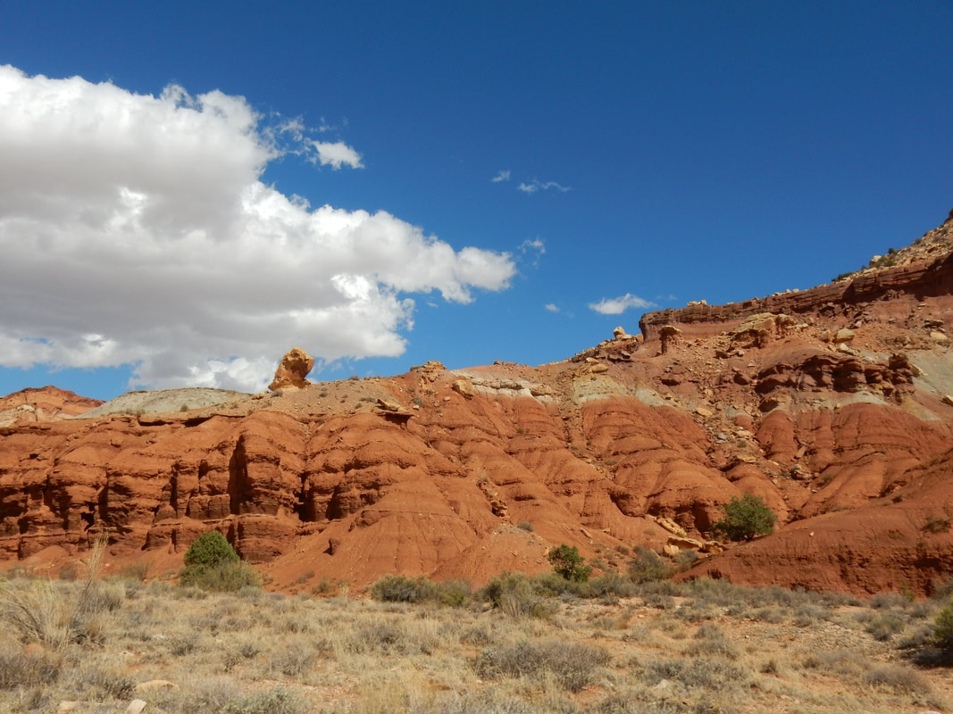
From Moab, we drove west toward Beaver, UT and stopped at the Capitol Reef National Park along the way, before resting the night in the little sleepy town called Beaver. The park is in south-central Utah, red rocks are everywhere filled with cliffs, canyons, domes that you don’t see anywhere else.
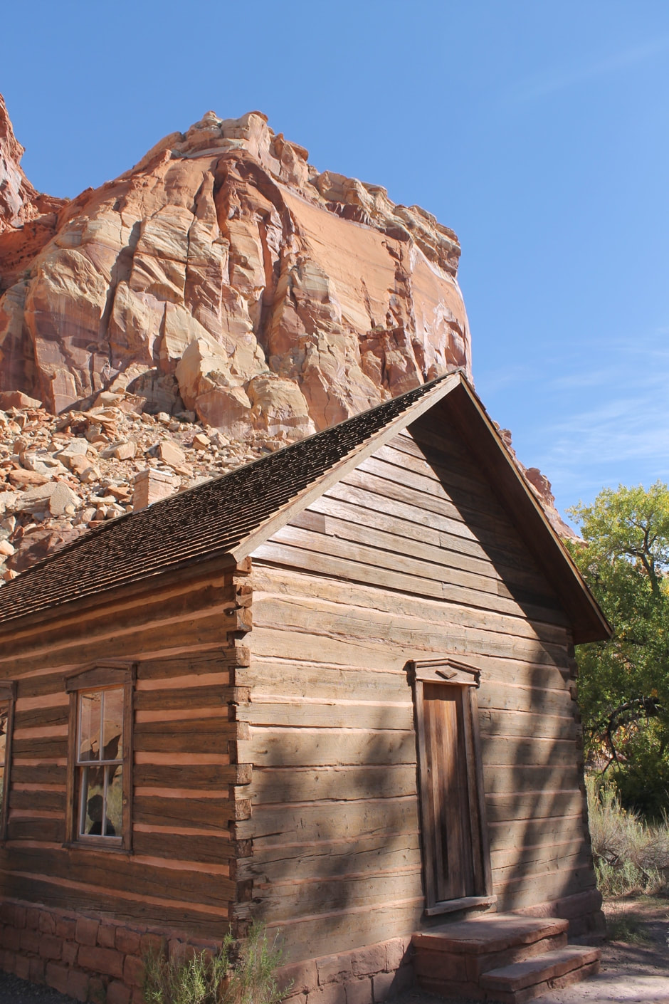
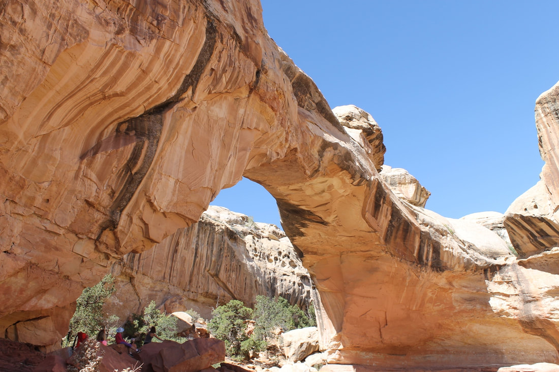
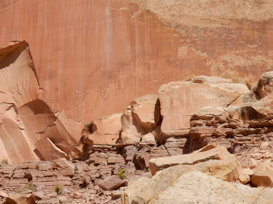
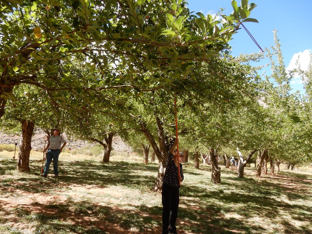
At the park, we hiked a mile long trail to Hickman Bridge. It was a bit treacherous, up and down thru uneven rocks and sand, but it was well worth it at the end with the awesome view of the natural formed rock. There were quite a few souls just as determined as we were. An old man with walking stick, click clack, click clack but steadily he climbed. A mom and daughter enjoyed the trip together. I overheard the mom begged the daughter for a selfie, apparently she was not too fond of it, but the mom wanted to treasure the priceless memory. At another trail in the park, we walked on a board walk along the red rock wall full of petroglyph from the ancient time, the Native American Indian left their relics on the rock. We visited a one-room school house that also was used as a meeting hall. Many Mormons lived here, life was quite simple and hash back then, but they survived thru determination. We stopped at a fruit orchard in the park and picked a few apples for a dollar a pound. It was quite delicious and fun.
The 'waterpocket fold' is quite an interesting phenomenon here in this park. It termed wrinkle in earth’s crust, created overtime by three powerful processes- deposition, uplift, and erosion.
As we left the park, just little past Torrey going west, in Bicknell, we encountered some cheesy advertisement for cold beer. The big sign on the side of the road enticed people to stop for a cold beer said: “Beer as cold as your ex’s heart”. Hahah
Overnight: Beaver, UT
Driving Distance: Moab to Beaver: 3 h 27 min (235.6 mi) via I-70 W
“Capitol Reef National Park is in Utah's south-central desert. It surrounds a long wrinkle in the earth known as the Waterpocket Fold, with layers of golden sandstone, canyons and striking rock formations. Among the park's sights are the Chimney Rock pillar, the Hickman Bridge arch, and Capitol Reef, known for its white sandstone domes. In the north are the towering monoliths of Cathedral Valley.” Wikipedia
From Moab, we drove west toward Beaver, UT and stopped at the Capitol Reef National Park along the way, before resting the night in the little sleepy town called Beaver. The park is in south-central Utah, red rocks are everywhere filled with cliffs, canyons, domes that you don’t see anywhere else.
At the park, we hiked a mile long trail to Hickman Bridge. It was a bit treacherous, up and down thru uneven rocks and sand, but it was well worth it at the end with the awesome view of the natural formed rock. There were quite a few souls just as determined as we were. An old man with walking stick, click clack, click clack but steadily he climbed. A mom and daughter enjoyed the trip together. I overheard the mom begged the daughter for a selfie, apparently she was not too fond of it, but the mom wanted to treasure the priceless memory. At another trail in the park, we walked on a board walk along the red rock wall full of petroglyph from the ancient time, the Native American Indian left their relics on the rock. We visited a one-room school house that also was used as a meeting hall. Many Mormons lived here, life was quite simple and hash back then, but they survived thru determination. We stopped at a fruit orchard in the park and picked a few apples for a dollar a pound. It was quite delicious and fun.
The 'waterpocket fold' is quite an interesting phenomenon here in this park. It termed wrinkle in earth’s crust, created overtime by three powerful processes- deposition, uplift, and erosion.
As we left the park, just little past Torrey going west, in Bicknell, we encountered some cheesy advertisement for cold beer. The big sign on the side of the road enticed people to stop for a cold beer said: “Beer as cold as your ex’s heart”. Hahah
Day08 – Great Basin National Park, Nevada
Overnight: Beaver, UT
Driving Distance: Beaver to Great Basin NP: 2 h 4 min (118.5 mi) via UT-21 W
“Great Basin National Park is in eastern Nevada near the Utah border. It's in the Great Basin Desert and contains most of the South Snake Mountains. In the north, the mountain-hugging Wheeler Peak Scenic Drive leads to towering Wheeler Peak. Nearby is one of several ancient bristlecone pine groves. The marble Lehman Caves have distinctive stalactites and other formations. Park wildlife includes bighorn sheep.” Wikipedia
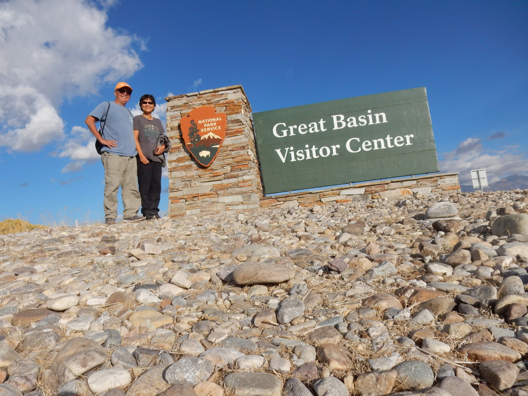
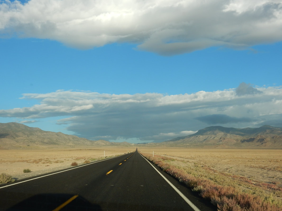
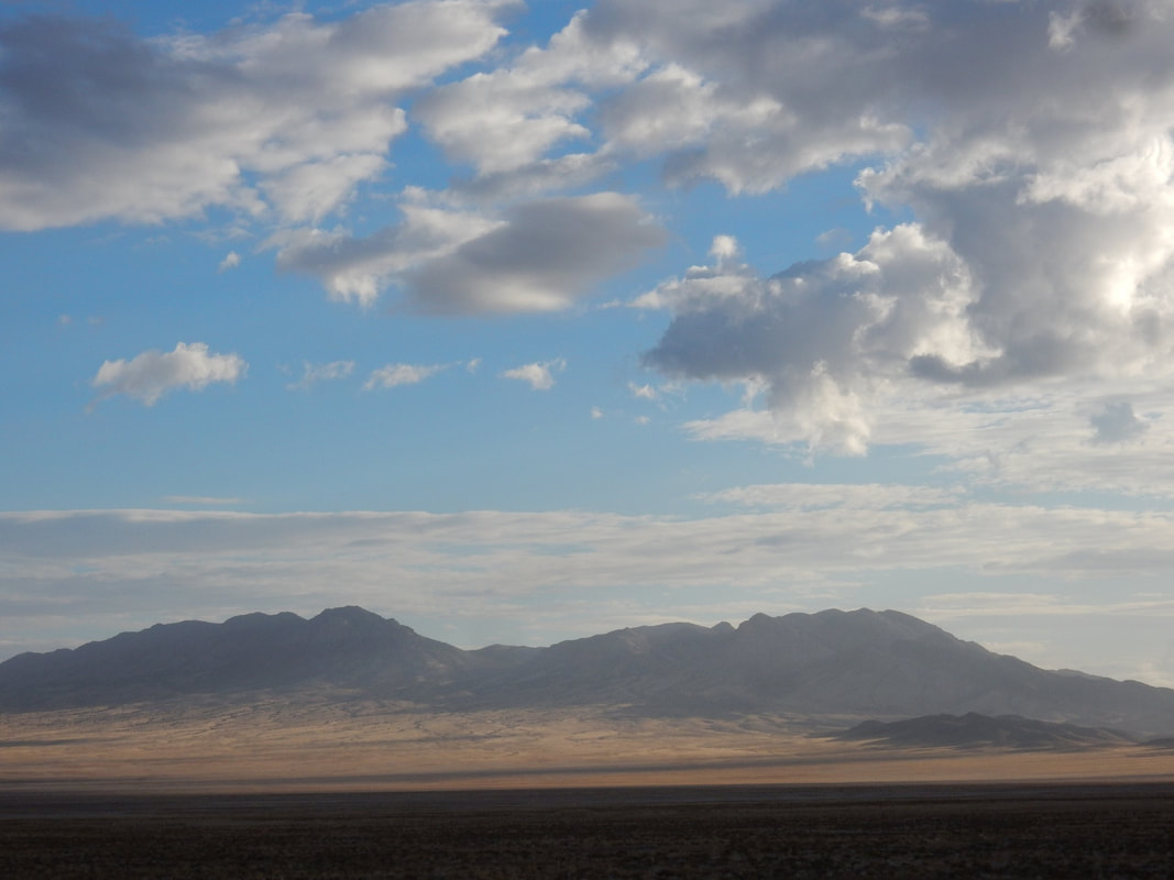
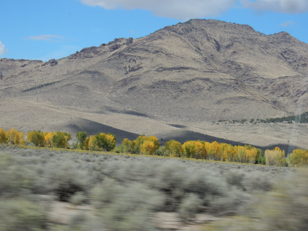
We drove two hours from Beaver, Utah to the Great Basin National Park. This area is truly in the isolated part of Nevada. You drive miles and miles seeing flat land full of sage bushes, you see the highway in front of you as straight as an arrow leading up into the mountain at the far distance. Not a single house can be seen all around you. You are heading into the wilderness. The park is proud of its isolation and that’s why they said if you are seeking for solitude of the wilderness then this is the place to go.
There is a Visitor Center in Baker just outside of the park, but it’s only open seasonally. It was closed at the time we arrived, so we went on to Hyman Cave Visitor Center which is about 8 miles up the road. There we watched a ½ hrs movie about the park. It’s called the Great Basin since water here mostly has no outlet to the sea so it stayed in the shallow salt lakes, mud flats and eventually evaporated in the desert. It’s sandwiched in between the two mountain ranges, the Sierra Nevada and the Wasatch Mountains.
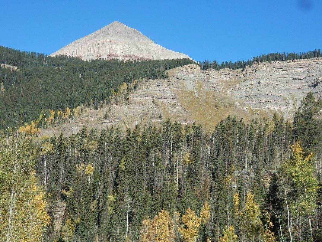
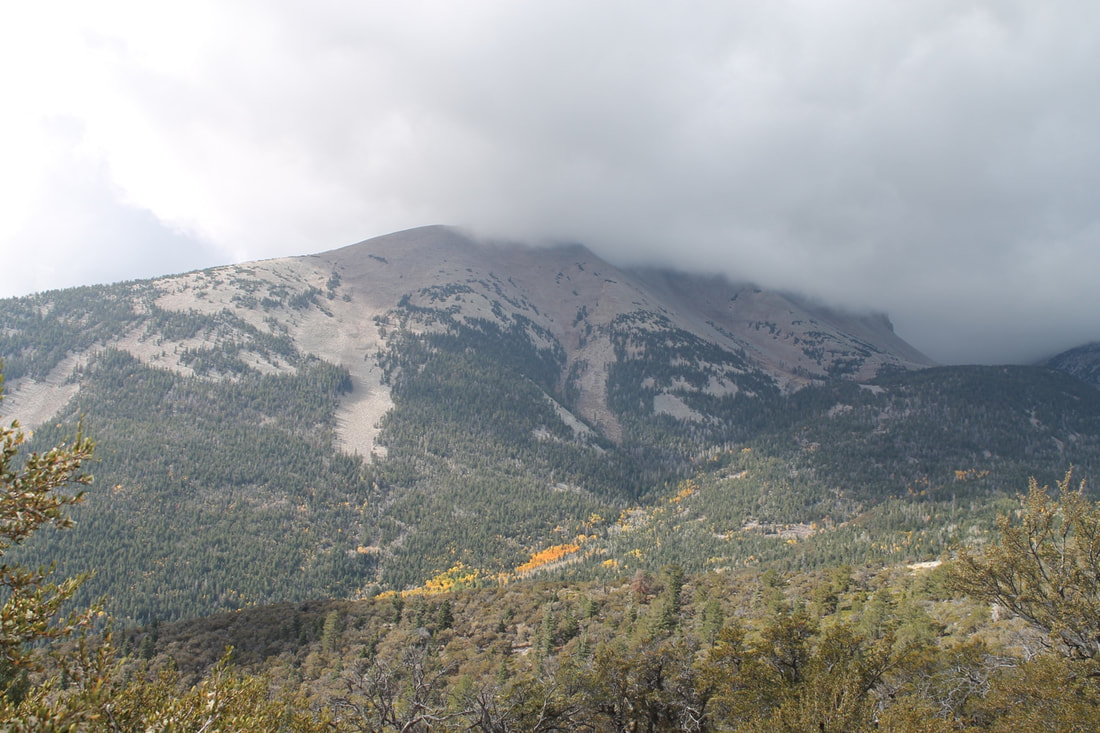
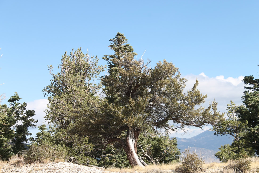
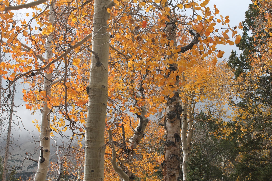
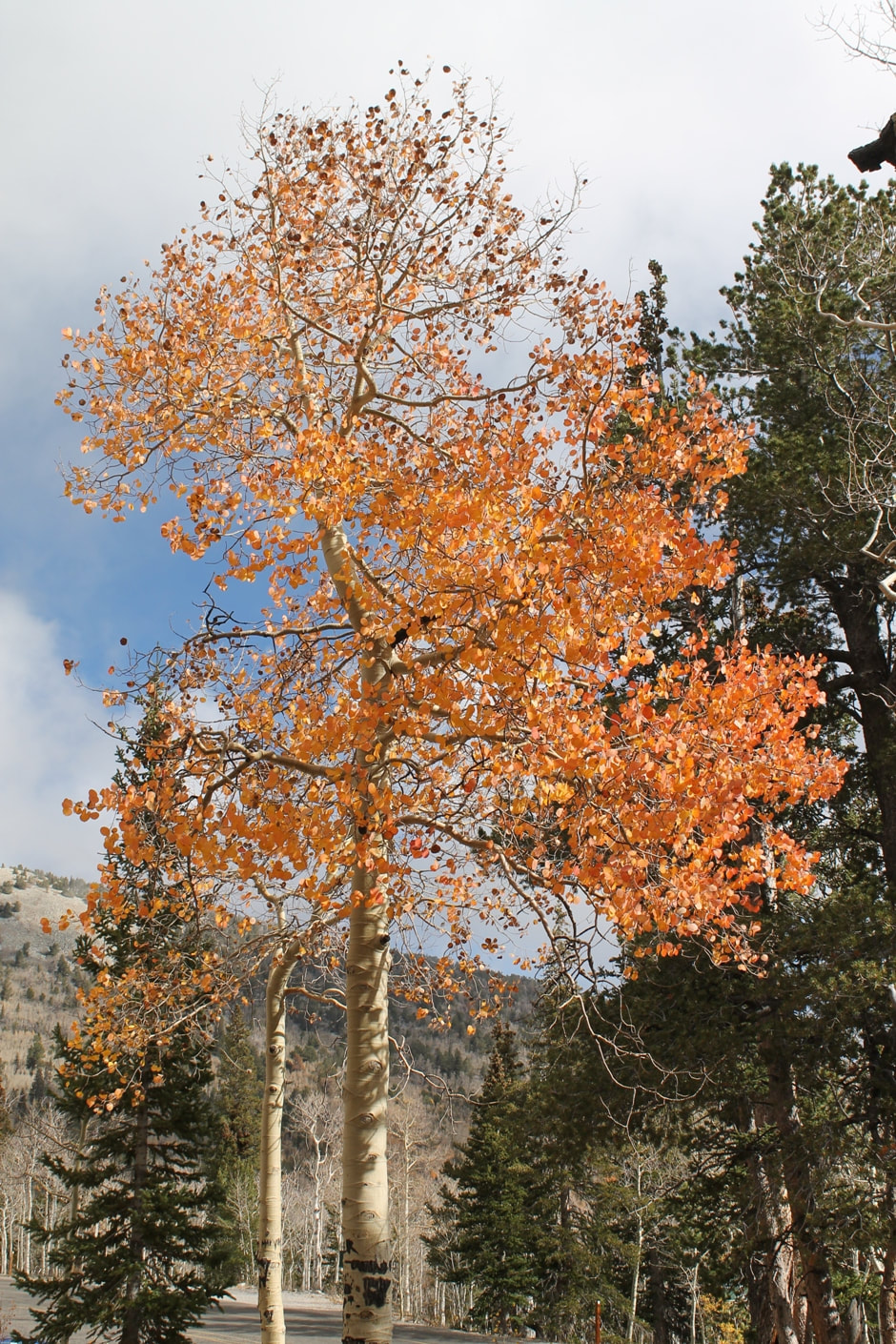
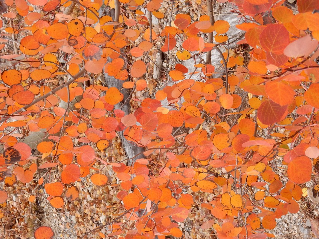
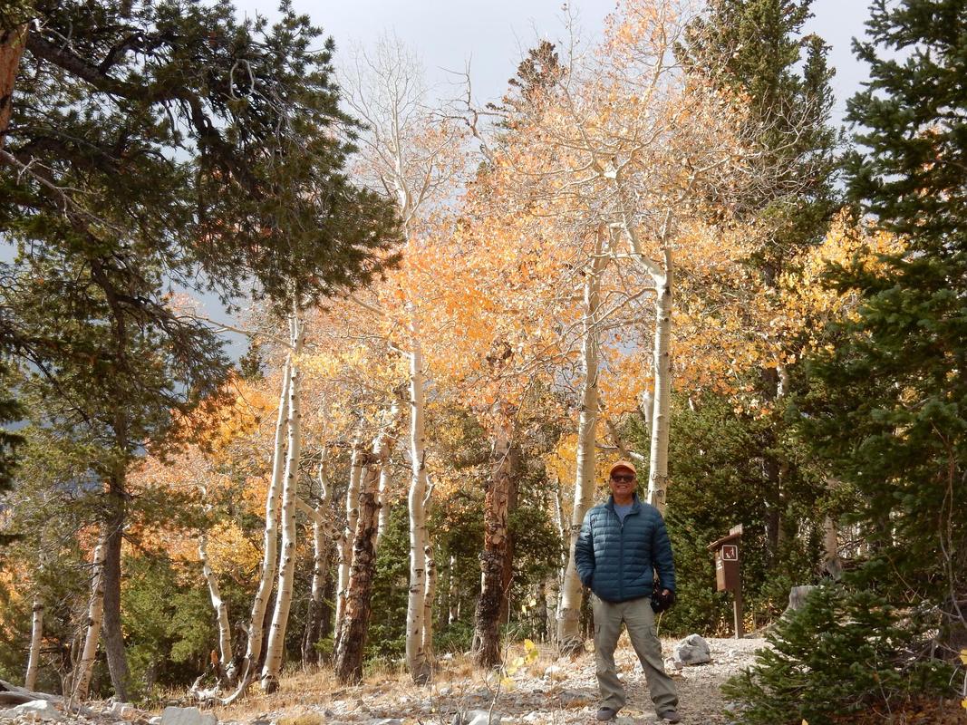
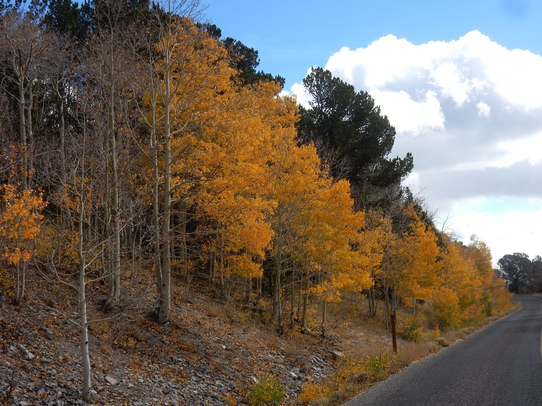
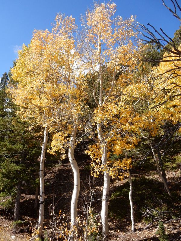
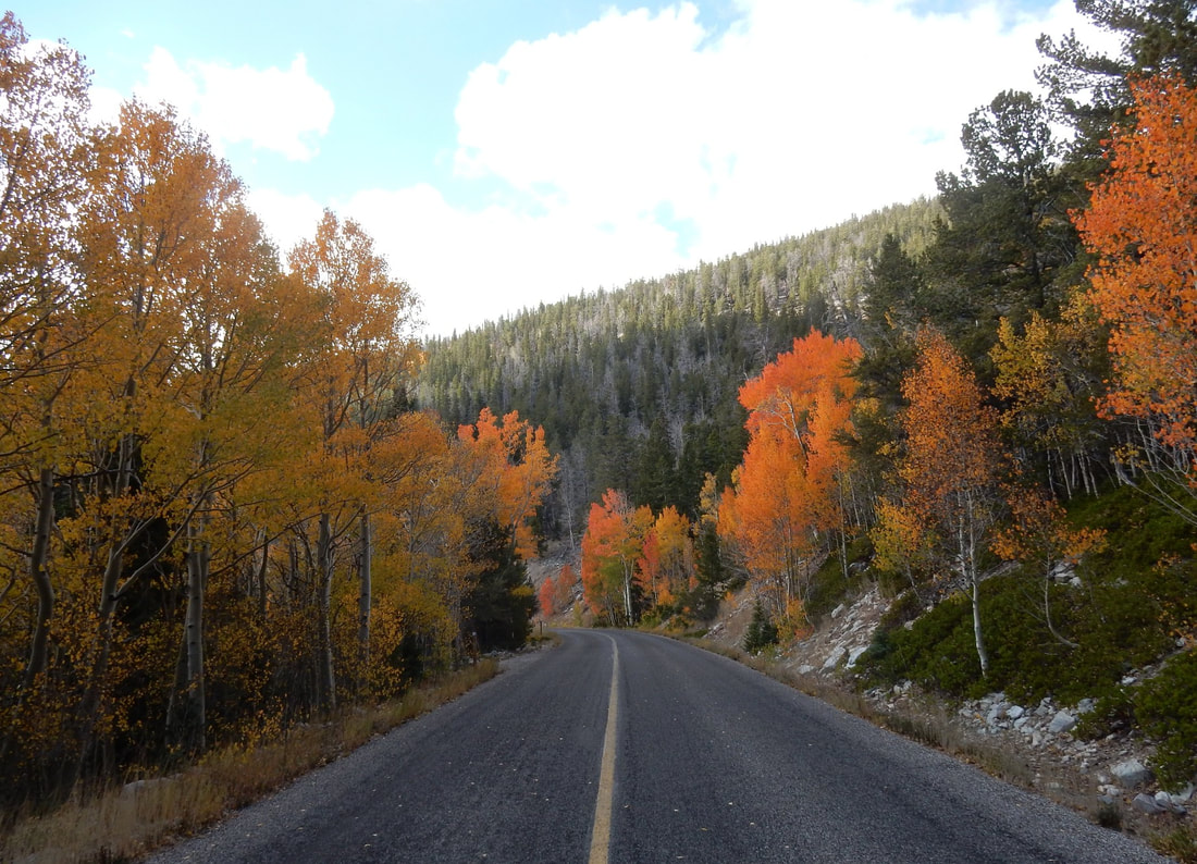
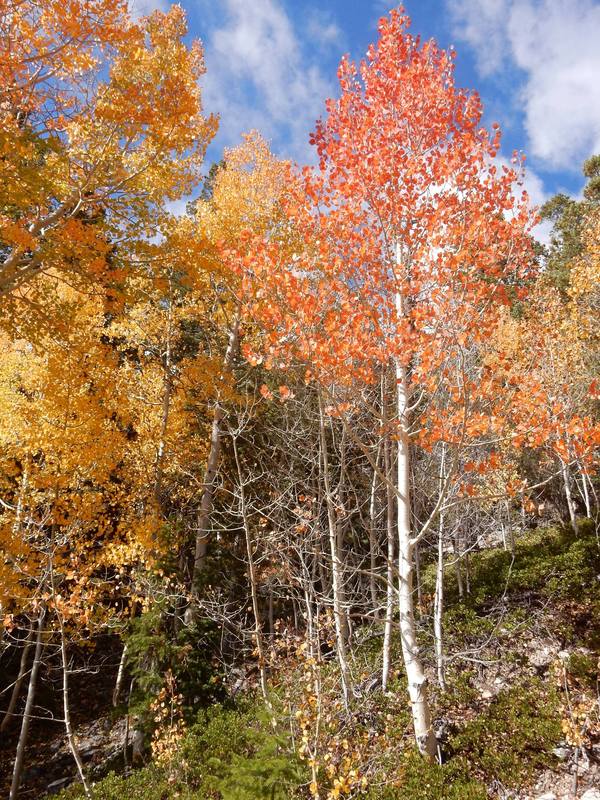
The isolation of the area makes it a great place to get away from a busy city life. We drove the park’s narrow, windy, no shoulder road up to the top of the 1300-foot summit of Wheeler Peak. It's awesome particularly at this time of the year since aspen trees with their spectacular color dotted the landscape among the green, tall pine trees here and there and the bristlecone pine coves. The bristlecone tree is the oldest living tree in the world and it can be found here in this park. We saw clumps of them at the top of Wheeler Peak. Many of them look rugged but they are alive well into their thousand years of age.
We did not see any entrance booth to the park thus we assumed admission to the park is free.
Overnight: Beaver, UT
Driving Distance: Beaver to Great Basin NP: 2 h 4 min (118.5 mi) via UT-21 W
“Great Basin National Park is in eastern Nevada near the Utah border. It's in the Great Basin Desert and contains most of the South Snake Mountains. In the north, the mountain-hugging Wheeler Peak Scenic Drive leads to towering Wheeler Peak. Nearby is one of several ancient bristlecone pine groves. The marble Lehman Caves have distinctive stalactites and other formations. Park wildlife includes bighorn sheep.” Wikipedia
We drove two hours from Beaver, Utah to the Great Basin National Park. This area is truly in the isolated part of Nevada. You drive miles and miles seeing flat land full of sage bushes, you see the highway in front of you as straight as an arrow leading up into the mountain at the far distance. Not a single house can be seen all around you. You are heading into the wilderness. The park is proud of its isolation and that’s why they said if you are seeking for solitude of the wilderness then this is the place to go.
There is a Visitor Center in Baker just outside of the park, but it’s only open seasonally. It was closed at the time we arrived, so we went on to Hyman Cave Visitor Center which is about 8 miles up the road. There we watched a ½ hrs movie about the park. It’s called the Great Basin since water here mostly has no outlet to the sea so it stayed in the shallow salt lakes, mud flats and eventually evaporated in the desert. It’s sandwiched in between the two mountain ranges, the Sierra Nevada and the Wasatch Mountains.
The isolation of the area makes it a great place to get away from a busy city life. We drove the park’s narrow, windy, no shoulder road up to the top of the 1300-foot summit of Wheeler Peak. It's awesome particularly at this time of the year since aspen trees with their spectacular color dotted the landscape among the green, tall pine trees here and there and the bristlecone pine coves. The bristlecone tree is the oldest living tree in the world and it can be found here in this park. We saw clumps of them at the top of Wheeler Peak. Many of them look rugged but they are alive well into their thousand years of age.
We did not see any entrance booth to the park thus we assumed admission to the park is free.
Day09 – Salt Lake City - Home
Driving Distance: Beaver, UT to Salt lake City, UT: 2 h 42 min (198.7 mi) via I-15 N
We left Beaver early in the morning, plenty of time to get to the airport to catch a late afternoon flight back home. It was a wonderful road trip full of diversified landscapes. I would not hesitate for a second to recommend anyone to go west and see how beautiful America is and how lucky we are to have the opportunity to experience it.
