September 2018
National Parks visited: Four
Petrified Forest NP in Arizona
Saguaro NP in Arizona
Guadalupe NP in Texas
Big Bend NP in Texas
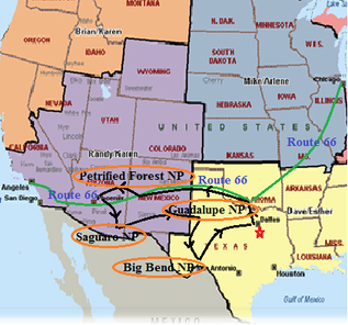
Route 66 and Southwest US Road Trip
Traveling on this historic Route 66, we wanted to relive that yesteryear experience, we wanted to visit the off-beaten paths on this old highway, we wanted to see what the nostalgic way of traveling is all about. After all, this is the Main Street of America, the Will Rogers Highway, the “Mother Road” as John Steinbeck coined it in his novel “The Grapes of wrath”. The highway, which became one of the most famous roads in America, originally ran from Chicago, Illinois to Santa Monica, California, covering a total of 2,448 miles. Since 1926, driving down Route 66 has been the experience of a lifetime for travelers, adventurers, desperados and dreamers.
So off we went, wandering around for 3100 miles of driving, the big state of Texas took a big chunk out of that mileage. Along the way, we managed to visit four National Parks: Petrified Forest NP in Arizona, Saguaro NP in Arizona, Guadalupe Mountains NP in Texas, and Big Bend NP in Texas.
We were thrilled of what we saw. It makes us yearning for more.
Dallas to Amarillo on a portion of Route 66 - Overnight in Amarillo, TX
Dallas to Amarillo: 5 h 30 min (365.1 mi) via US-287 N
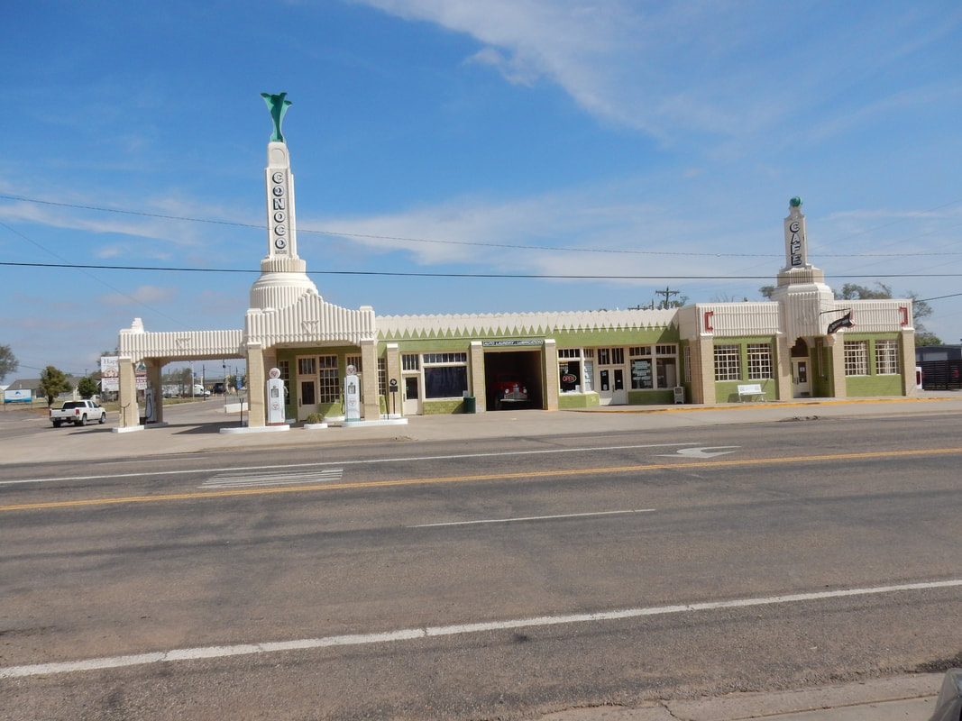
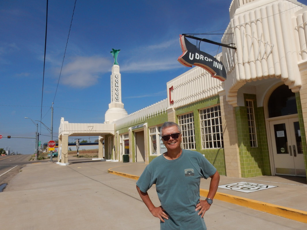
Our first stop on Route 66 was Shamrock, TX. Here, the landmarks of the yesteryear are the U-Drop Inn and the Cocono Service Station. The service station is now turned into a gift shop, and the old café inside the station where Elvis used to dine is still there. This service station was also used as an inspiration for Ramone’s paint shop in the movie Cars. The gas pump in the front still showed gasoline was a mere 28 cents a gallon.
We met a couple from Denmark. They have been on the road trip for a week, traveling on Route 66 from Chicago to here. They planned to drive to LA, then on to San Francisco, before heading home. In the US, we tend not to appreciate much of old historical stuff, but to the foreigners, coming to the US to be able to drive on these old highways, stop here and there in these little towns along the way to find out what real America is all about is a blast. Another young couple we met on the route was from Italy.
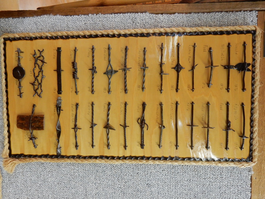
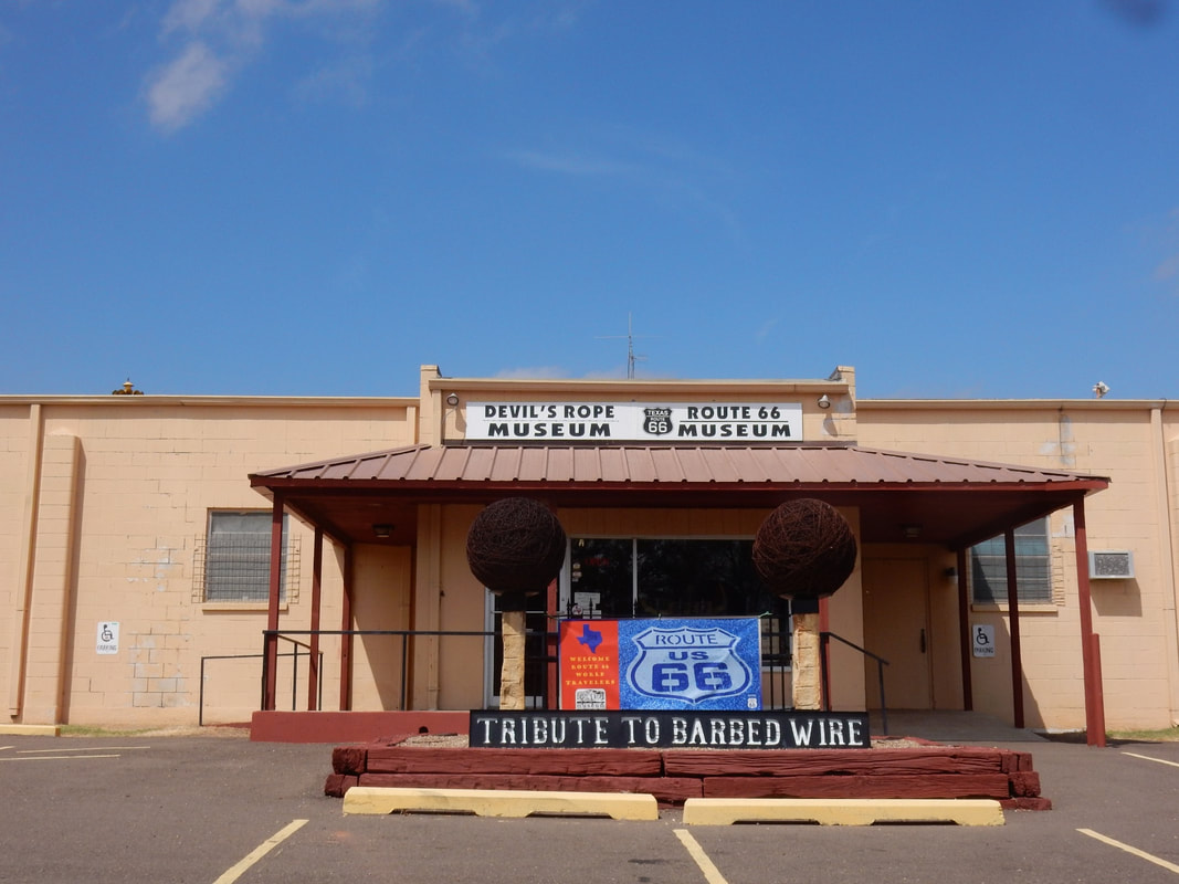
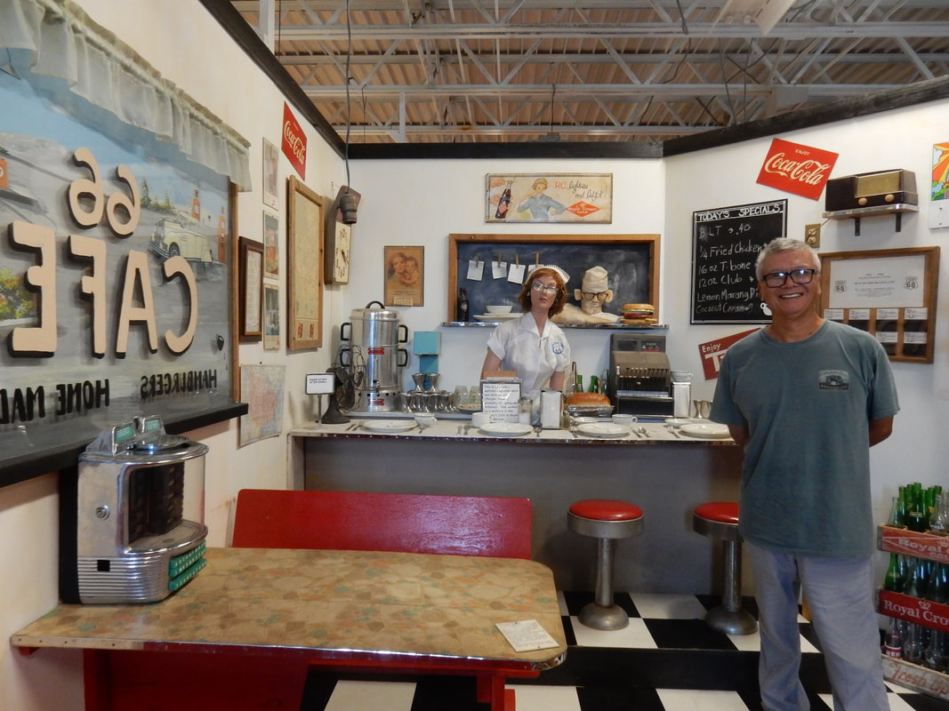
From Shamrock, we meandered along the old highway 66 to McLean, TX where we visited the Devil’s Rope Museum (Barbwire in the modern term) the largest of its kind in the world.
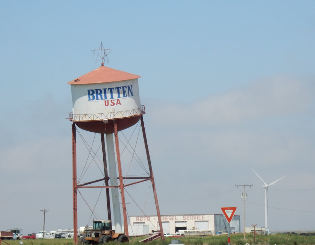
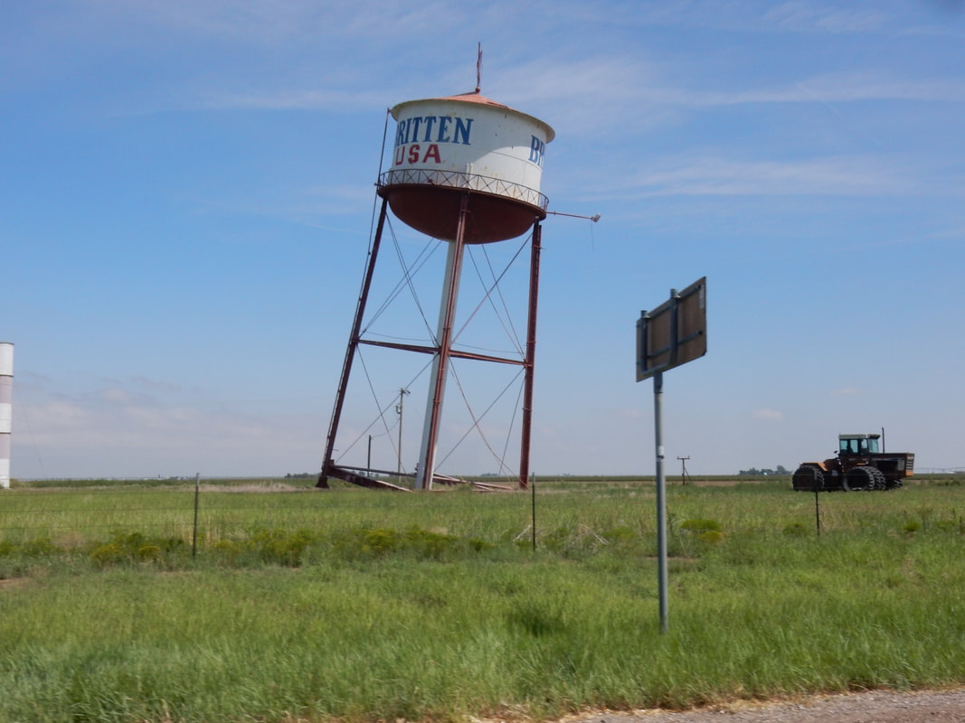
Little further west, we drove by the “Leaning Tower of Texas” in the town of Groom, TX. The water tower was purposely built tilted to draw travelers on Route 66 into town in the old days.
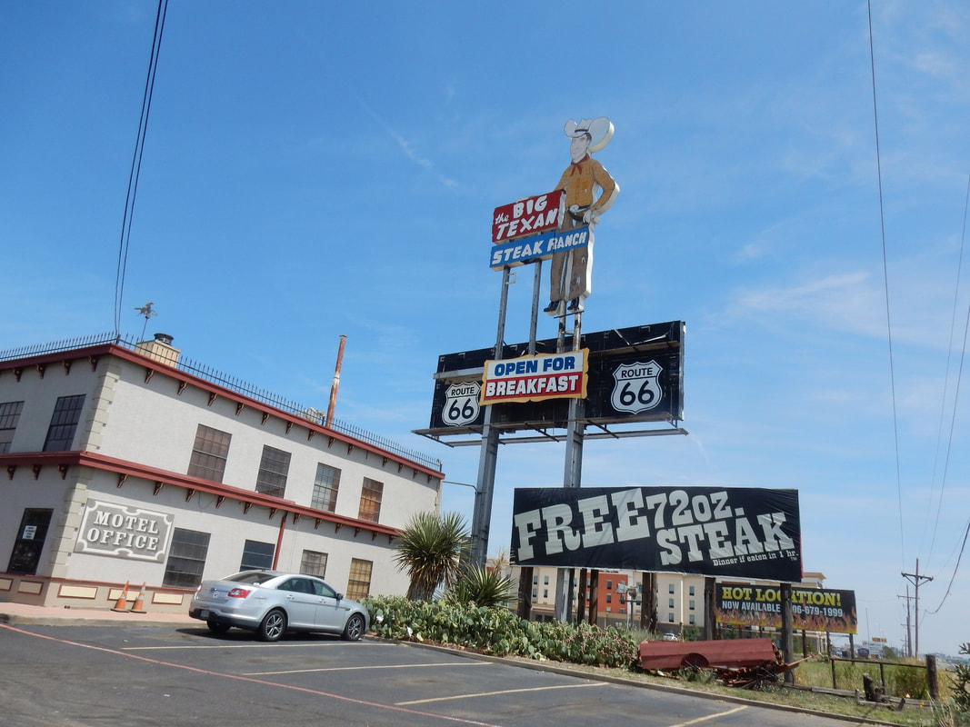
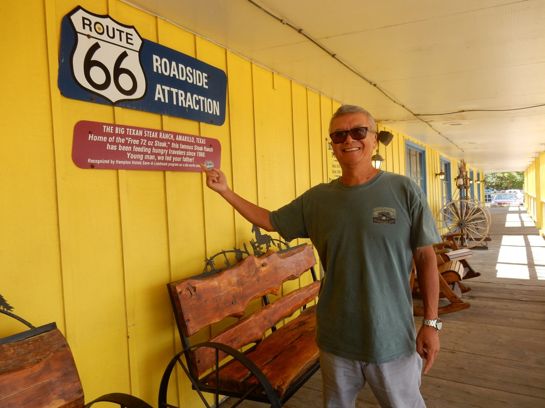
We got to Amarillo, TX in the early afternoon, hungry and all, so it was quite appropriate to check out another landmark on Route 66 and had a bite to eat, the world famous “Big Texan Steak Ranch”. The restaurant offers its famous “Home of the 72 oz free steak” meal if you can devout it and all the trimmings within one hour. And yes, there are people, large cowboys, and skinny cowboys down it well within the time limit. Writing on the chalkboard hanging on the wall indicated there was a 230-pounds guy that can do it all in 31 minutes.
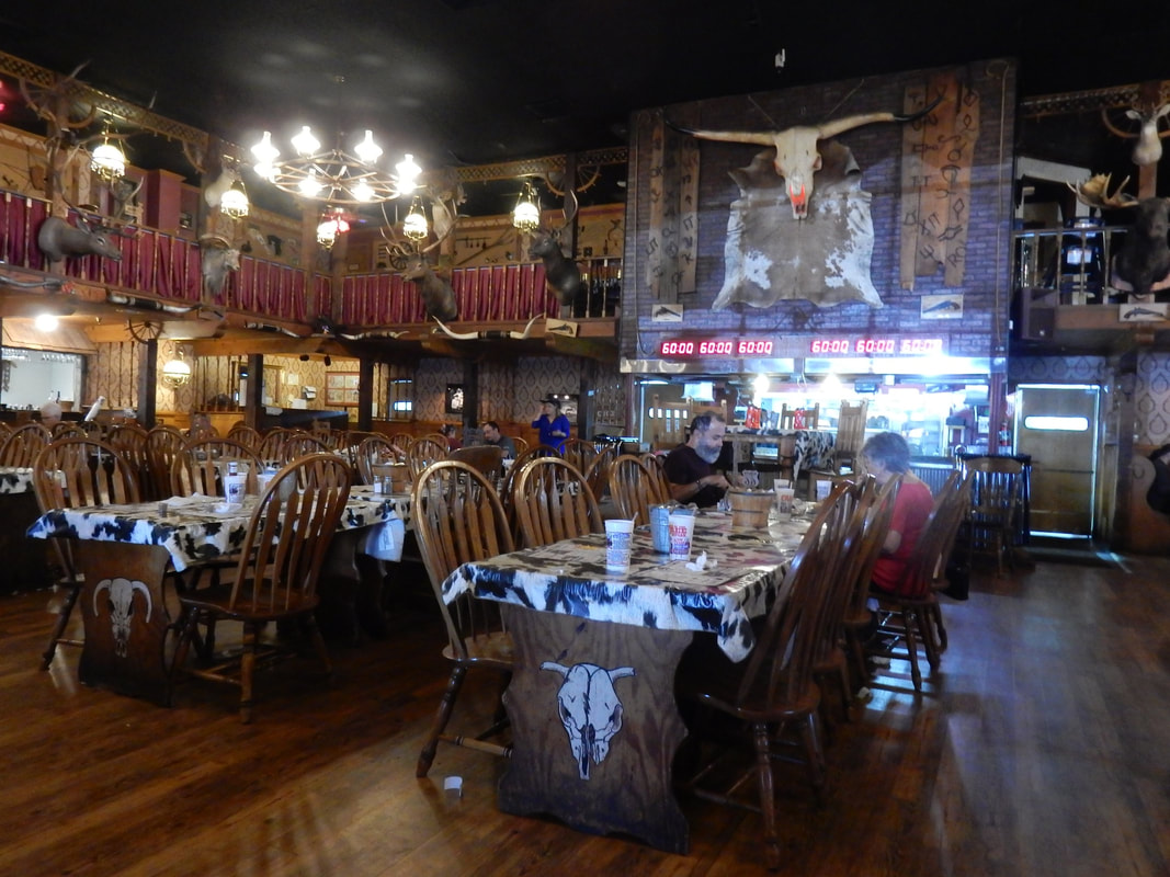
In the big dining hall, they have a clock-timer hanging on the wall, nearby there’s big and high table sits in the middle of a gigantic dining hall. The contestants would sit around this special table eating their meals, and the diners/spectators in the surrounding tables hollering, cheering while the contestants devouring the gigantic meals. It must be quite a scene.
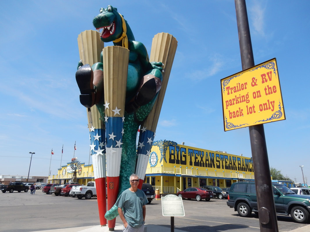
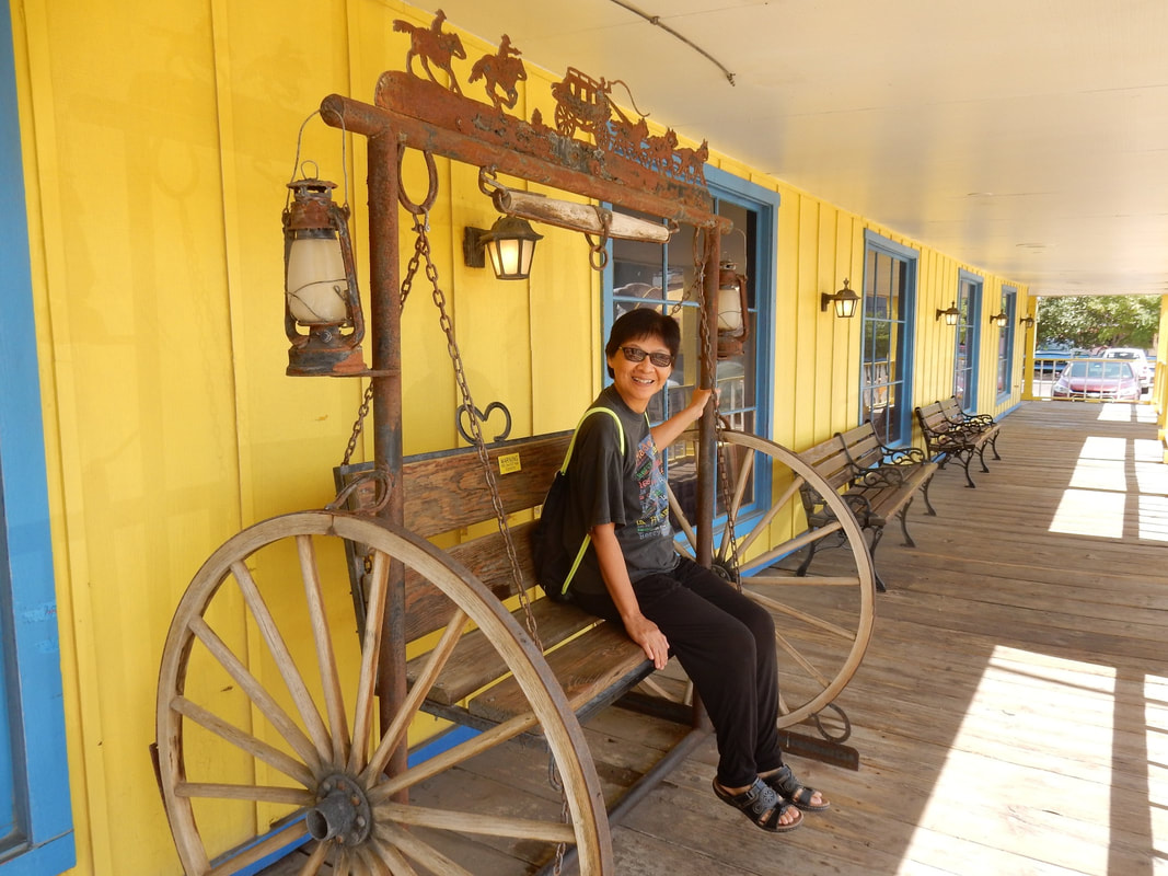
We had a petite steak for lunch, and it was quite delicious. As a matter of fact, we stayed in Amarillo that night and came back for dinner. The steakhouse is highly decorated with bright decor on the outside. Inside is a big dining hall with long tables in the middle meant to share, and surrounding it on the second floor was more tables. Stuffed deer heads, longhorn skulls hanging on the wall around you staring at you while you eat. The place was packed full on a week-day night, with servers adorned in the cowboys’ clothing and cowboys’ hats. There were musicians strolling around, playing guitars singing a cowboy tune for tips of course. Then large portion dessert is being tempted by the waitresses. As you walked out the restaurant, there’s the fudge shop and the ice-cream bar right in front, a pretty cowgirl at the counter winked at me saying “Howdy, would you like to try some fudge?”…heheh. Just across the entrance hall is a gift shop selling cowboys hats, T-shirts, cowbells, longhorns, shotglasses...etc.
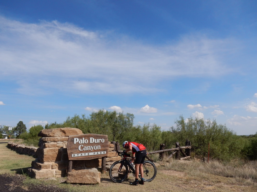
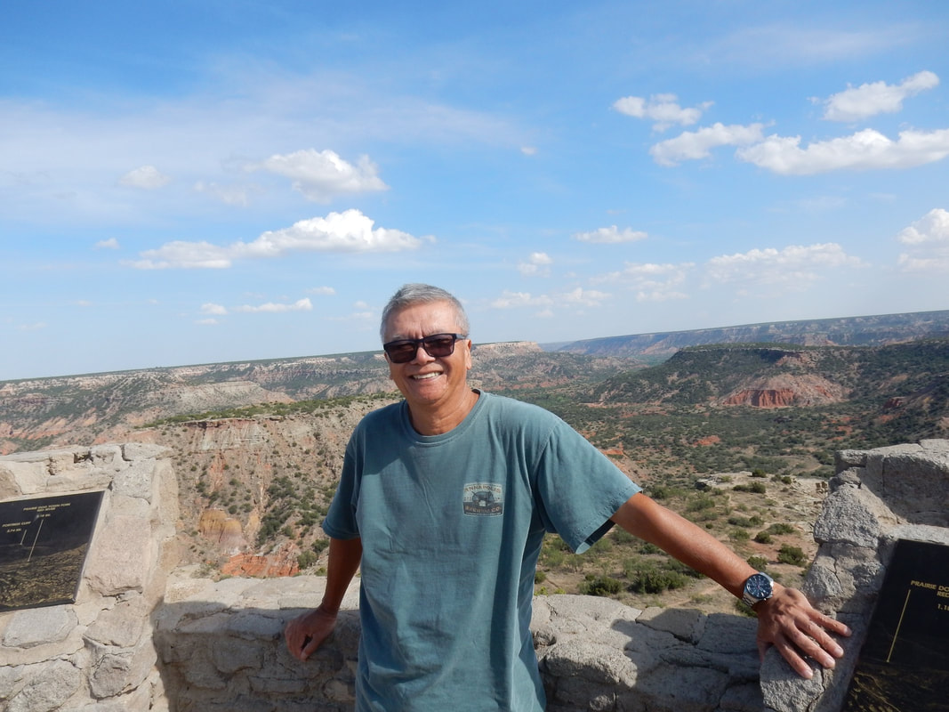
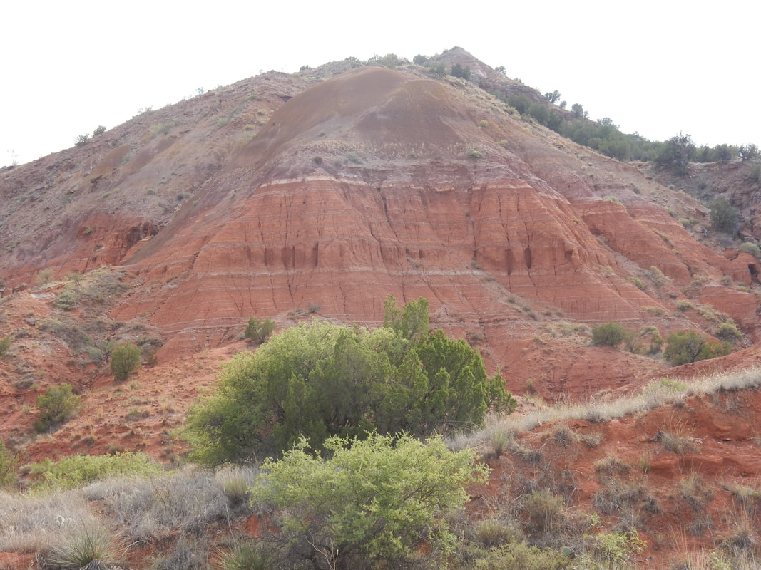
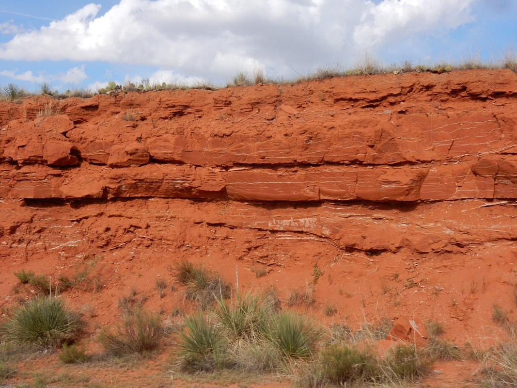
Before dinner we had some extra time so we drove out to Palo Duro Canyon State Park. It’s about half an hour drive from Amarillo. We visited it in the late afternoon, so the weather was pleasant, not too hot. It was a beautiful canyon, small, but resemble of the Grand Canyon.
Dallas to Amarillo: 5 h 30 min (365.1 mi) via US-287 N
Our first stop on Route 66 was Shamrock, TX. Here, the landmarks of the yesteryear are the U-Drop Inn and the Cocono Service Station. The service station is now turned into a gift shop, and the old café inside the station where Elvis used to dine is still there. This service station was also used as an inspiration for Ramone’s paint shop in the movie Cars. The gas pump in the front still showed gasoline was a mere 28 cents a gallon.
We met a couple from Denmark. They have been on the road trip for a week, traveling on Route 66 from Chicago to here. They planned to drive to LA, then on to San Francisco, before heading home. In the US, we tend not to appreciate much of old historical stuff, but to the foreigners, coming to the US to be able to drive on these old highways, stop here and there in these little towns along the way to find out what real America is all about is a blast. Another young couple we met on the route was from Italy.
From Shamrock, we meandered along the old highway 66 to McLean, TX where we visited the Devil’s Rope Museum (Barbwire in the modern term) the largest of its kind in the world.
Little further west, we drove by the “Leaning Tower of Texas” in the town of Groom, TX. The water tower was purposely built tilted to draw travelers on Route 66 into town in the old days.
We got to Amarillo, TX in the early afternoon, hungry and all, so it was quite appropriate to check out another landmark on Route 66 and had a bite to eat, the world famous “Big Texan Steak Ranch”. The restaurant offers its famous “Home of the 72 oz free steak” meal if you can devout it and all the trimmings within one hour. And yes, there are people, large cowboys, and skinny cowboys down it well within the time limit. Writing on the chalkboard hanging on the wall indicated there was a 230-pounds guy that can do it all in 31 minutes.
In the big dining hall, they have a clock-timer hanging on the wall, nearby there’s big and high table sits in the middle of a gigantic dining hall. The contestants would sit around this special table eating their meals, and the diners/spectators in the surrounding tables hollering, cheering while the contestants devouring the gigantic meals. It must be quite a scene.
We had a petite steak for lunch, and it was quite delicious. As a matter of fact, we stayed in Amarillo that night and came back for dinner. The steakhouse is highly decorated with bright decor on the outside. Inside is a big dining hall with long tables in the middle meant to share, and surrounding it on the second floor was more tables. Stuffed deer heads, longhorn skulls hanging on the wall around you staring at you while you eat. The place was packed full on a week-day night, with servers adorned in the cowboys’ clothing and cowboys’ hats. There were musicians strolling around, playing guitars singing a cowboy tune for tips of course. Then large portion dessert is being tempted by the waitresses. As you walked out the restaurant, there’s the fudge shop and the ice-cream bar right in front, a pretty cowgirl at the counter winked at me saying “Howdy, would you like to try some fudge?”…heheh. Just across the entrance hall is a gift shop selling cowboys hats, T-shirts, cowbells, longhorns, shotglasses...etc.
Before dinner we had some extra time so we drove out to Palo Duro Canyon State Park. It’s about half an hour drive from Amarillo. We visited it in the late afternoon, so the weather was pleasant, not too hot. It was a beautiful canyon, small, but resemble of the Grand Canyon.
Amarillo to Albuquerque via Route 66 - Overnight in Albuquerque, NM
Amarillo to Albuquerque: 4 h 16 min (288.3 mi) via I-40 W
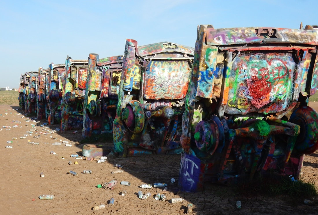
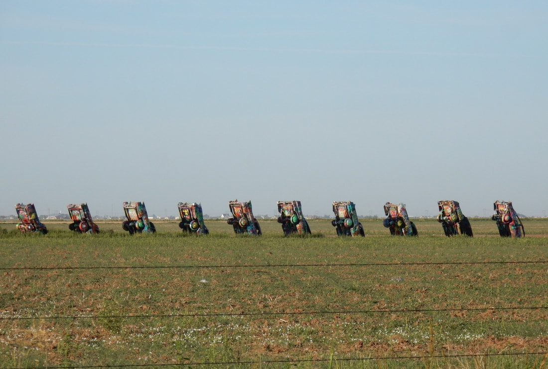
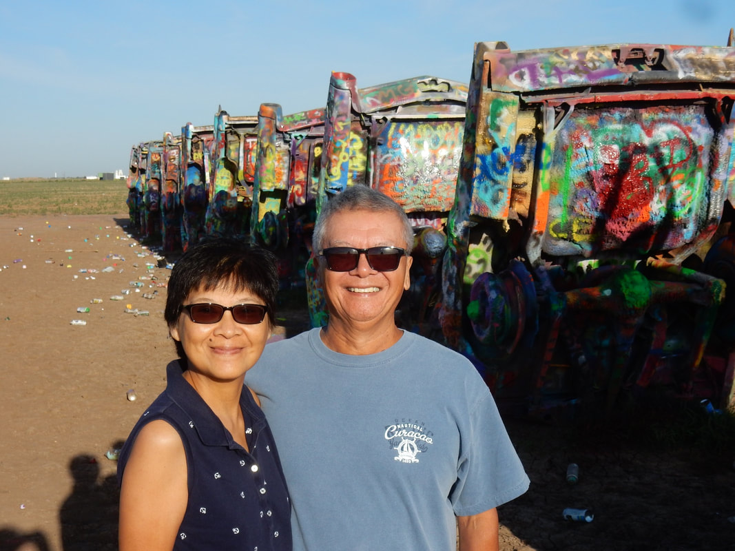
We started the day, driving just west of Amarillo to see this place called “Cadillac Ranch”. The sight of ten vintage Cadillacs, half buried into the ground in the vast dirt field. We were the first ones there, but then more and more people decided to show up right after us. Some with a spray can in their hands ready to try their artistic talent on the old beat-up skeleton of cars upside down in the dirt. Some came with their own unique statement like driving and old school bus with the sign “skipping skool” on its side.
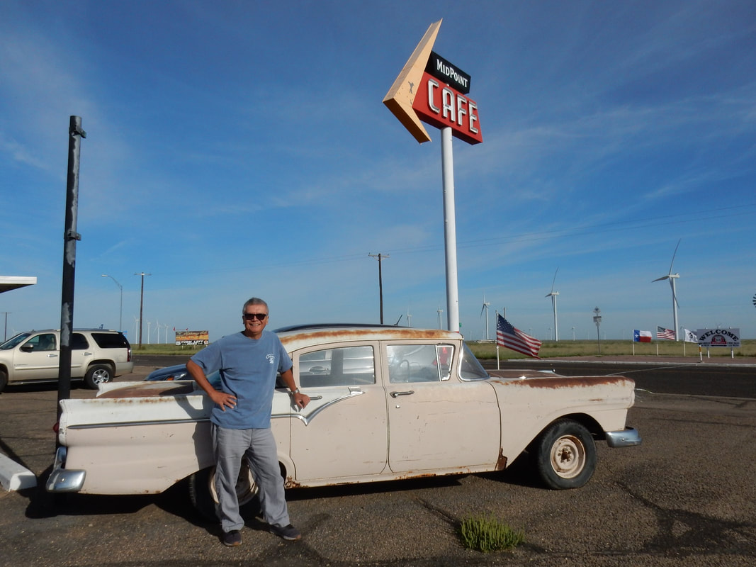
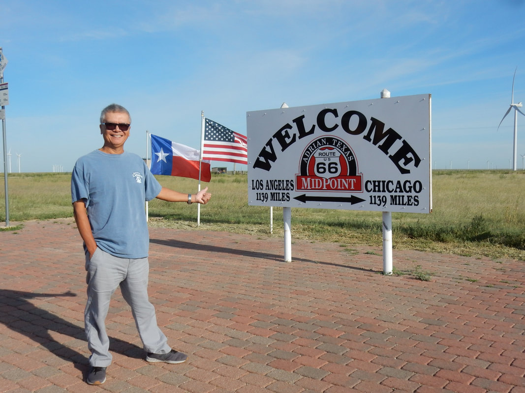
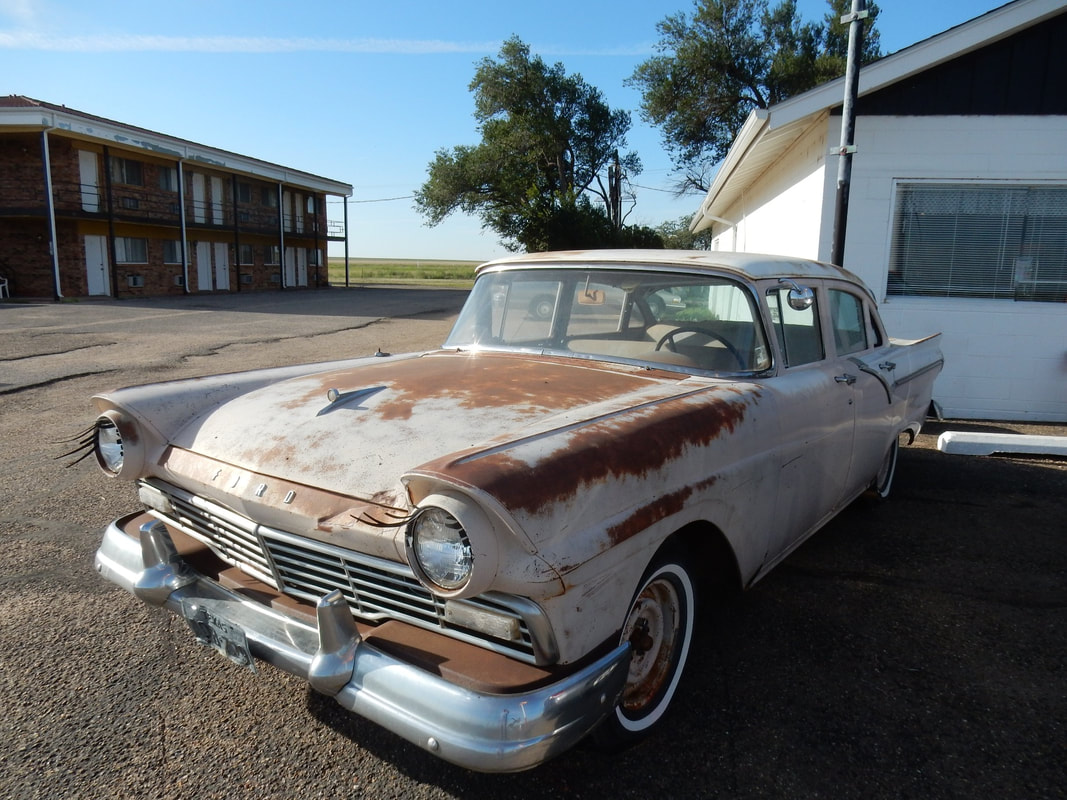
Driving westward on to Adrian, TX, we stopped at the Midpoint Cafe. This café is located right next to the Route 66’s mileage center point between Chicago and LA. There’s a line painted on the road and the signpost next to it that says 1139 miles this way to Chicago and 1139 miles that way to LA. In front of the café parked a 1957 Ford Fairland, the same very first car I’ve ever owned in this country…hahah. It even had the exact same ugly rusty brown color that my car had. What a nostalgic, cool, and awesome memory.
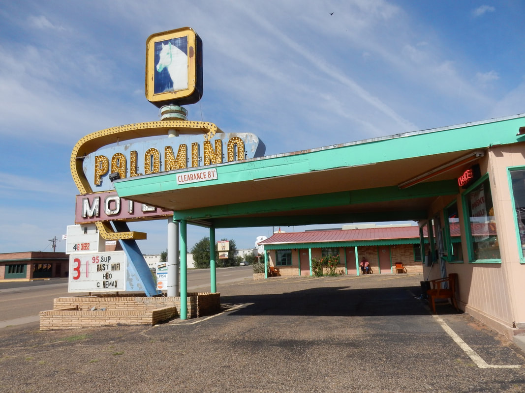
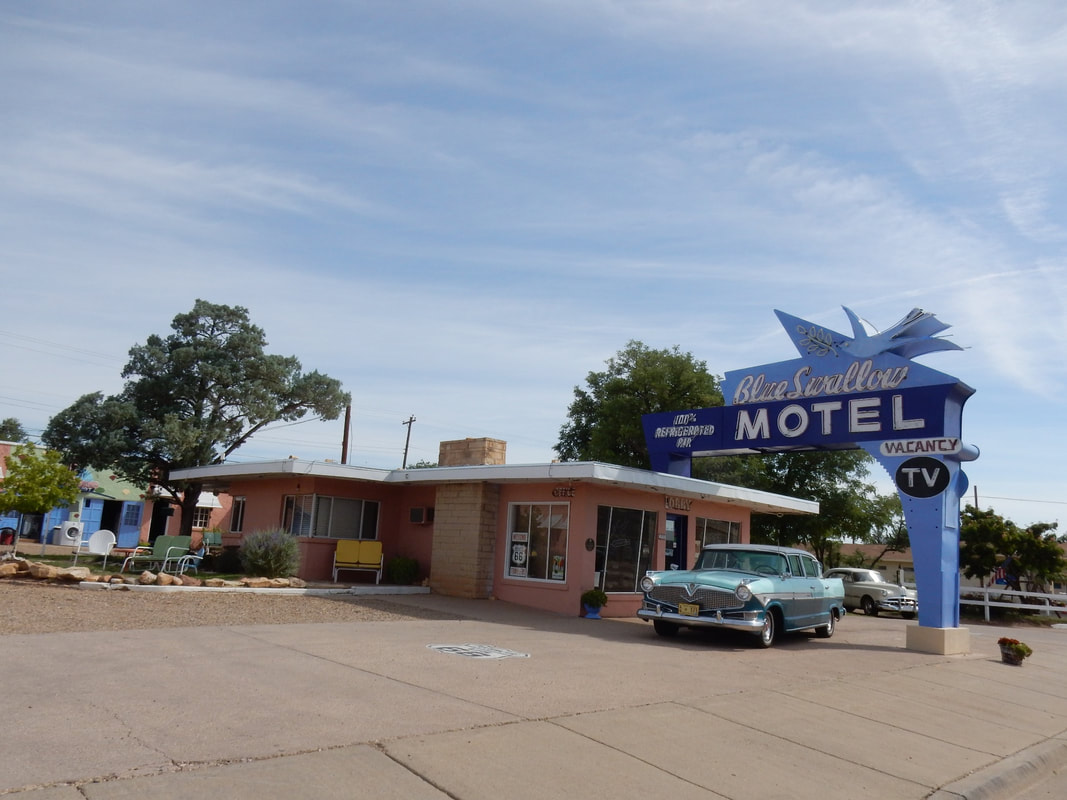
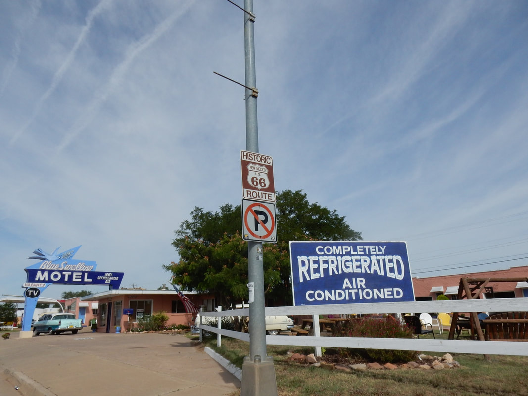
On to Tucumcari, NM, another town on Route 66, we saw a bunch of old hotels lining the old Route 66 that once busy to serve travelers like the iconic “Blue Swallow”, “The Palomino”, and “The Americana”. People don’t travel this way much anymore, instead opt for the main interstate. However, the hotels are still open with additional features as proudly displayed in front of the hotel’s office such as Free WIFI, AC.
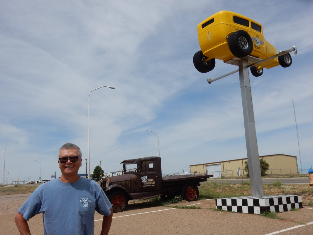
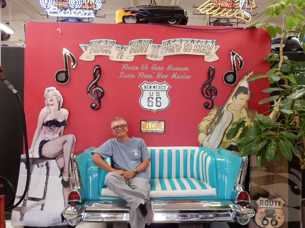
In Santa Rosa, NM we visited the Route 66 Auto Museum. Back in the days, Route 66’s history was always about the travelers and the cars that moved them.
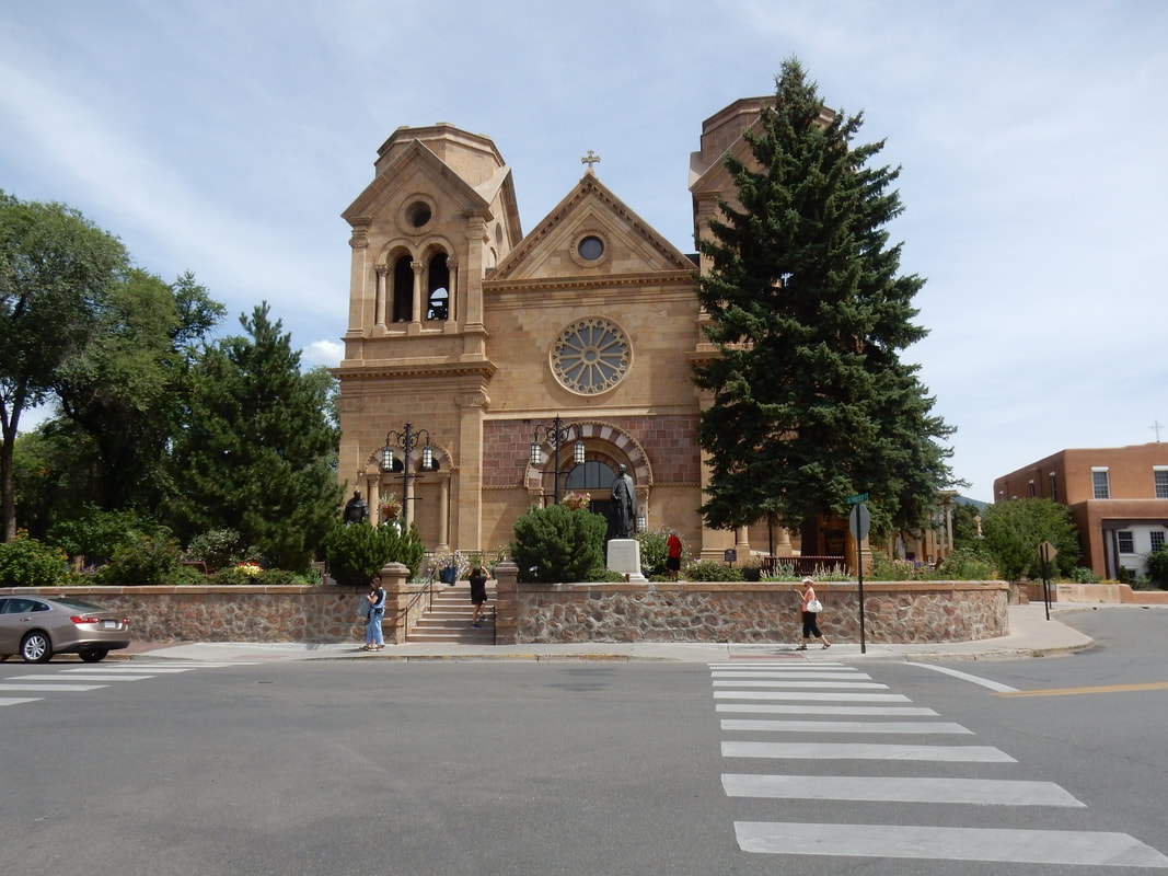
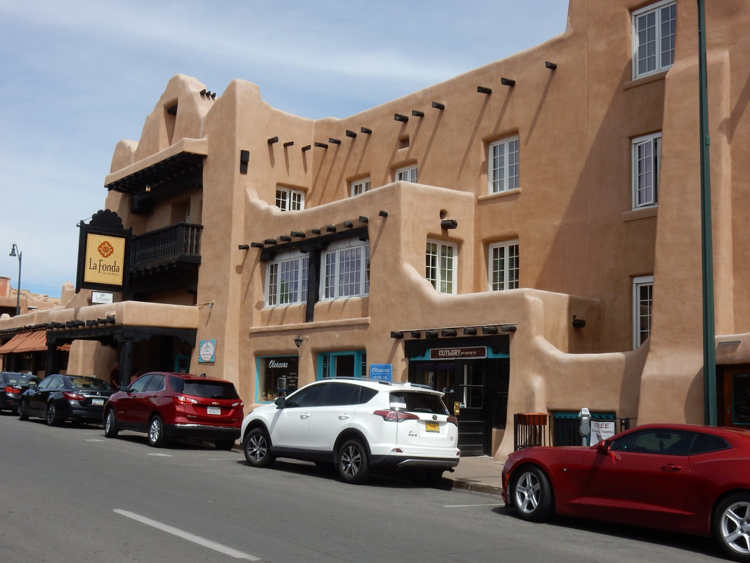
We decided to get off the Interstate 40 in Santa Rosa and opted to travel the old Route 66 to Santa Fe, NM. In Santa Fe, we walked around the downtown area to check out La Fonda on the Plaza, a landmark hotel next to the historic central plaza. It was quite a fancy place inside. We mingled around the square, had a coffee and pastry at the French bakery before heading south via the scenic Route 66 called Santa Fe loop.
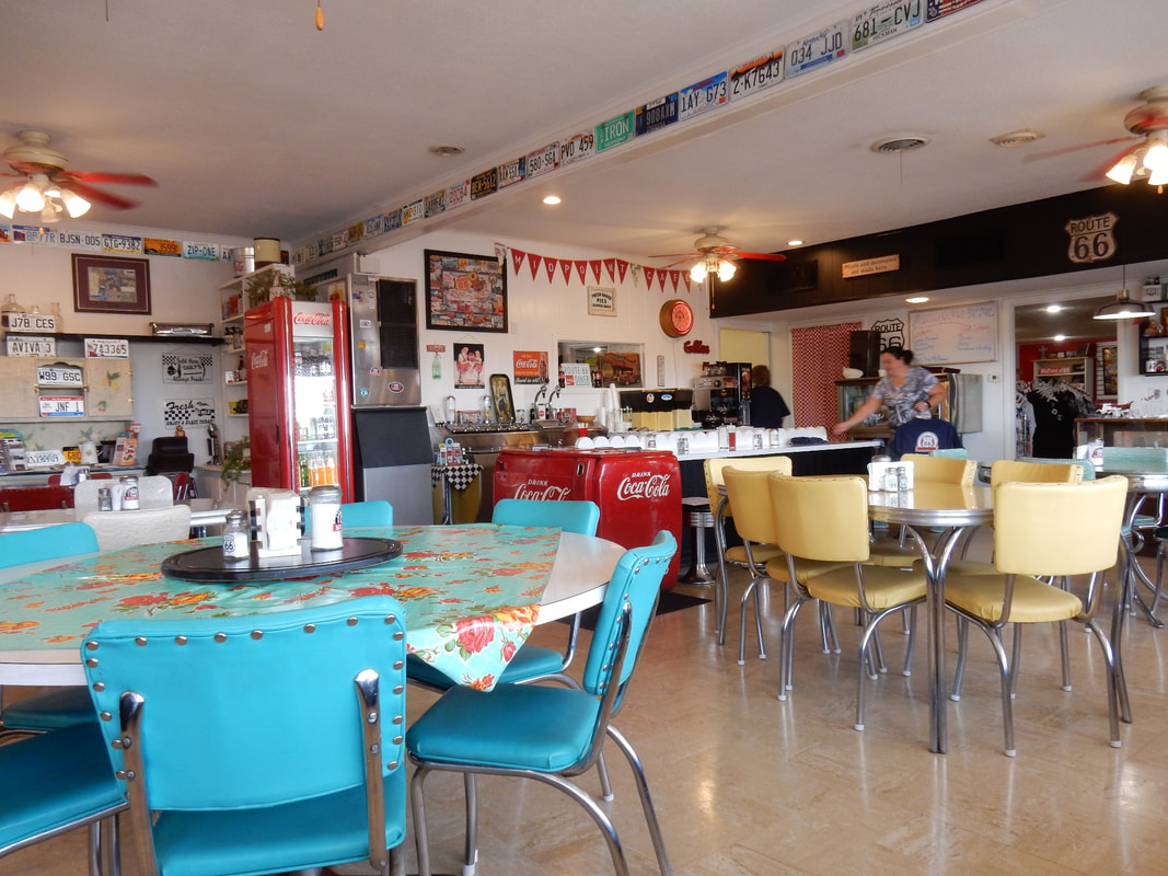
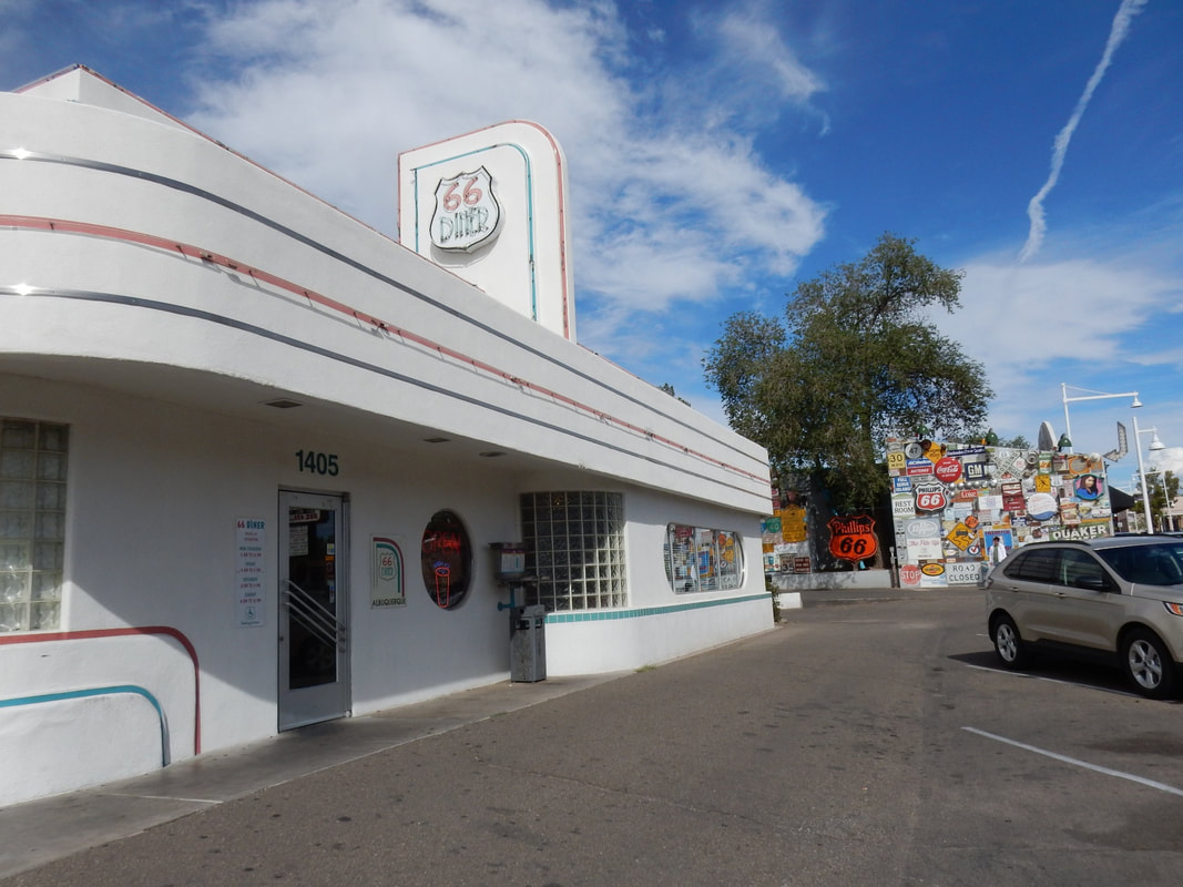
In Albuquerque we checked out the Route 66 Diner, where waitresses decked out in skirts of the 60s with colorful socks, jukebox sat there in the corner of the restaurant, and menu that serves burgers, fries and milkshakes.
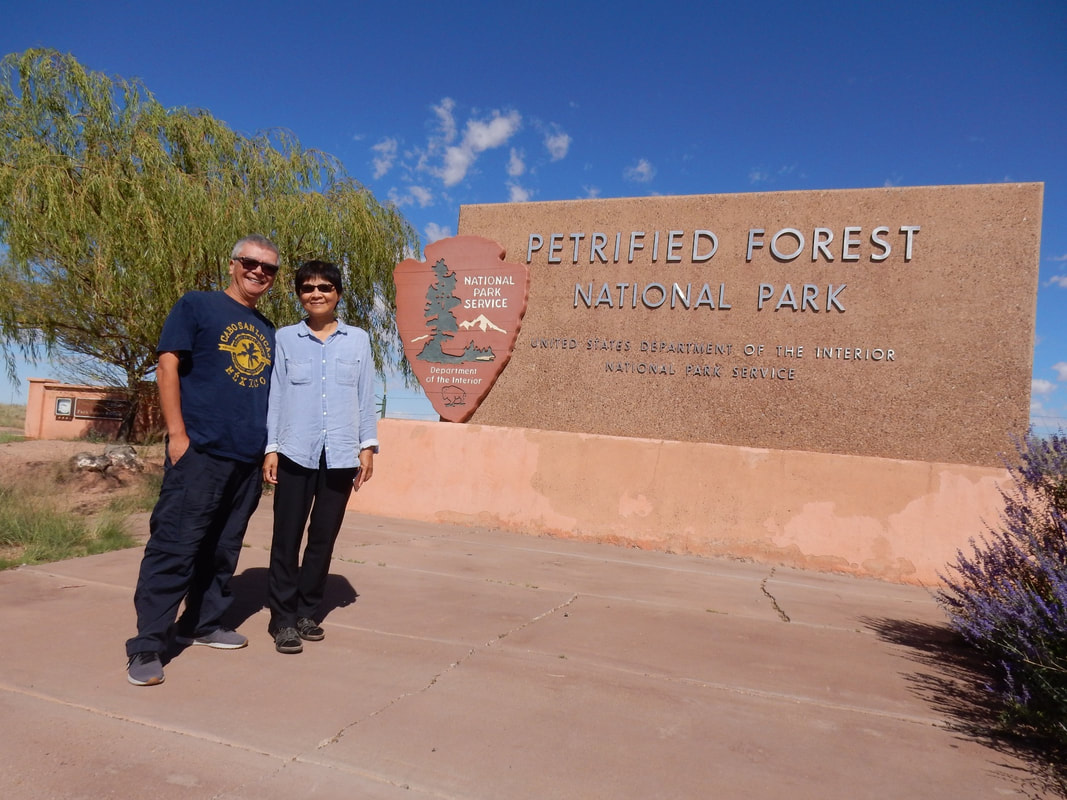
Petrified Forest National Park - Overnight in Holbrook, AZ
Albuquerque to Holbrook: 3 h 24 min (233.3 mi) via I-40 W
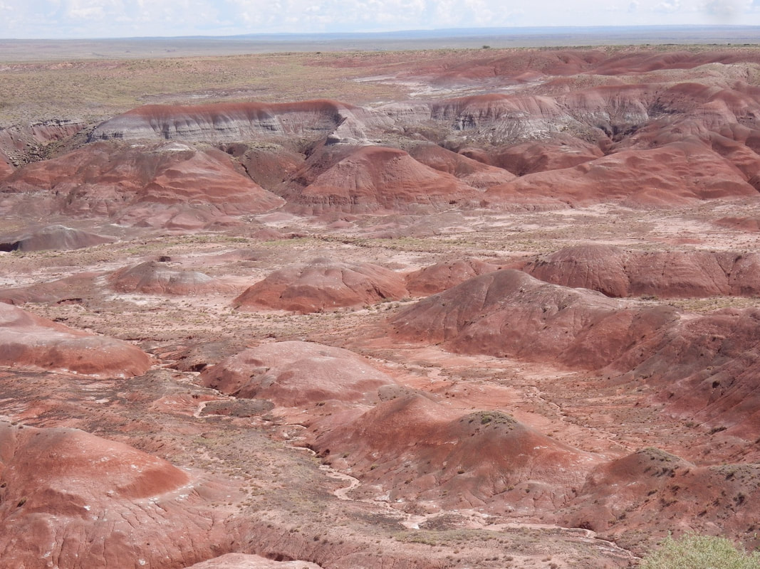
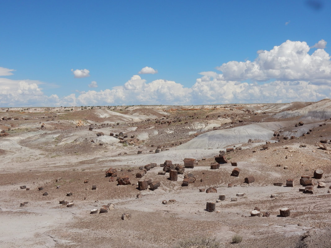
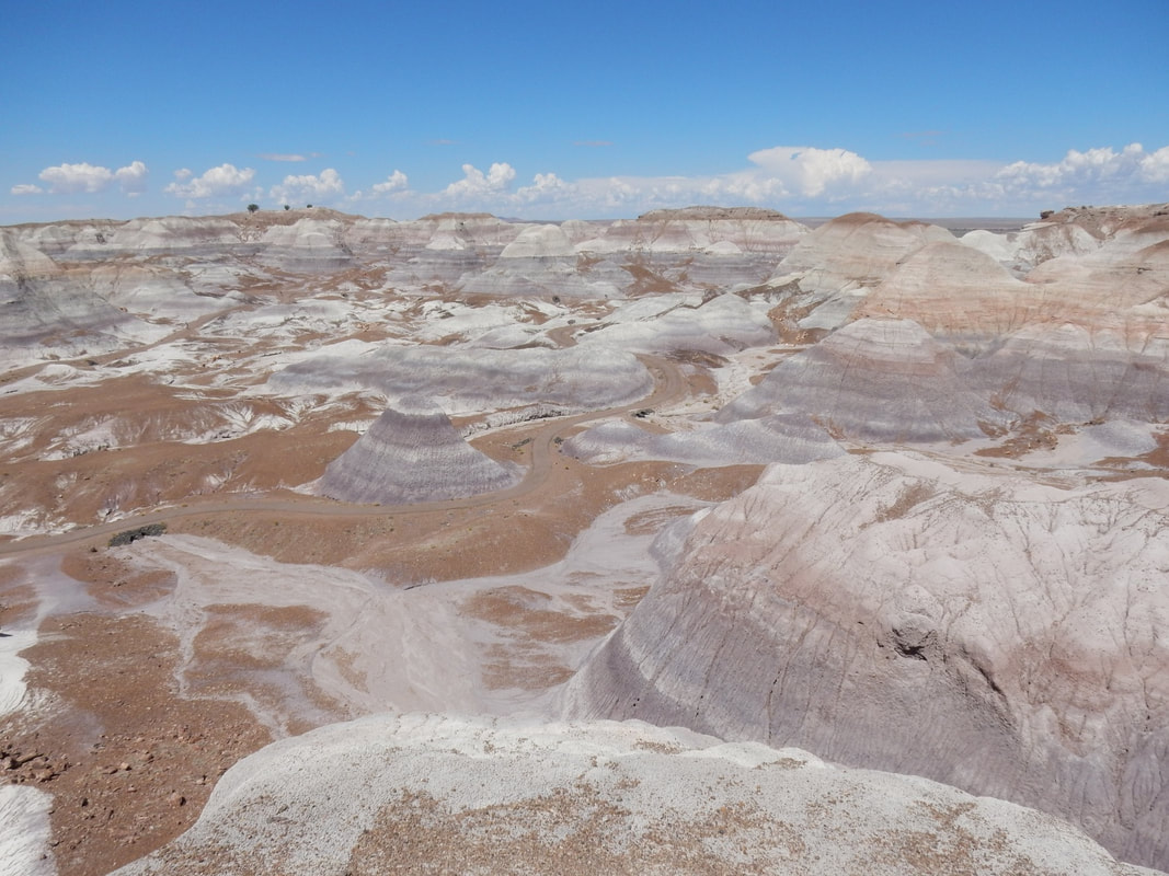
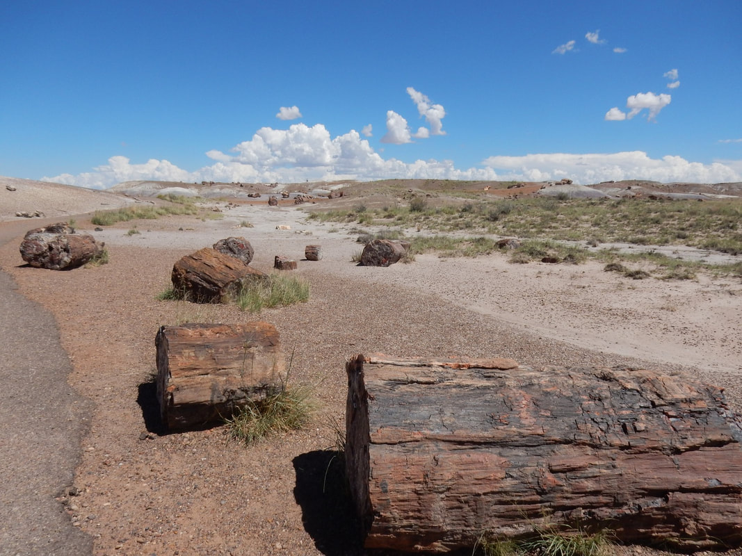
“Petrified Forest National Park is in northeastern Arizona. In its south, the Rainbow Forest is full of colorful petrified wood. It’s home to the Rainbow Forest Museum, with its paleontology exhibits and many trail access points. In the park's center are the petroglyphs of Newspaper Rock and the ruined village of Puerco Pueblo. To the north, the Painted Desert Inn, a 1930s adobe building, is a museum with Hopi murals.” Wikipedia
We left ABQ in the morning and stopped along the way to see few others Route 66’s historical landmarks along Route 66 on the way to Petrified Forest National Park.
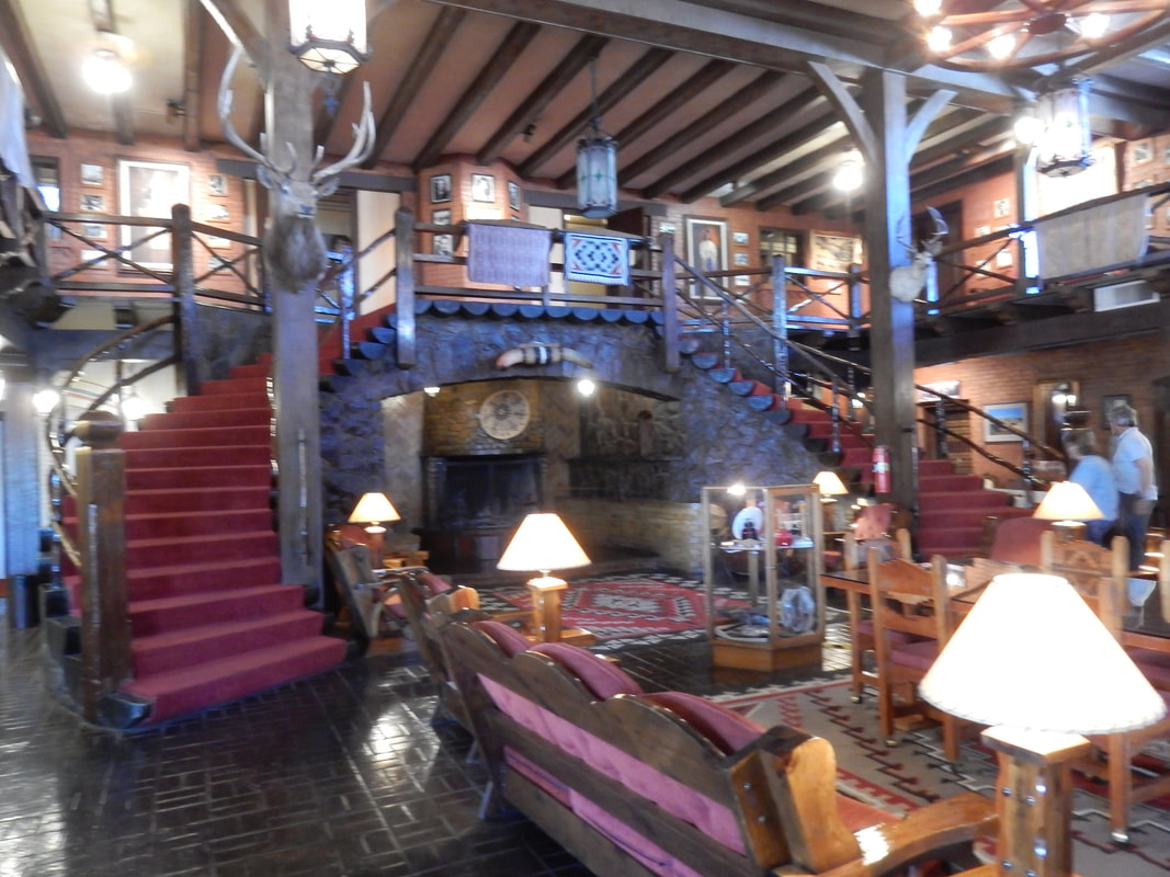
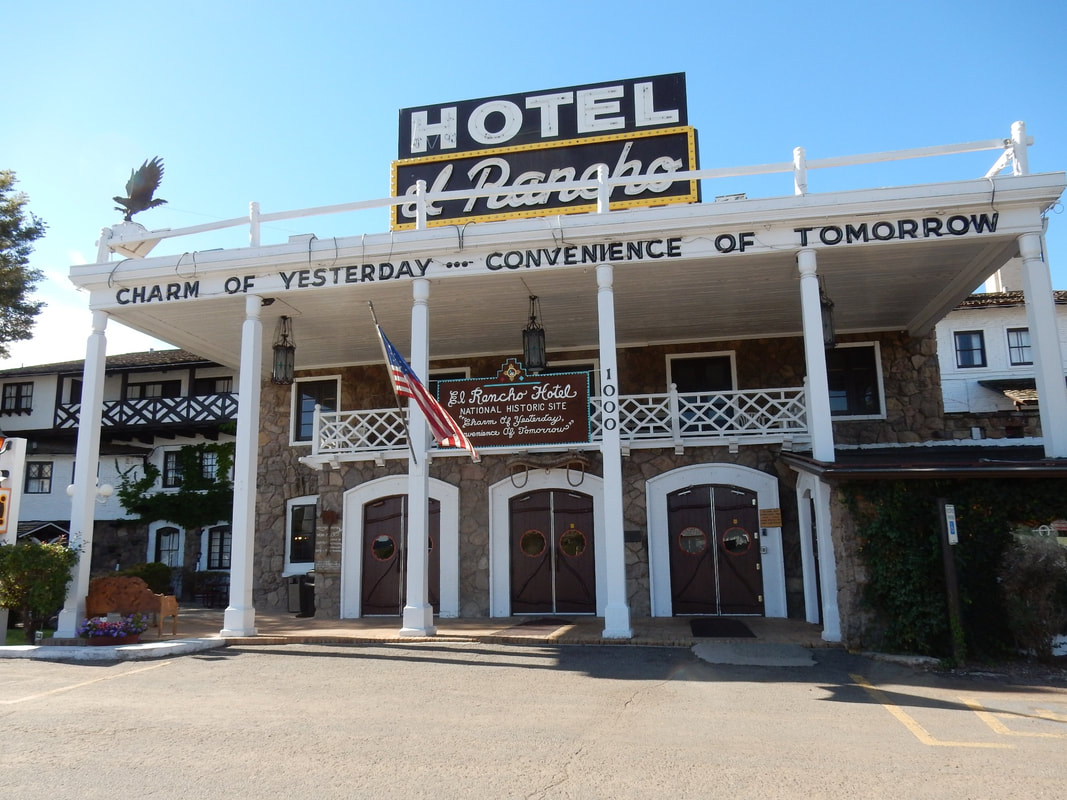
In Gallup, NM, about 130 miles west of Albuquerque, we saw El Rancho hotel with fancy 50s’ style decor inside. Some of the rooms are labeled with famous peoples’ names on them. Back in the 50s, Hollywood stars like John Wayne, Humphrey Bogart, and Lucille Ball stayed here in this elegant hotel during their filmings.
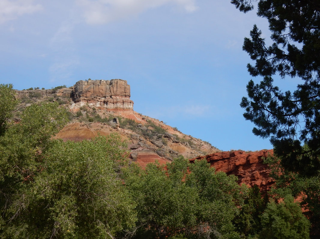
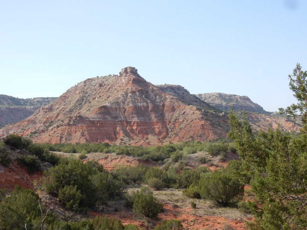
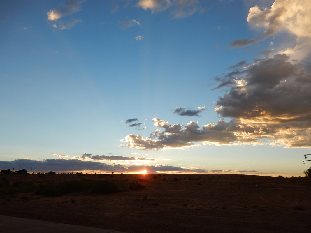
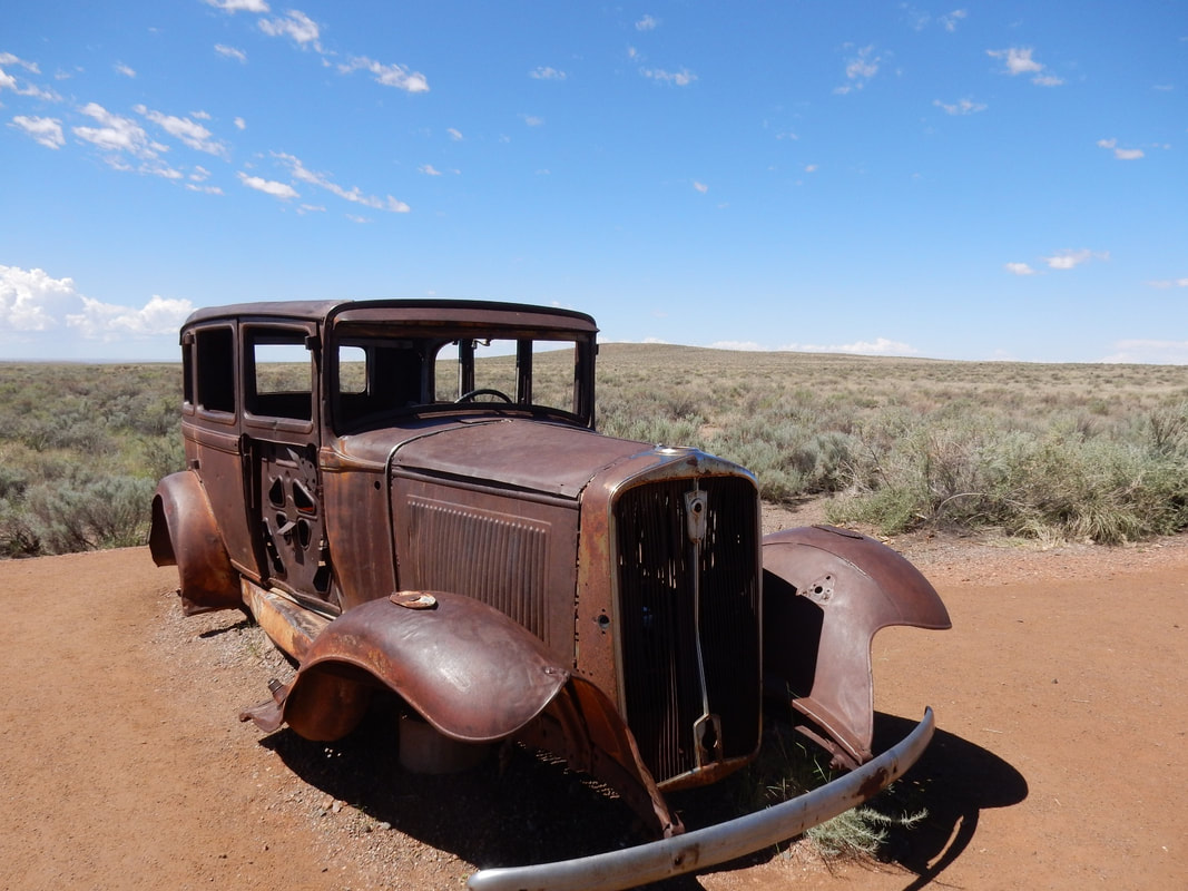
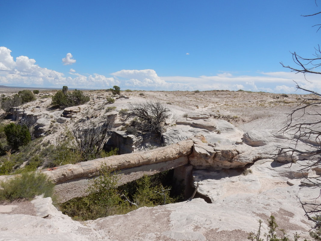
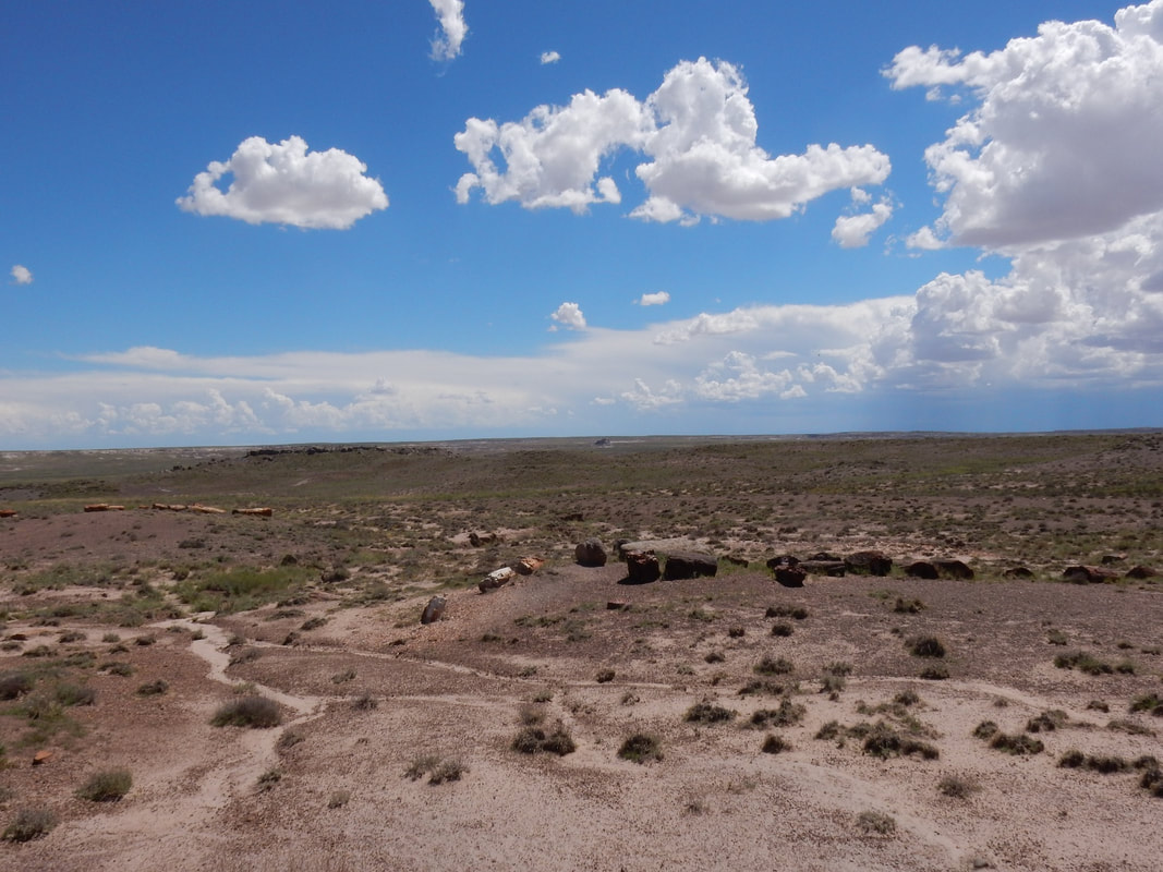
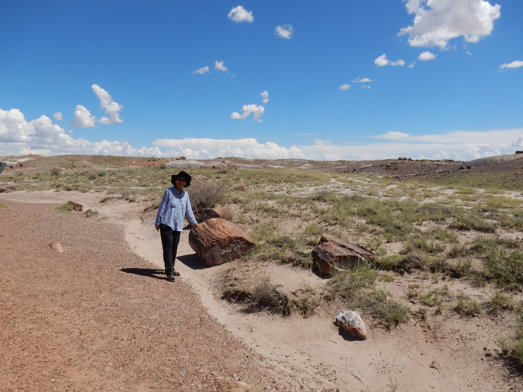
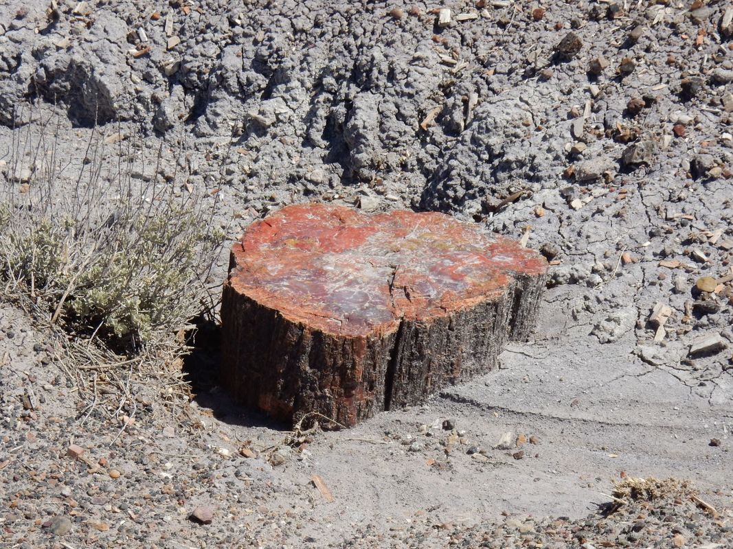
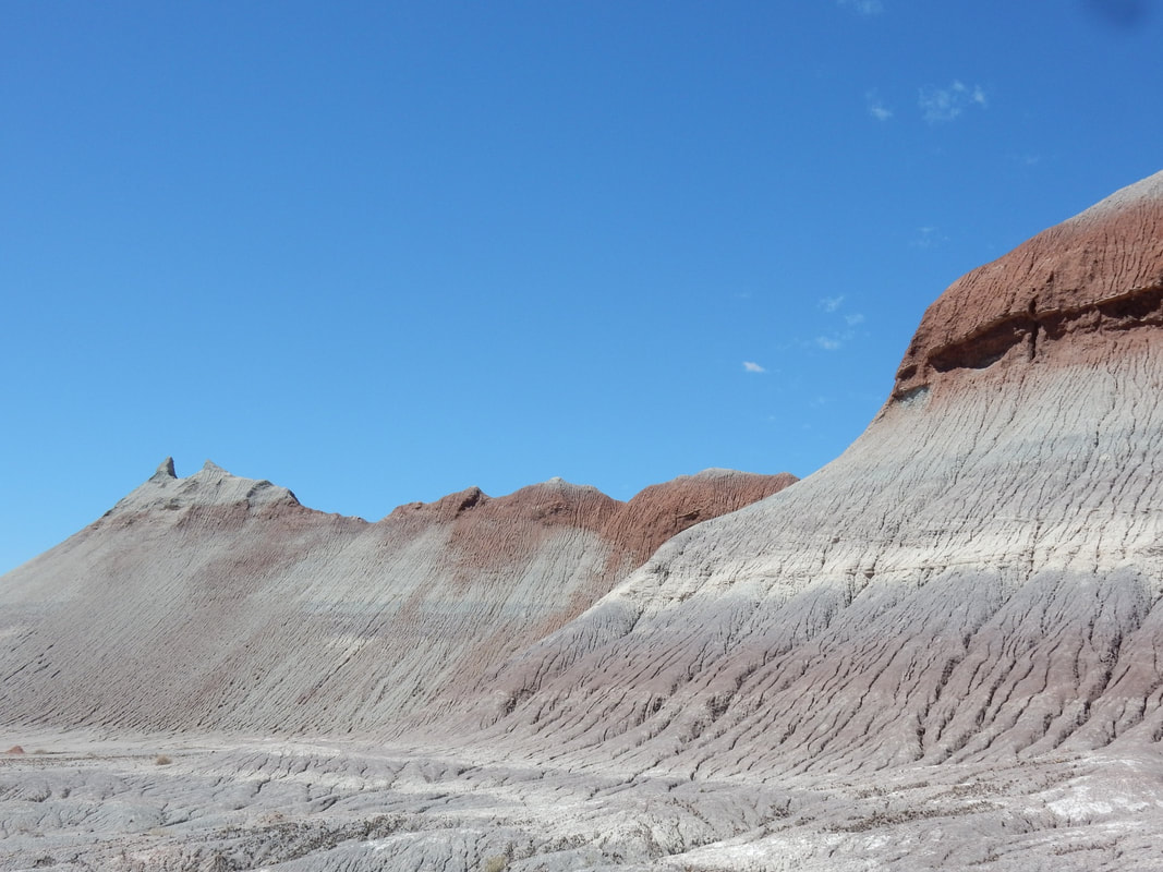
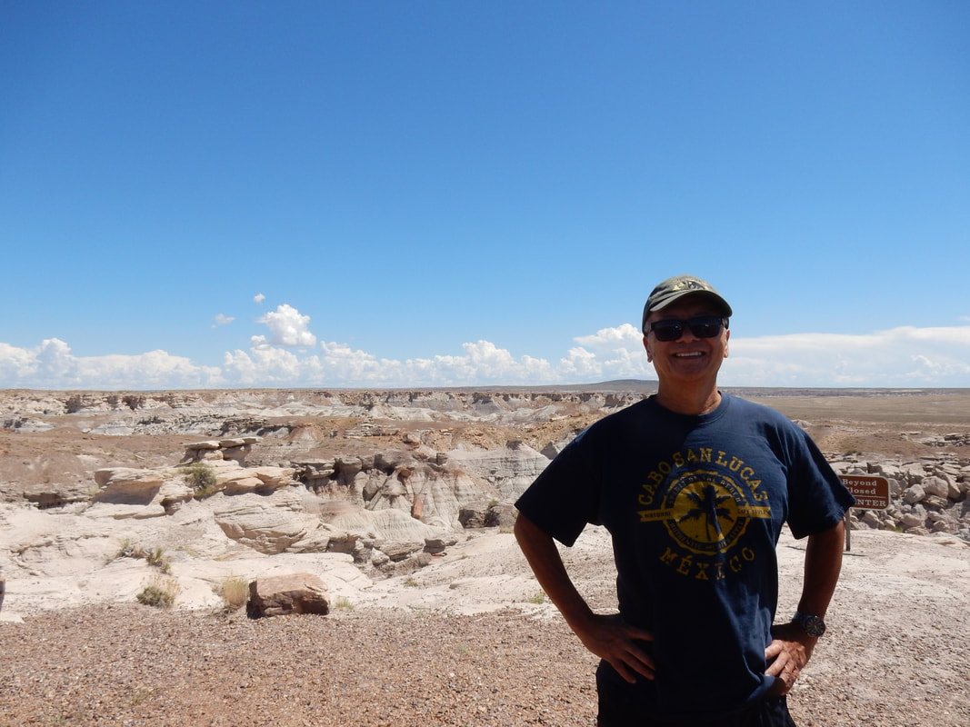
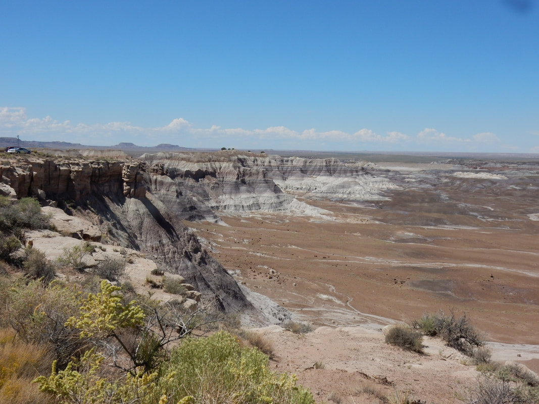
We got to Petrified Forest NP around noon with plenty of time to drive along the park road from north to south and saw interesting landscapes, petrified wood stumps. The weather was nice and the park was not crowded at all.
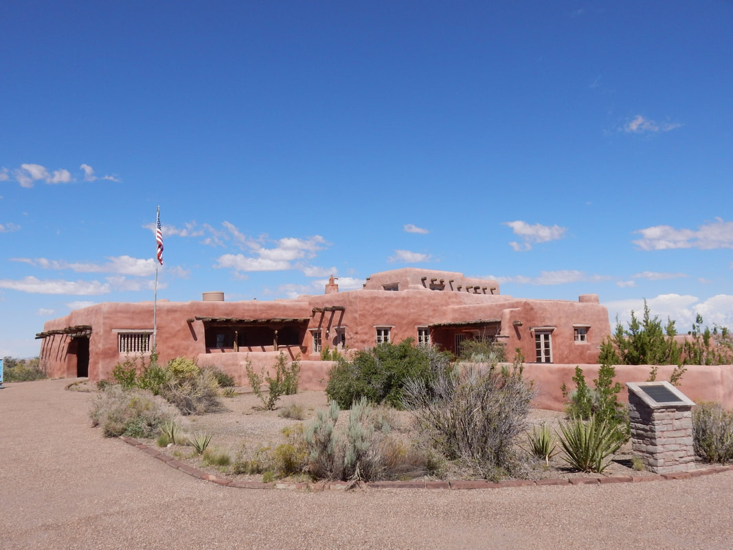
At Petrified Forest NP, we visited the Painted Desert Inn inside the park, it’s another historic landmark of Route 66. It was restored by the CCC (Civilian Conservation Corp), a public work relief program during the depression era for unemployed, unmarried men.
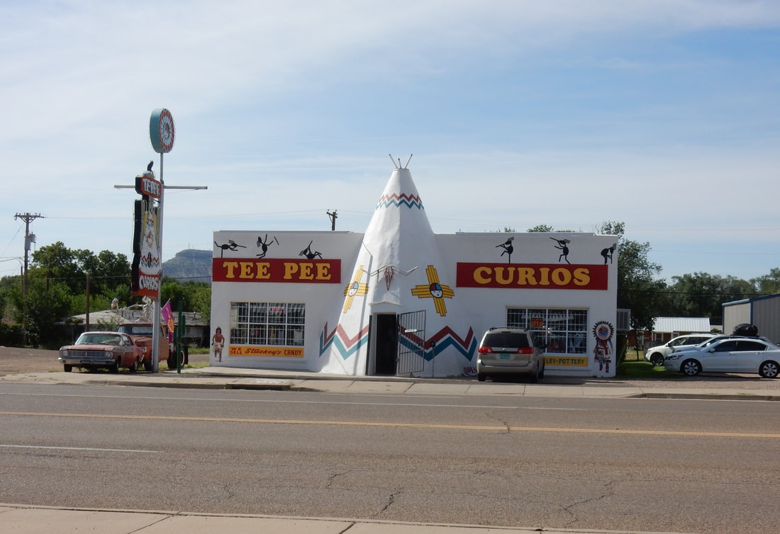
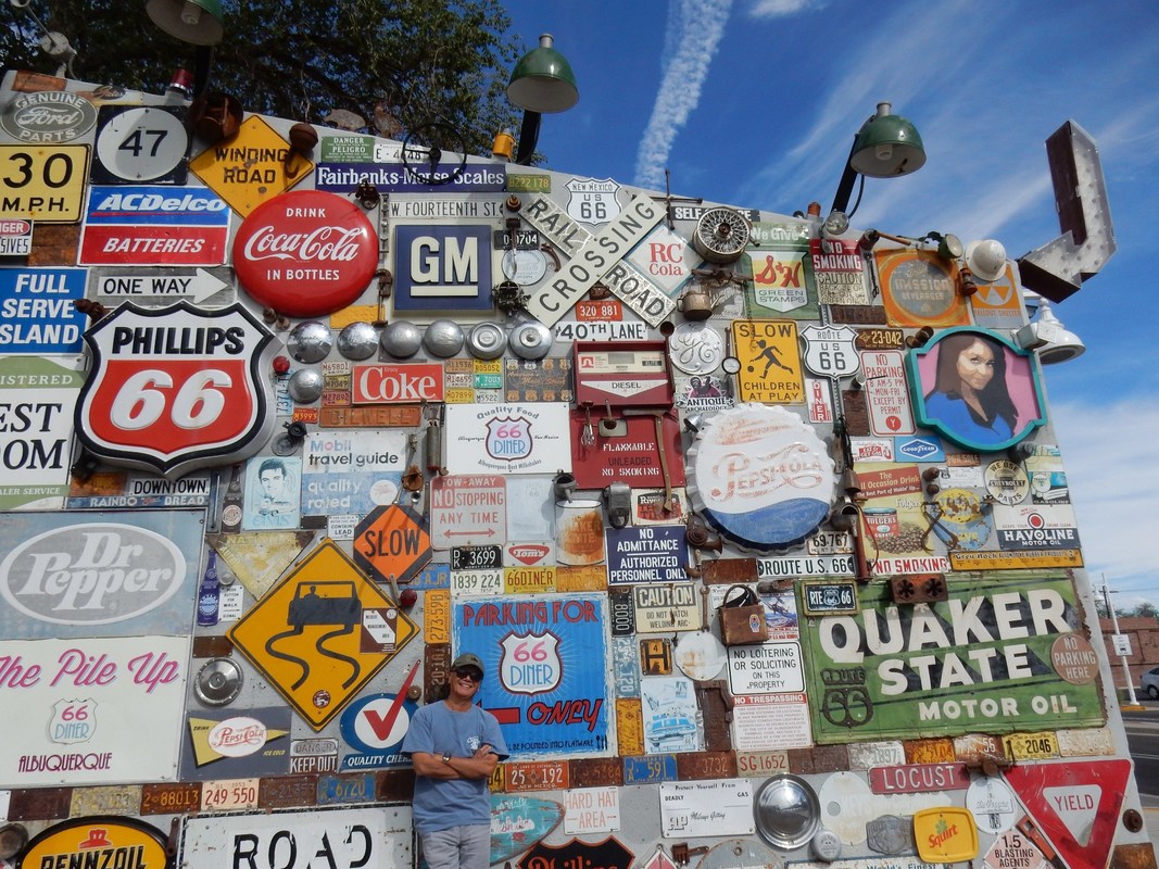
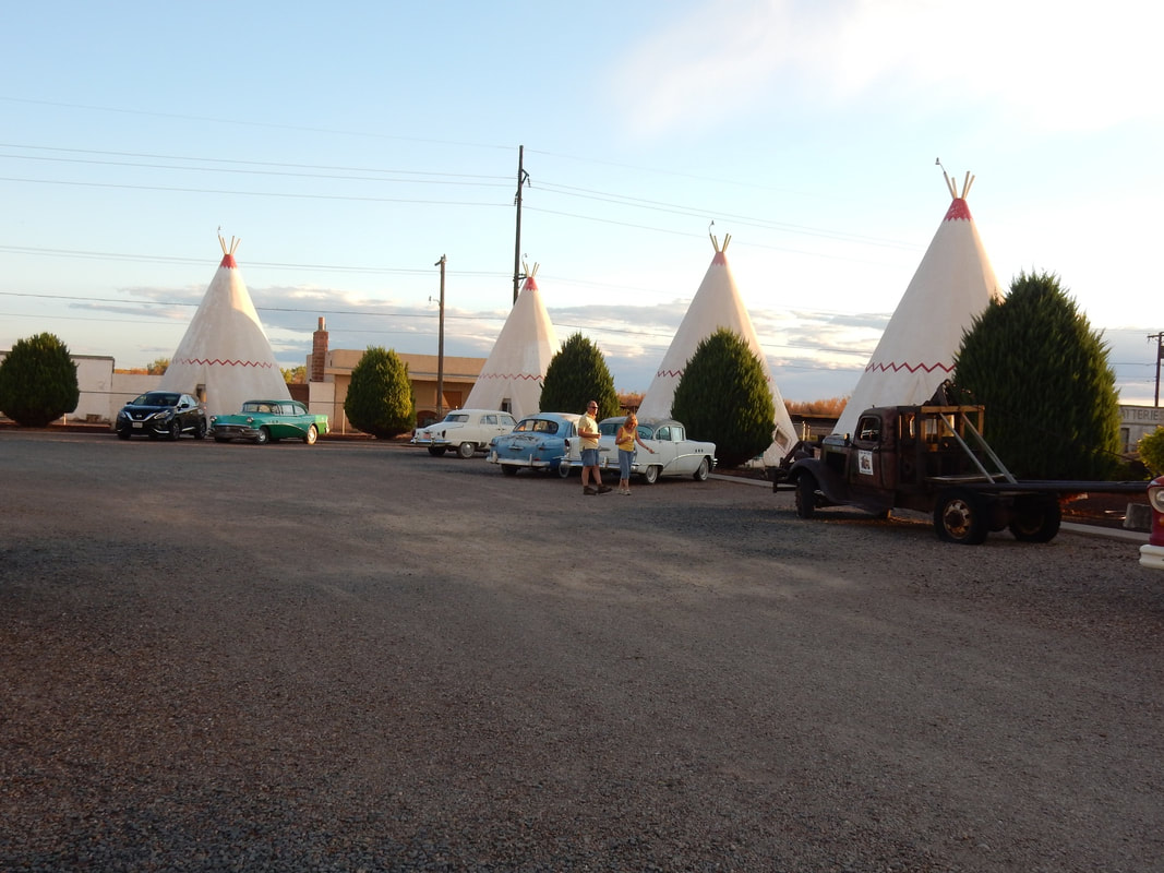
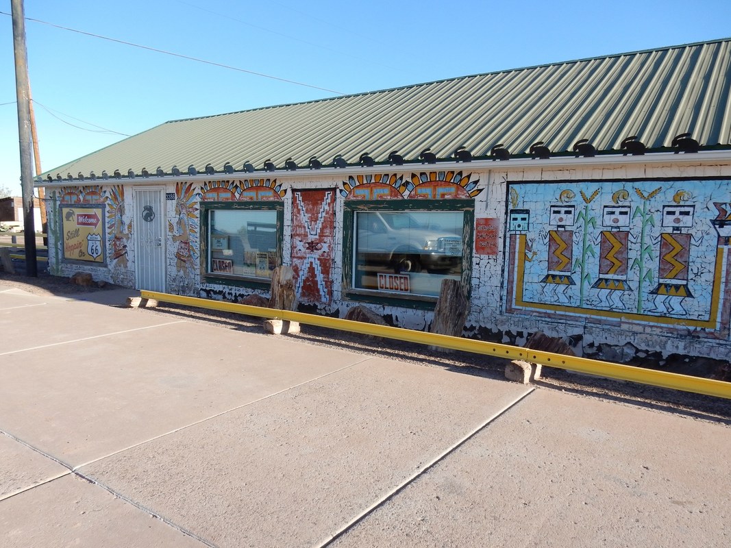
We dropped by the Wigwam Hotel, with hotel rooms built to look like tepee arranged in a U-shape around the gravel parking lot. There were old cars adorned the gravel parking lots here and there. I spotted a brand new Lexus sedan parked right next to the 40s Studebaker truck in the parking lot.
We had a delicious homemade meal at Tom and Marcy restaurant in Holbrook, AZ where we spent the night. The staff was very upbeat with excellent service. It was a nice pleasant surprise.
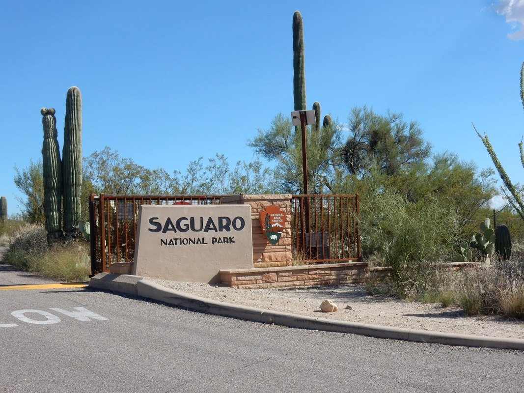
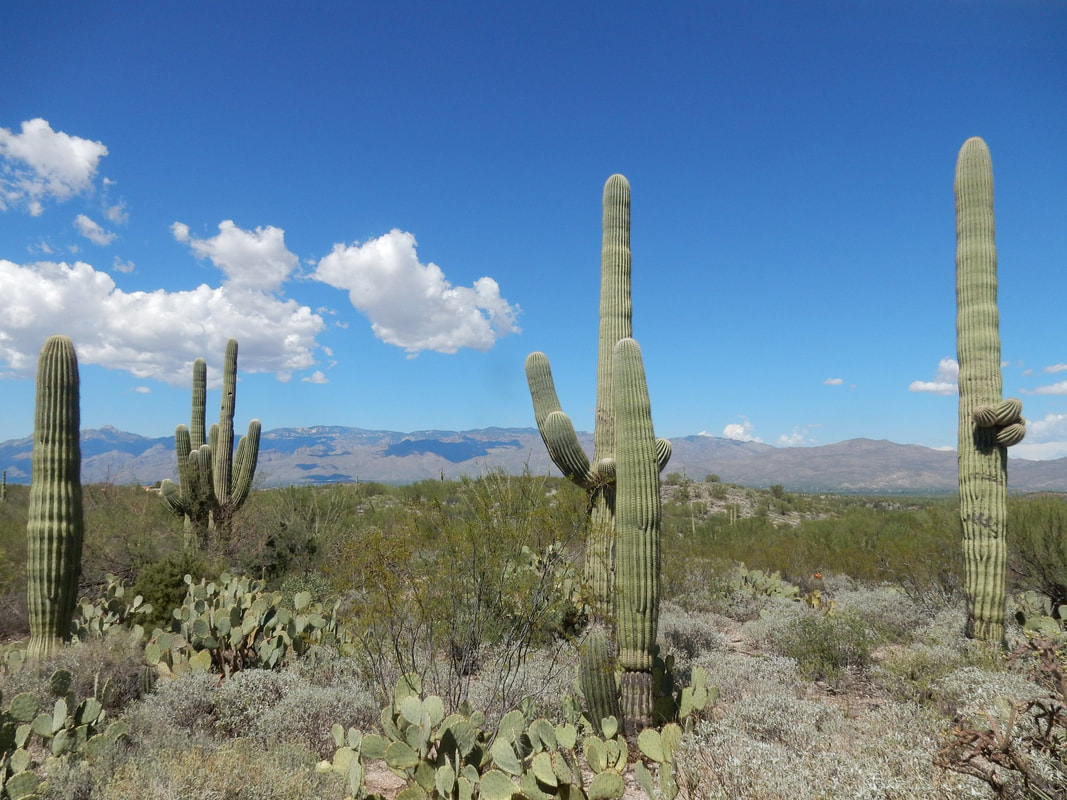
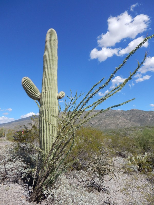
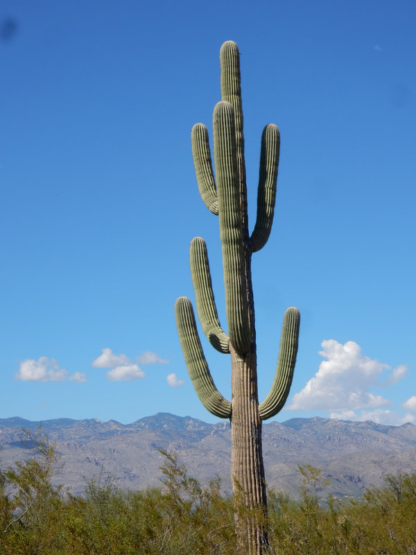
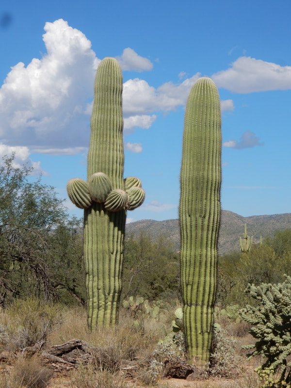
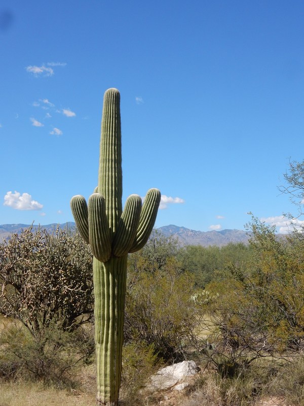
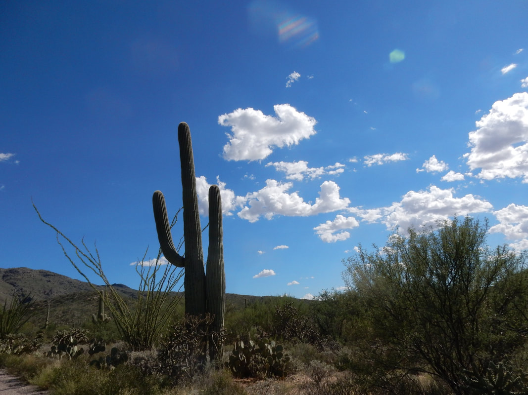
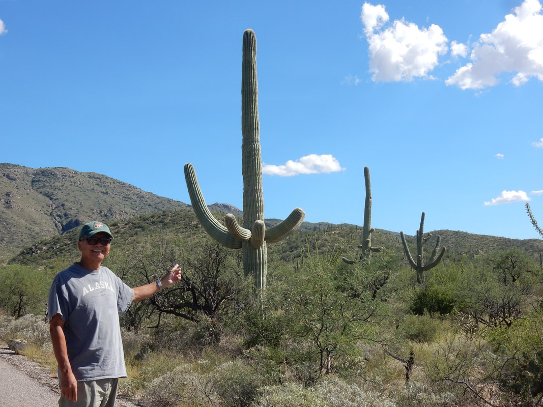
Saguaro National Park – Overnight in Tucson, AZ
Holbrook to Tucson: 4 h 24 min (235.2 mi) via AZ-77 S
“Welcome to Saguaro National Park
Tucson, Arizona is home to the nation's largest cacti. The giant saguaro is the universal symbol of the American west. These majestic plants, found only in a small portion of the United States, are protected by Saguaro National Park, to the east and west of the modern city of Tucson. Here you have a chance to see these enormous cacti, silhouetted by the beauty of a magnificent desert sunset.” NP Website
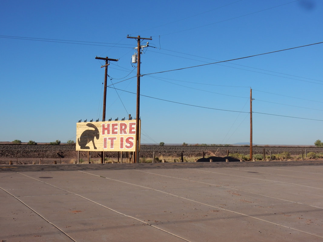
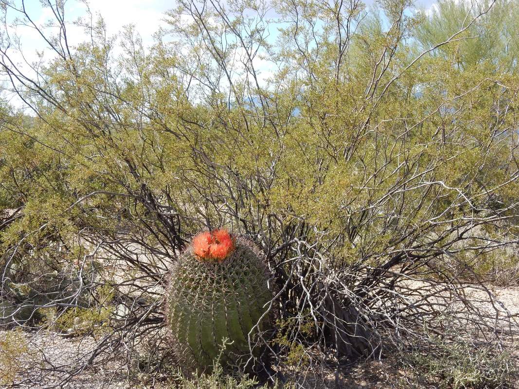
We left Holbrook at around 7 am heading west on Interstate 40 to see another landmark on Route 66, Jackrabbit Trading Post, another funky place, we took a few pictures before heading south on US 77 and US 60 to Tucson. It was a nice scenic route with plenty of tall pine trees through Apache-Sitgreaves National Forest and Tonto National Forest. We got to Saguaro at around 1 pm. We saw a movie about the park at the visitor center then listening to a ranger talk about the park from a park ranger outside the center, before taking the loop drive. We saw unique Cacti cactus (Saguaro), it looks like giant cowboys saying hi to you in the desert. The cacti plants are big and develop arms as they age, they are found exclusively here in the Sonoran Desert. Over all, there are very few NPs that locate on the outskirt of a big city like this one.
The weather was still quite hot in the 90s in early September in Tucson, AZ.
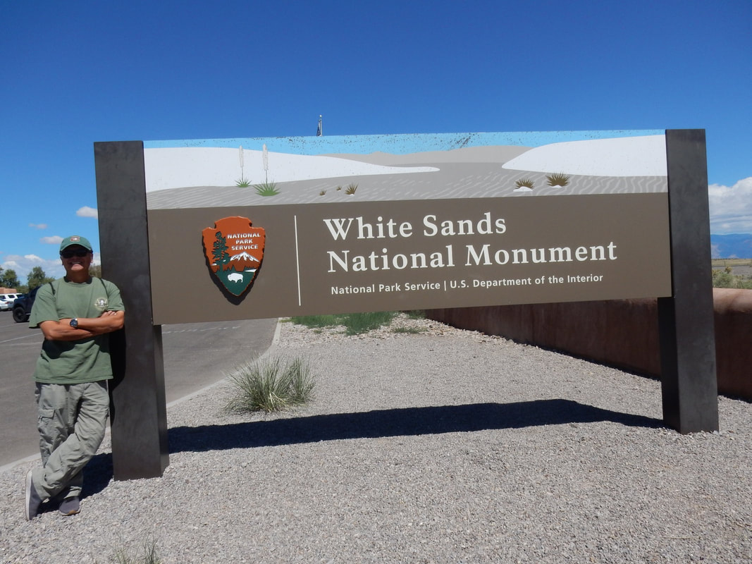
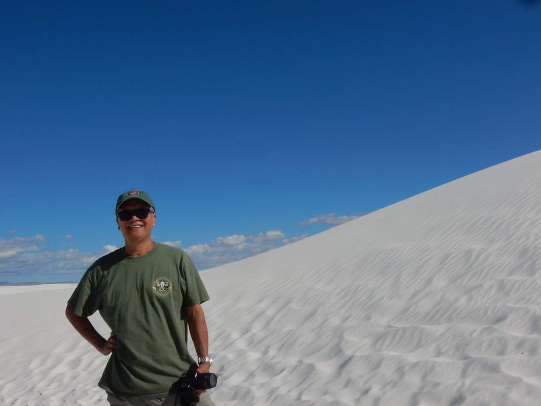
White Sand National Monument – Overnight in Las Cruces, NM
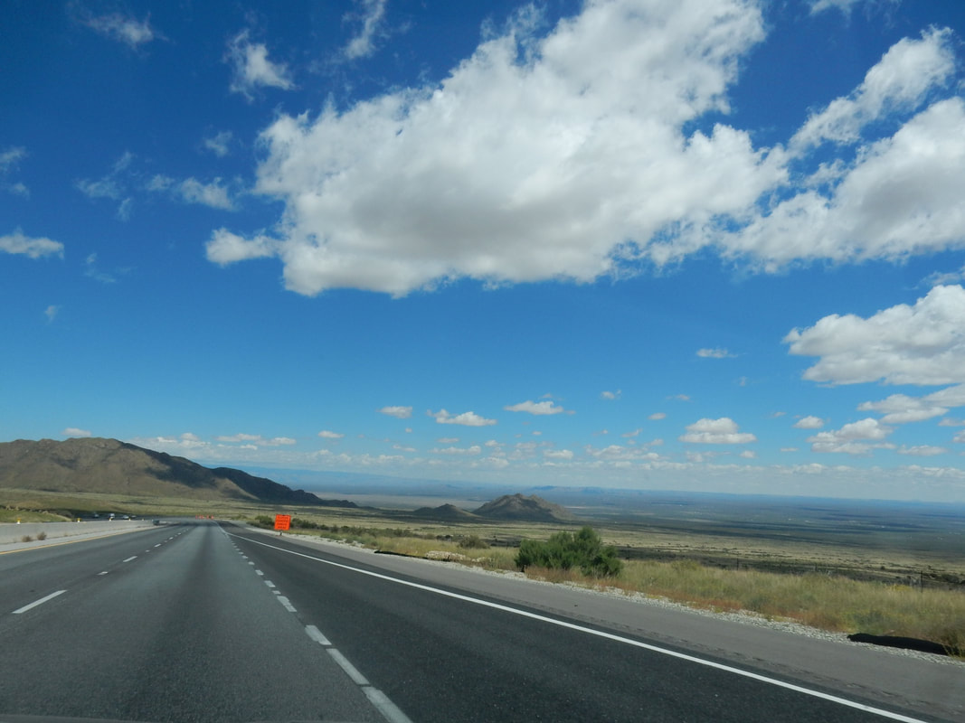
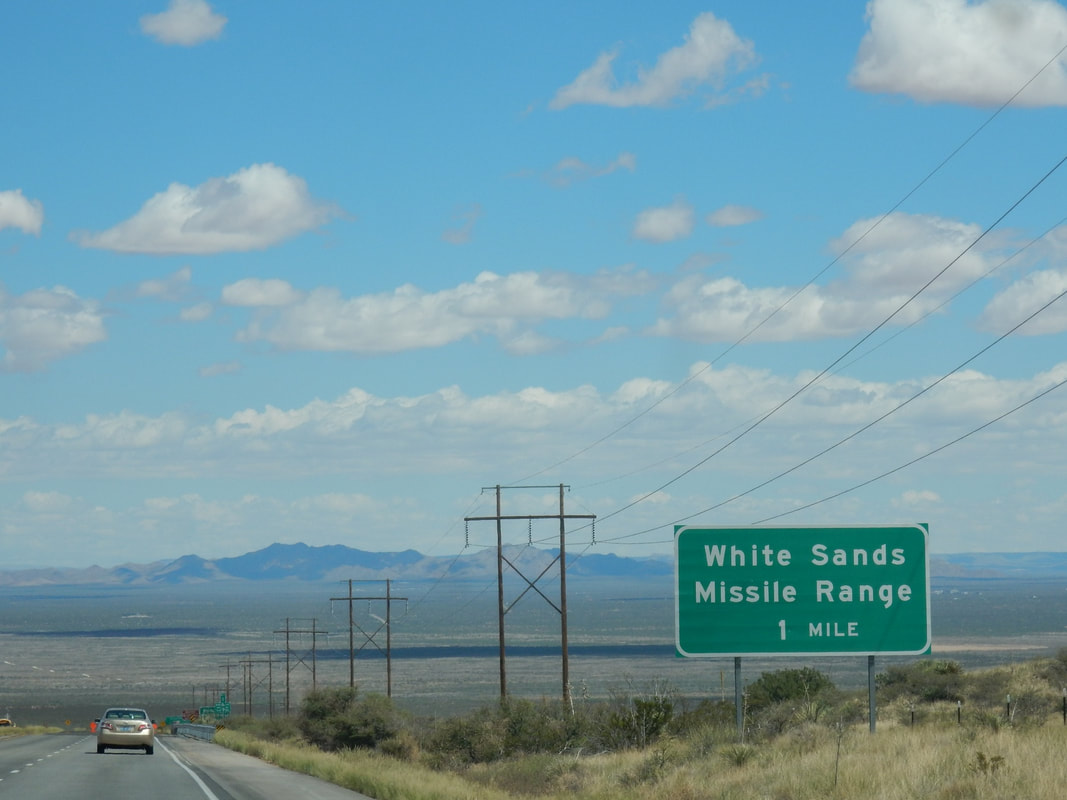
Tucson to White Sand National Monument: 4 h 49 min (333.3 mi) via I-10 E
White Sand National Monument to Las Cruces: 53 min (52.3 mi) via US-70 W
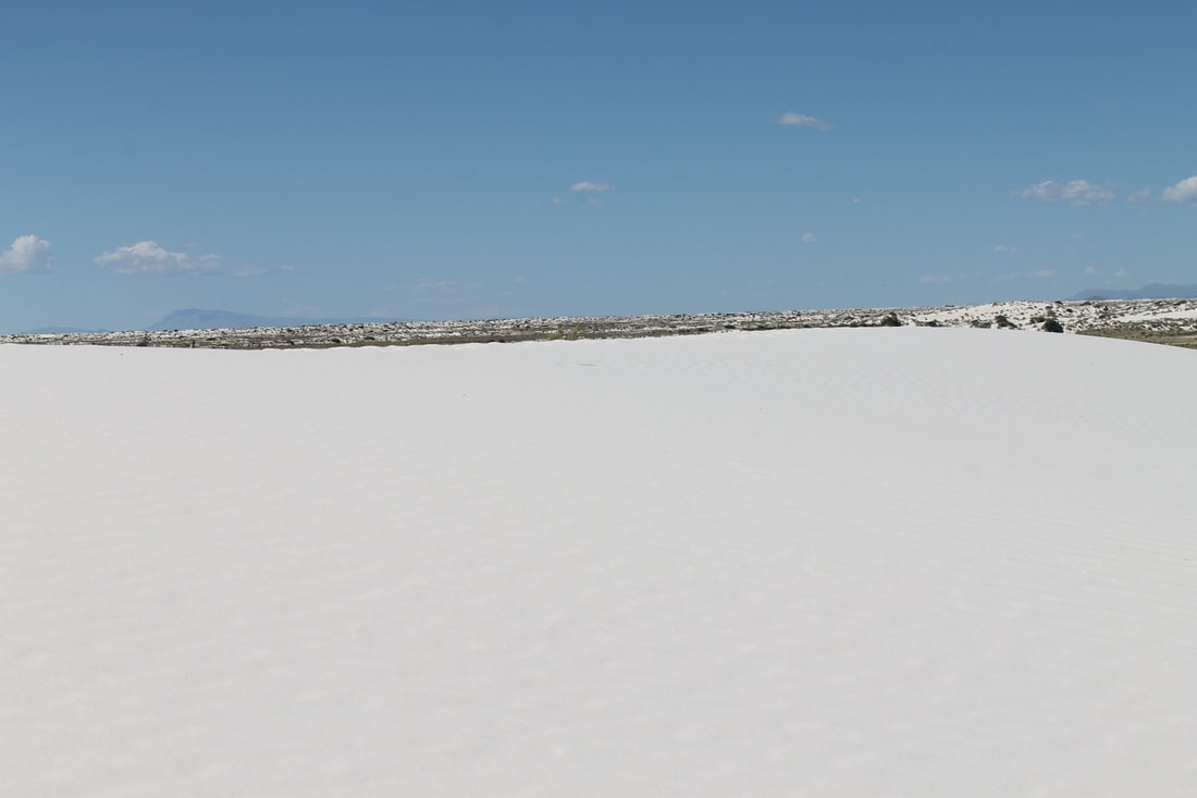
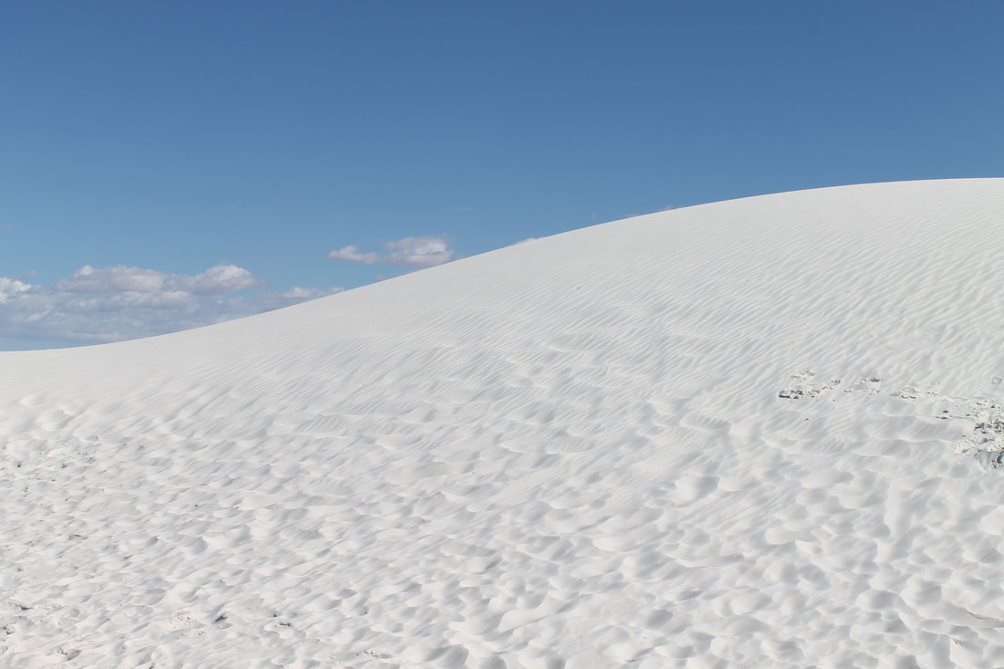
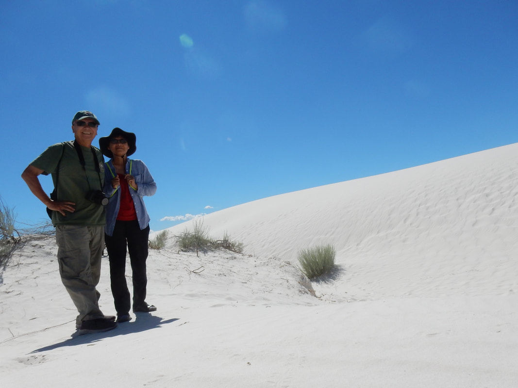
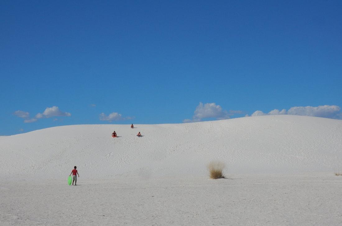
“Like No Place Else on Earth
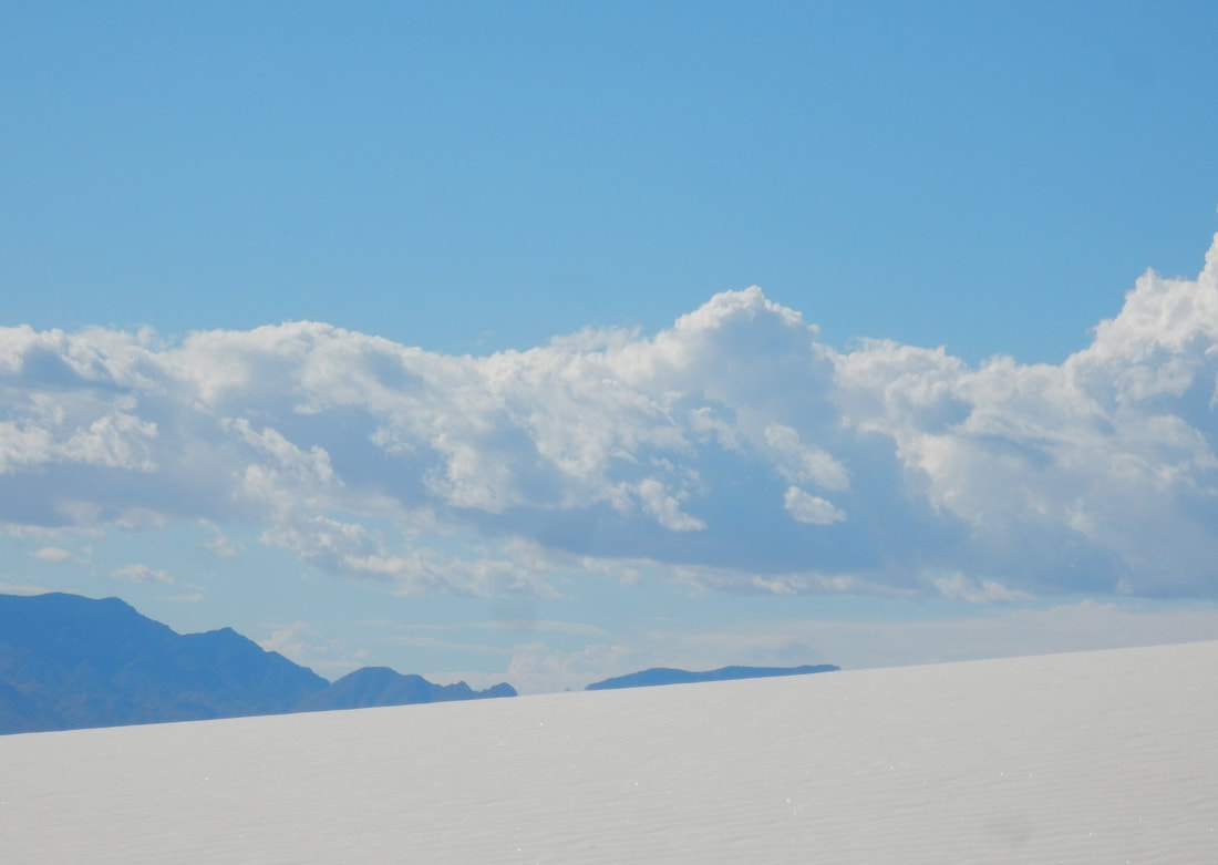
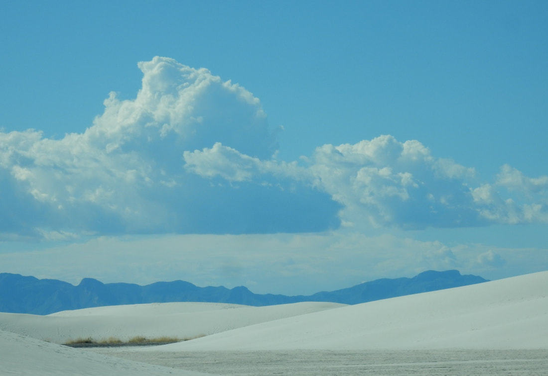
Rising from the heart of the Tularosa Basin is one of the world's great natural wonders - the glistening white sands of New Mexico. Great wave-like dunes of gypsum sand have engulfed 275 square miles of desert, creating the world's largest gypsum dunefield. White Sands National Monument preserves a major portion of this unique dunefield, along with the plants and animals that live here.” NP Website
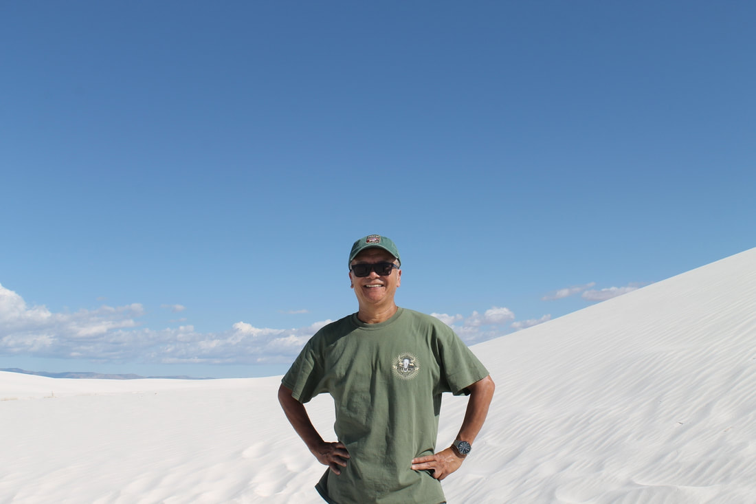
It took us about 5 hrs of driving from Tucson to White Sand National Monument. We got to the monument at around 1 pm. Watched the show about the changing in the ecosystem, then drove out to the sand dune. It was a spectacular place. They should elevate this place to a national park I think.
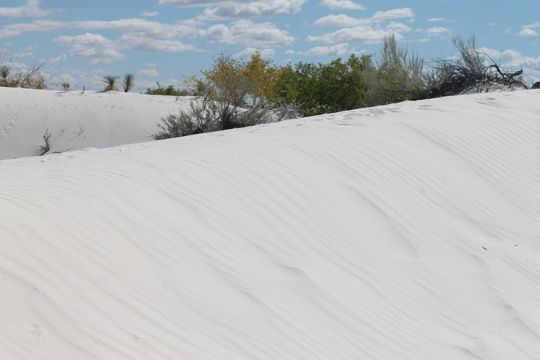
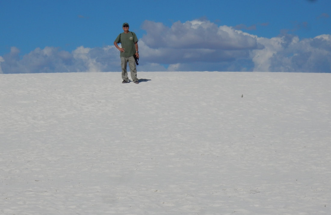
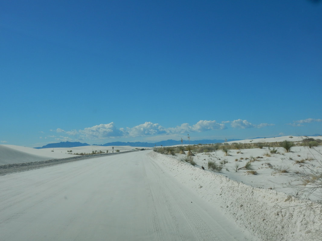
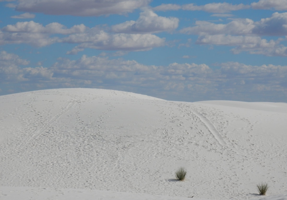
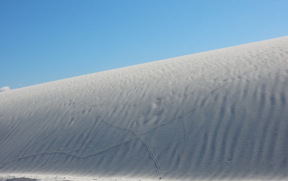
From the visitor center you drive out into the dunes along a paved road, some part was covered by the white gypsum, and evidently, it was clear by road maintenance crew. The blown-over gypsum on the road makes it look like we are on a snowy road, then it appears like snow-plow has been used to clear the road. This place is absolutely stunning.
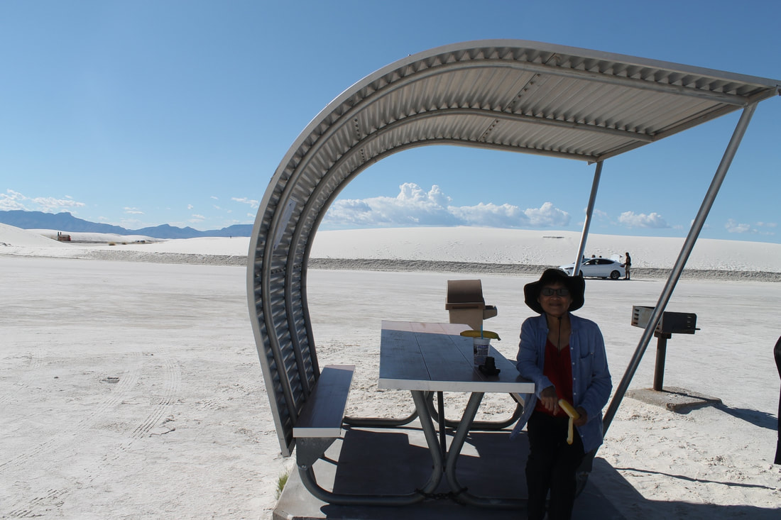
You can hike on or off the sand dunes from the road. It's quite an extraordinary thing to experience. We saw kids sliding down the hill. We had never seen any sand quite this white before. The weather was in the low 80, so the visit was enjoyable. The picnic area has plenty of picnic tables with shades for people to come out here picnicking while kids playing in the sand dunes. The park even has its brochure printed in foreign languages; I guess it’s a popular place for foreigners to visit.
They said sometimes this section of Hwy 70 to the monument is closed due to government testing of bombs, so be sure to check on the road condition.
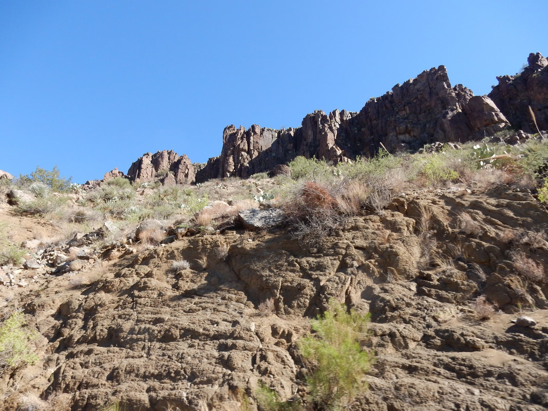
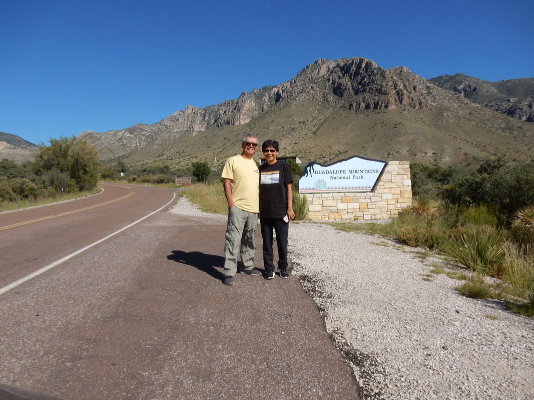
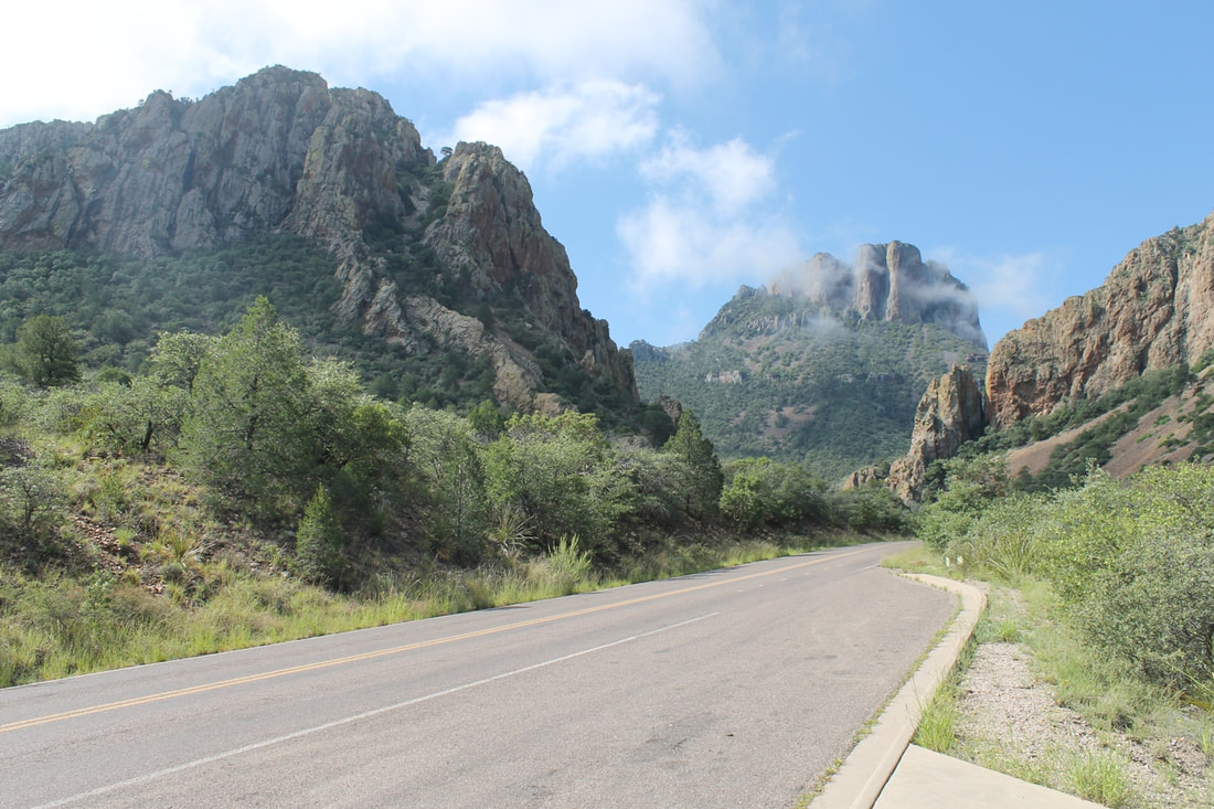
Guadalupe Mountains National Park - Overnight in Alpine, TX
Las Cruces to Guadalupe Mountains NP: 2 h 25min (151.8 mi) via US-180 E/US-62 E
Guadalupe Mountains NP to Alpine, TX: 2 h 32min (163.0 mi) via TX-54 S and US-90 E
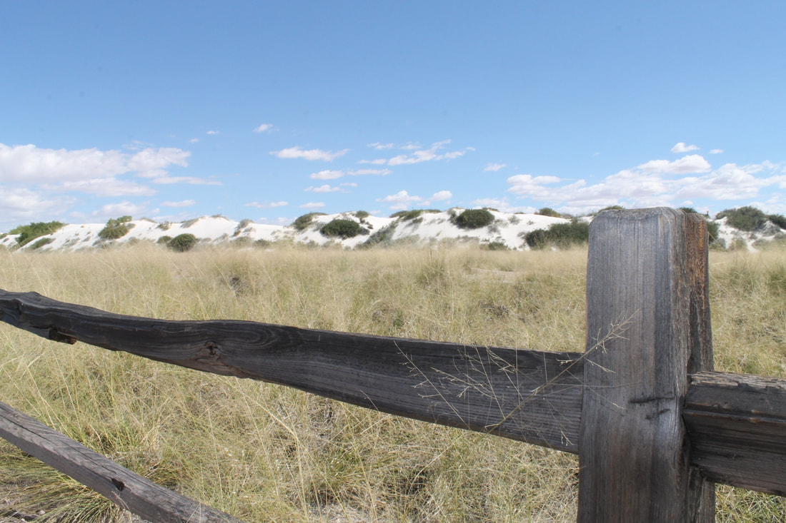
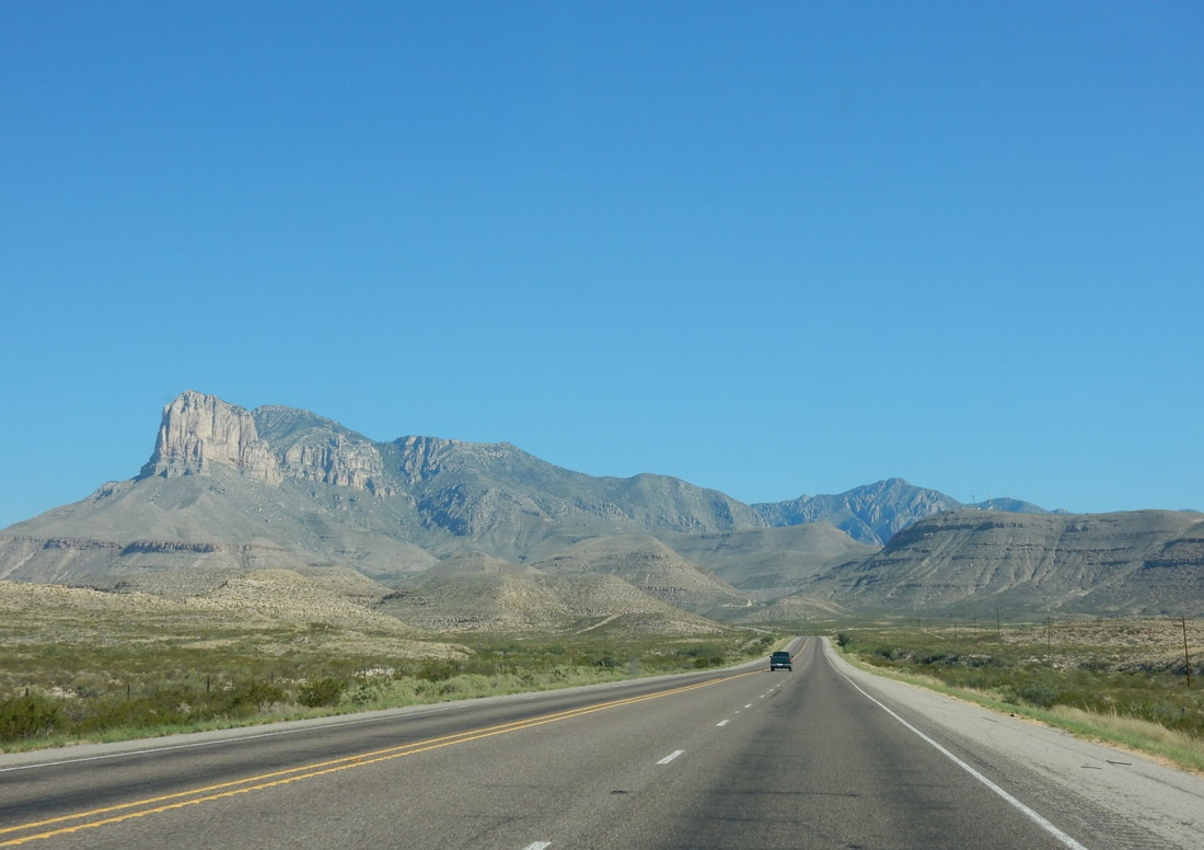
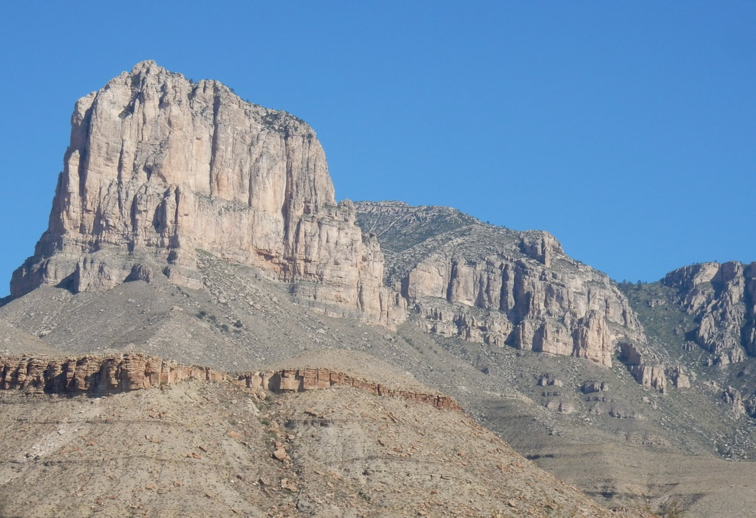
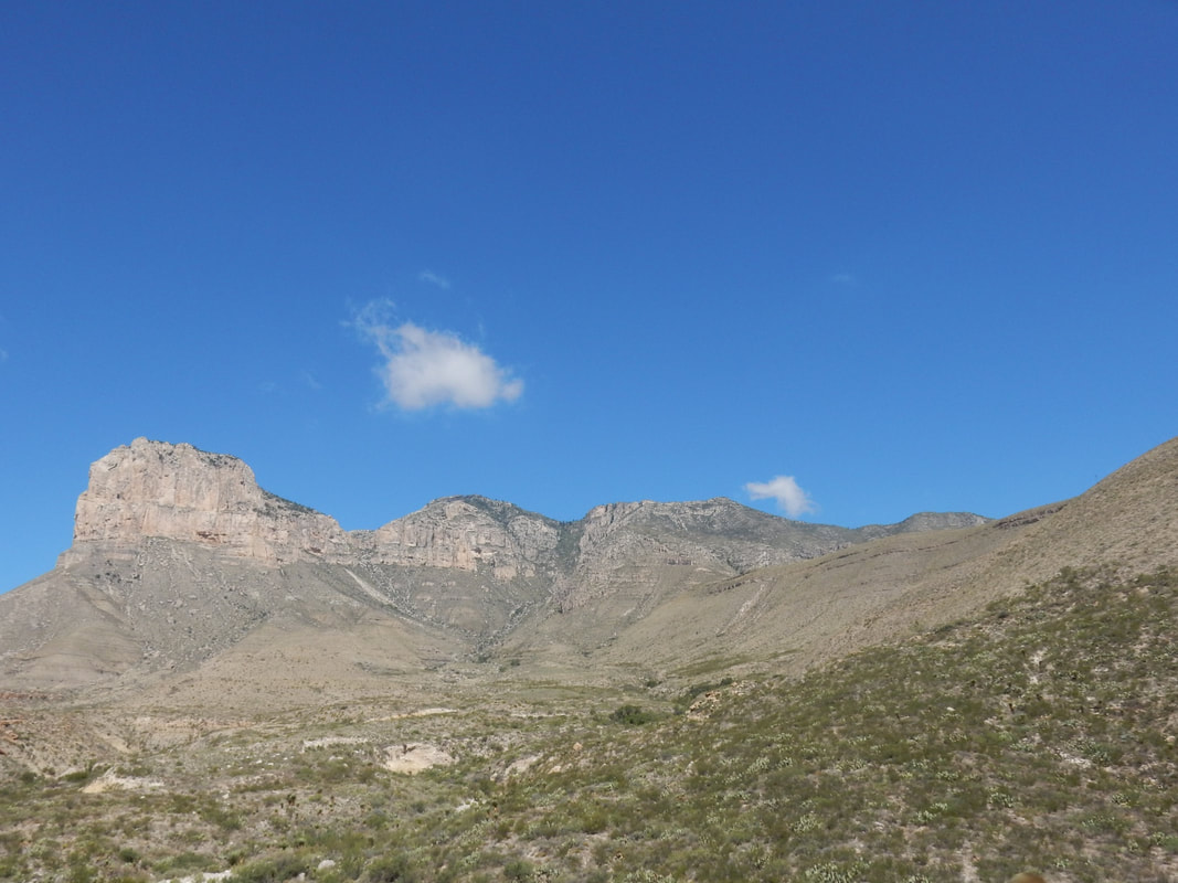
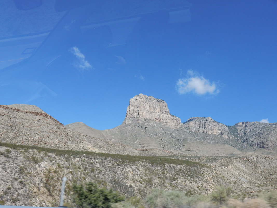
“Guadalupe Mountains National Park is in the vast Chihuahuan Desert of western Texas. It’s known for its bright-white Salt Basin Dunes, wildlife-rich grassland and fossilized reef mountains. The Guadalupe Peak Trail weaves up through a conifer forest to the state’s highest summit, with views of the rocky El Capitan peak to the south. In the north, the McKittrick Canyon Trail is known for its colorful fall foliage.” Wikipedia
It was a scenic drive from Las Cruces to the outskirt of El Paso then on to Guadalupe mountain pass. The looming of El Capital on the south side of the park was impressive. It was a landmark for travelers in the old days. We did a short nature walk in the park. This area used to be a reef in the old ancient seabed, then it got pushed up, thus it has quite diverse plants, some plants that grow here can be found in the area as north as in Canada.
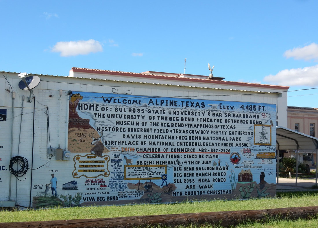
We left the park around noon and had lunch in Van Horn, TX. From here, about an hour and a half of driving put us in the town of Alpine, TX. It’s a nice little town, with some building in the downtown area resemble of towns in Europe, thus some called it Texas Alps. We went to see Big Bend Museum on the Sul Ross State University’s campus, showing artifacts and history of this area. It’s a cute little university on the outskirt of town.
Las Cruces to Guadalupe Mountains NP: 2 h 25min (151.8 mi) via US-180 E/US-62 E
Guadalupe Mountains NP to Alpine, TX: 2 h 32min (163.0 mi) via TX-54 S and US-90 E
“Guadalupe Mountains National Park is in the vast Chihuahuan Desert of western Texas. It’s known for its bright-white Salt Basin Dunes, wildlife-rich grassland and fossilized reef mountains. The Guadalupe Peak Trail weaves up through a conifer forest to the state’s highest summit, with views of the rocky El Capitan peak to the south. In the north, the McKittrick Canyon Trail is known for its colorful fall foliage.” Wikipedia
It was a scenic drive from Las Cruces to the outskirt of El Paso then on to Guadalupe mountain pass. The looming of El Capital on the south side of the park was impressive. It was a landmark for travelers in the old days. We did a short nature walk in the park. This area used to be a reef in the old ancient seabed, then it got pushed up, thus it has quite diverse plants, some plants that grow here can be found in the area as north as in Canada.
We left the park around noon and had lunch in Van Horn, TX. From here, about an hour and a half of driving put us in the town of Alpine, TX. It’s a nice little town, with some building in the downtown area resemble of towns in Europe, thus some called it Texas Alps. We went to see Big Bend Museum on the Sul Ross State University’s campus, showing artifacts and history of this area. It’s a cute little university on the outskirt of town.
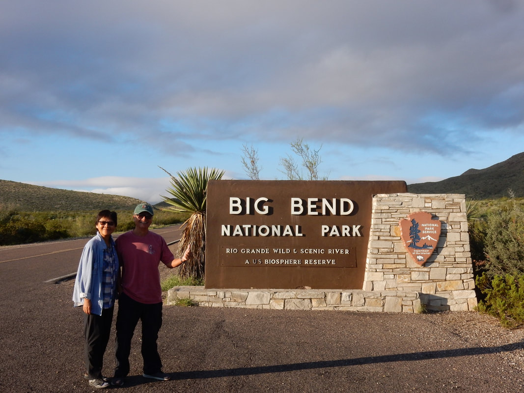
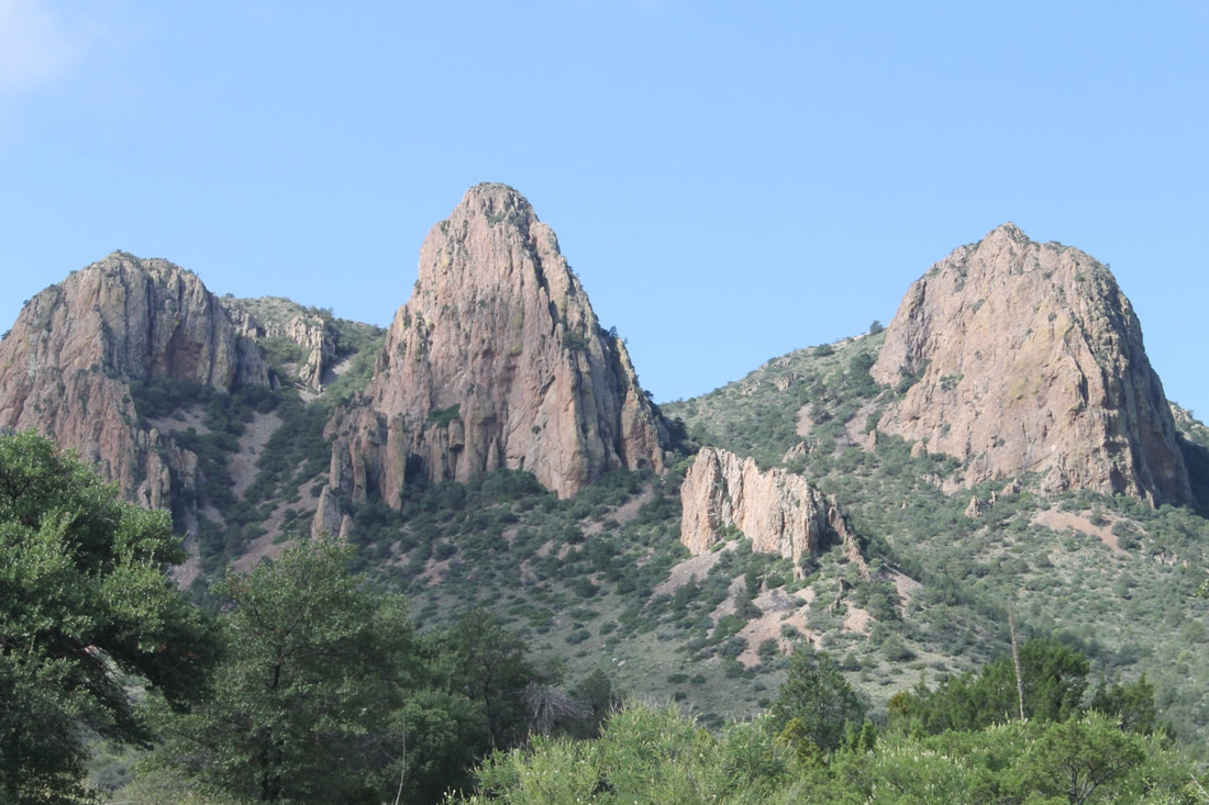
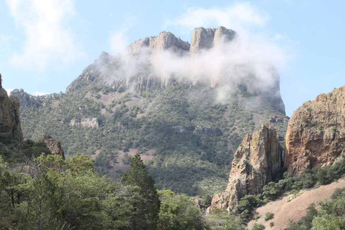
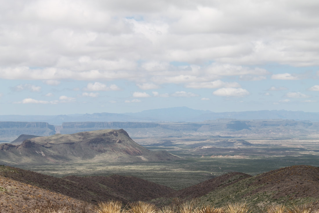
Big Bend National Park - Overnight in Fort Stockton, TX
Alpine, TX to Big Bend National Park: 1 h 11min (72.1 mi) via US-90 E and US-385 S
Big Bend National Park to Fort Stockton, TX: 1 h 32min (99.2 mi) via US-385 N
“Splendid Isolation, the Big Bend...
There is a place in Far West Texas where night skies are dark as coal and rivers carve temple-like canyons in ancient limestone. Here, at the end of the road, hundreds of bird species take refuge in a solitary mountain range surrounded by weather-beaten desert. Tenacious cactus bloom in sublime southwestern sun, and diversity of species is the best in the country. This magical place is Big Bend...” NP Website
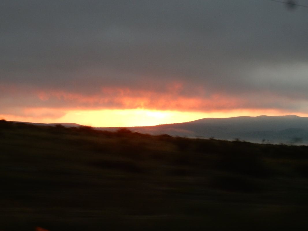
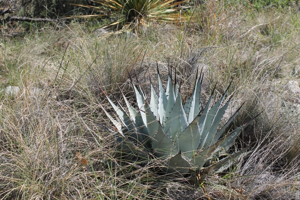
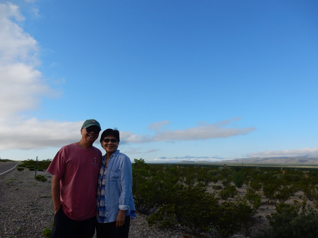
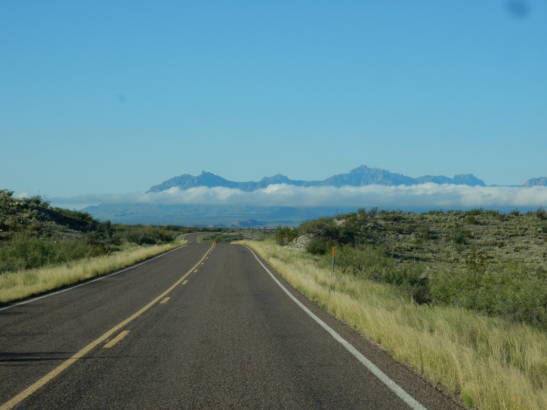
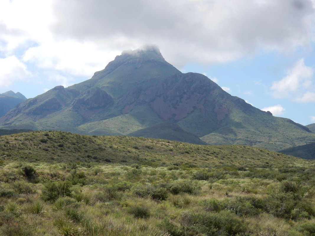
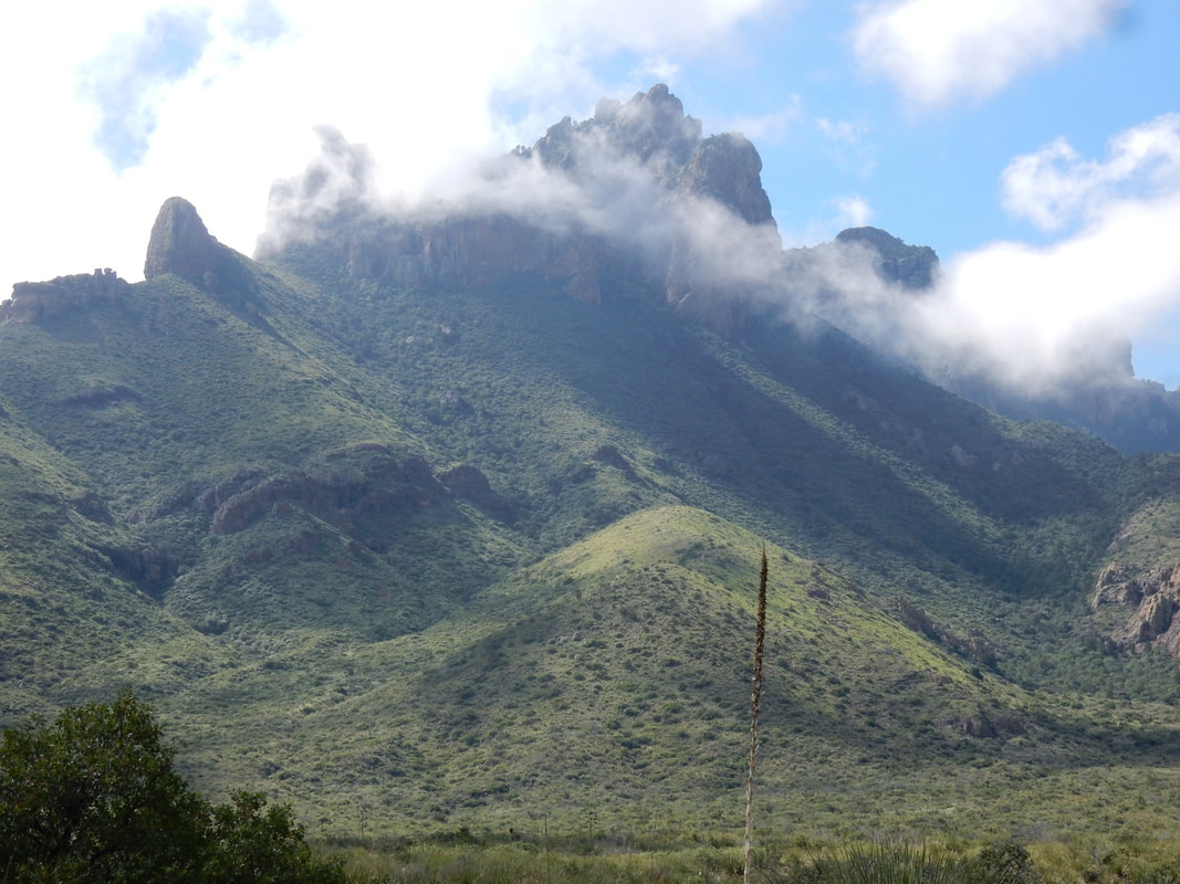
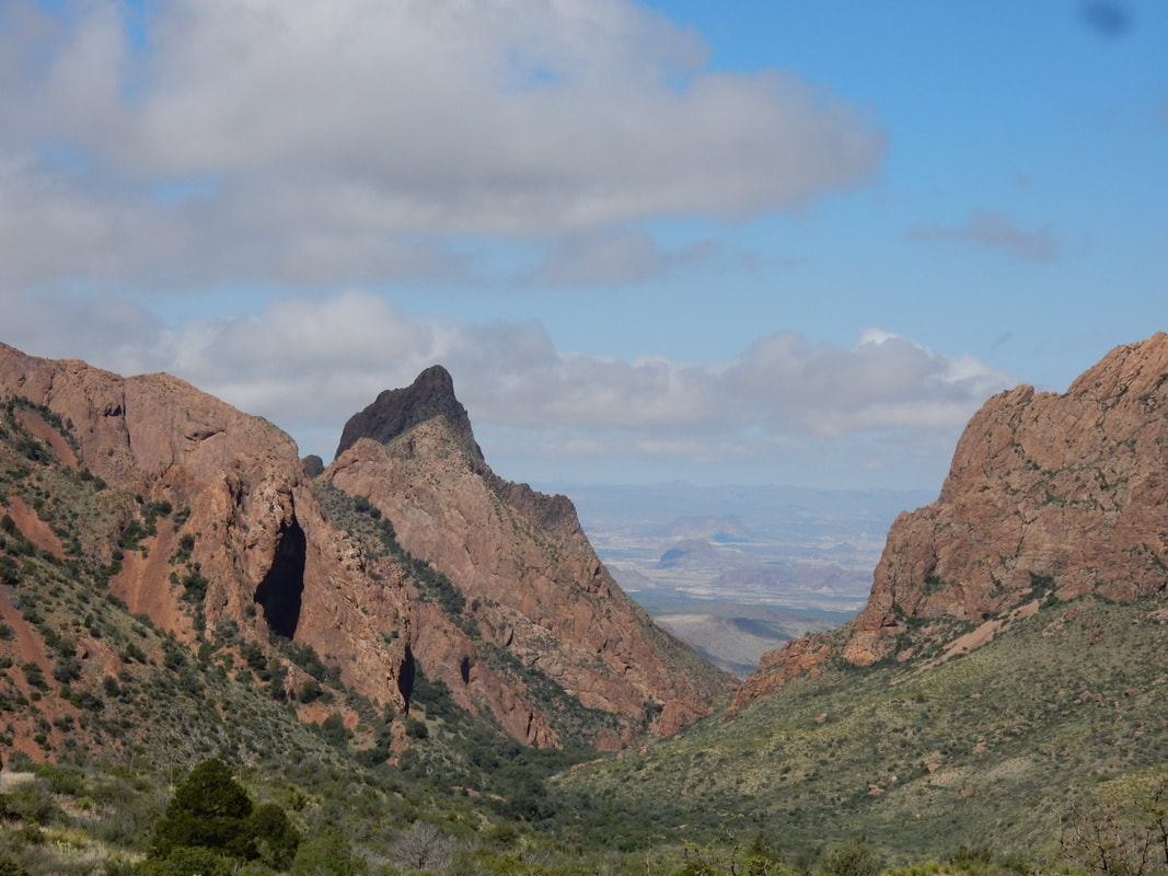
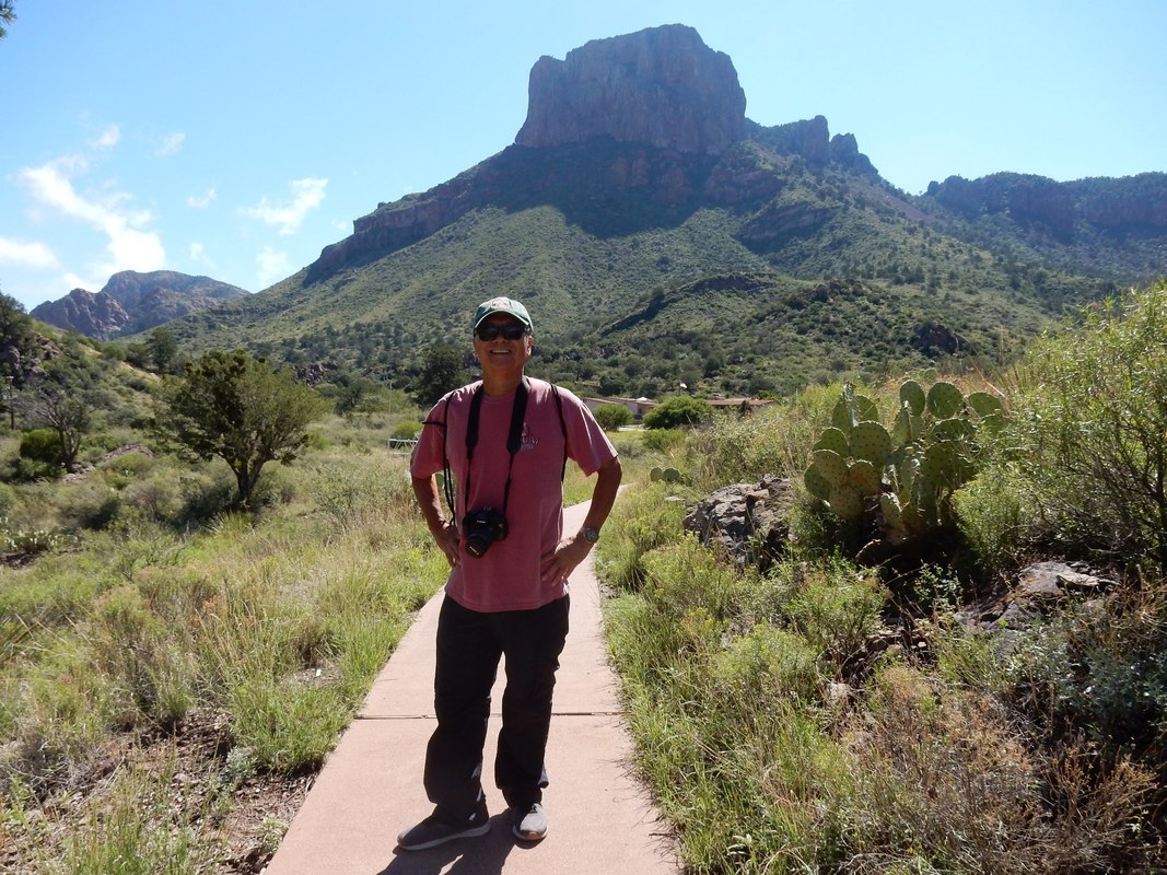
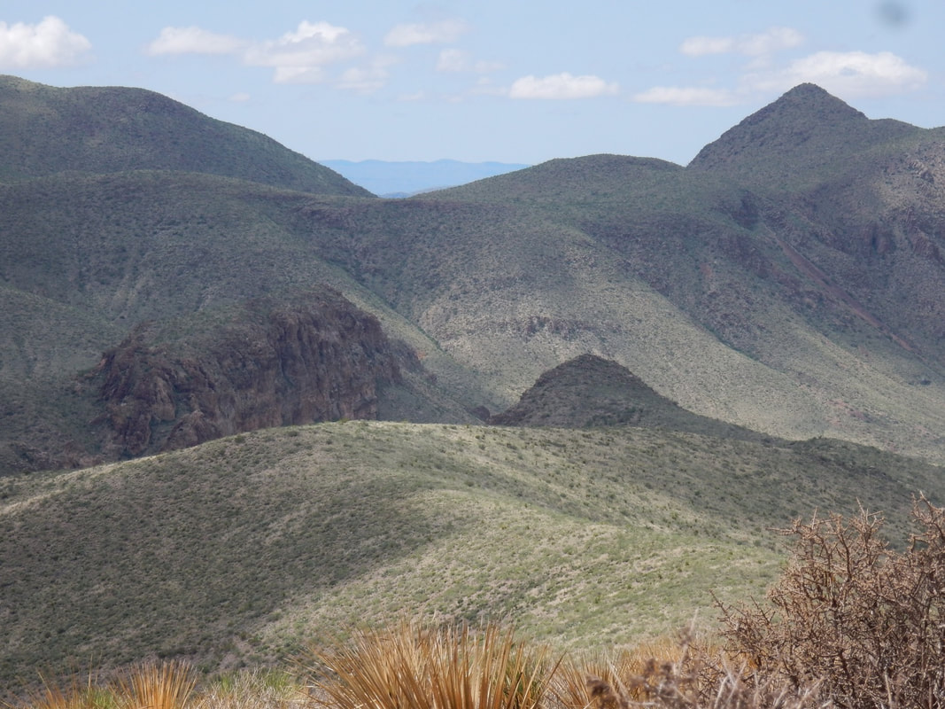
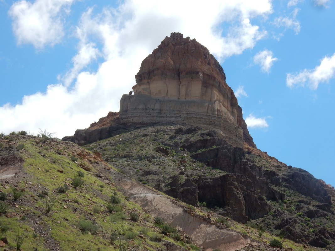
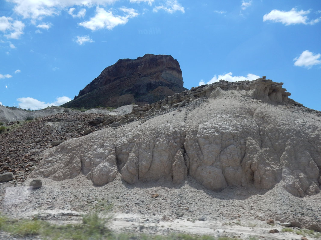
It was a short drive from Alpine to Big Bend National Park this morning, south on US 285. The weather was so nice. The temperature was in the low 60s. The terrain is quite different from other parts of Texas, no wonder they call the area the Texas Alps. On the way to the park’s visitor center, we stopped at the fossil exhibit to see relic of different mammals that were once roaming this part of the country. We stopped at the Panther Creek Visitor Center and joined other park visitors for a ranger talk session about plants in the park. Saw movie about the park then drove to Chisos Basin and did a little hiking in the area. From there we drove to Castolon visitor center along the spectacular Ross Maxwell scenic drive. I did not know that it’s quite mountainous in this part of Texas.
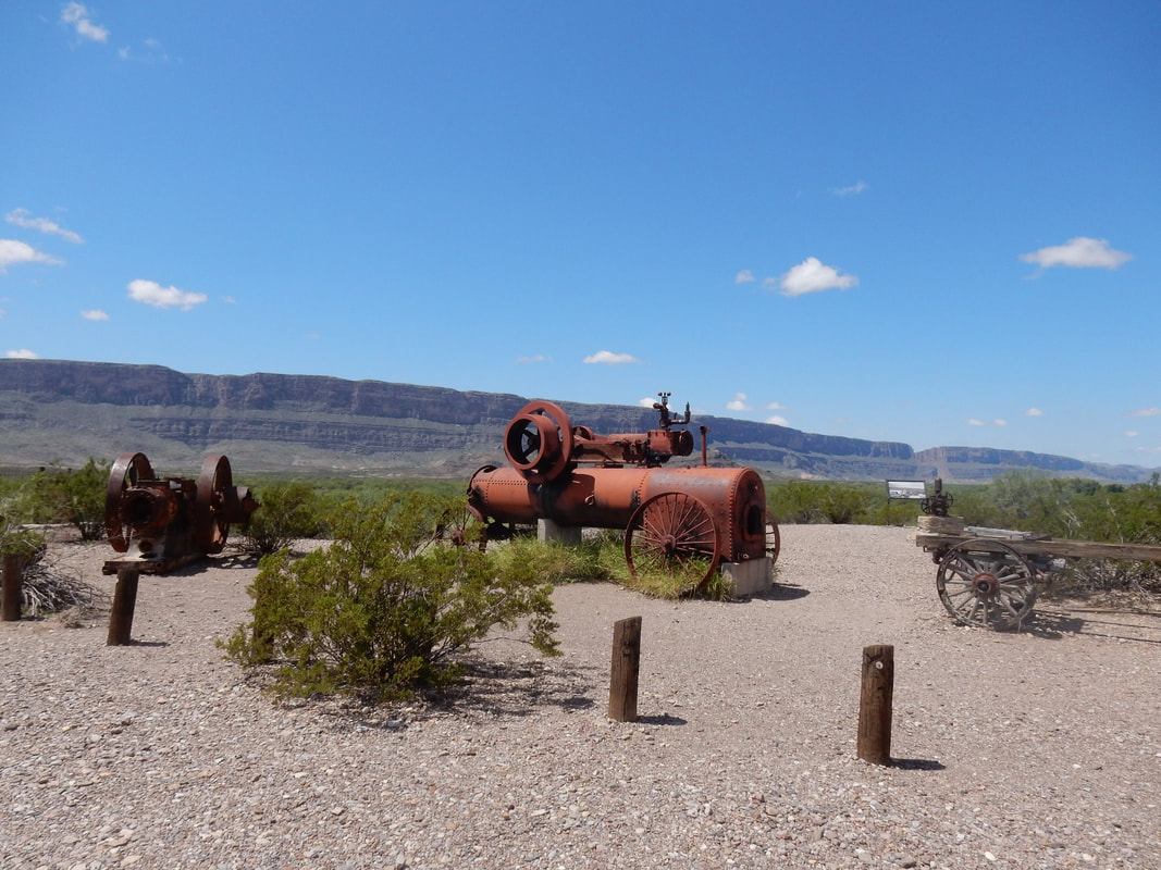
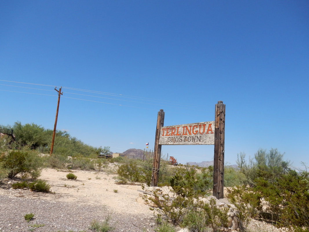
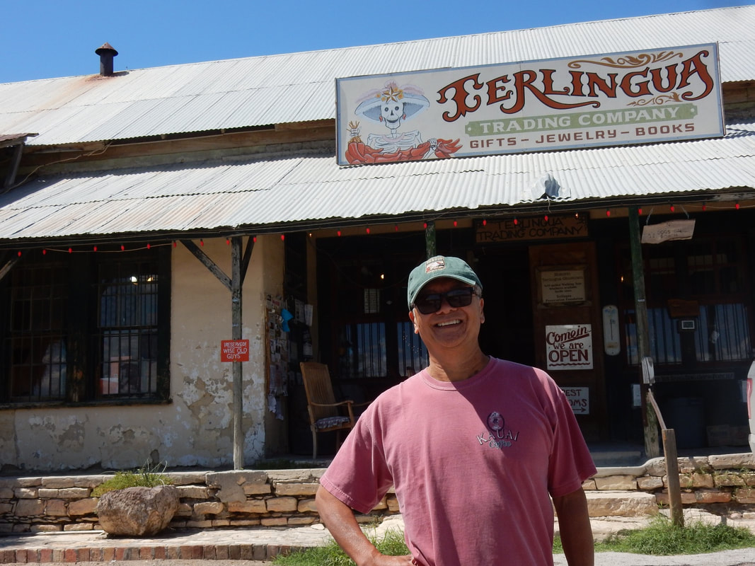
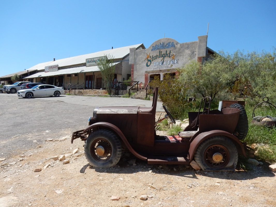
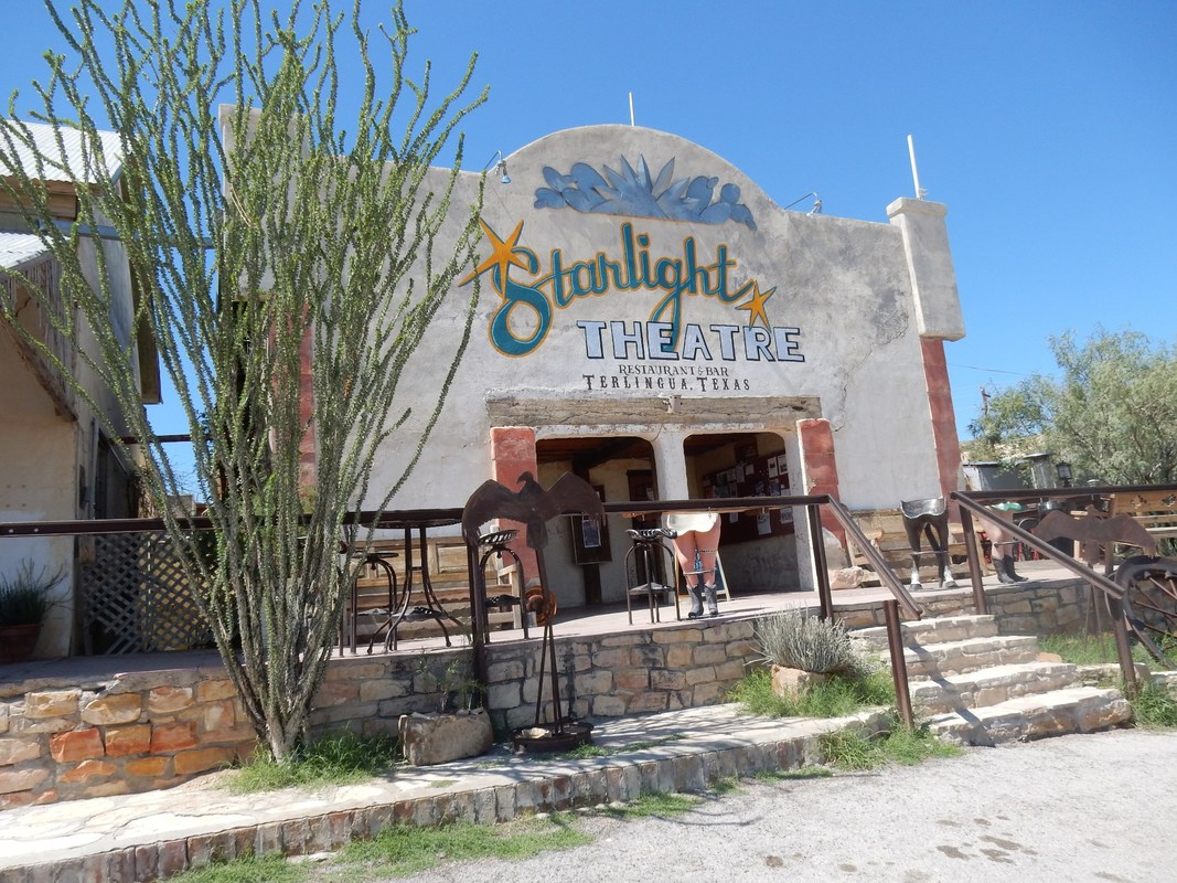
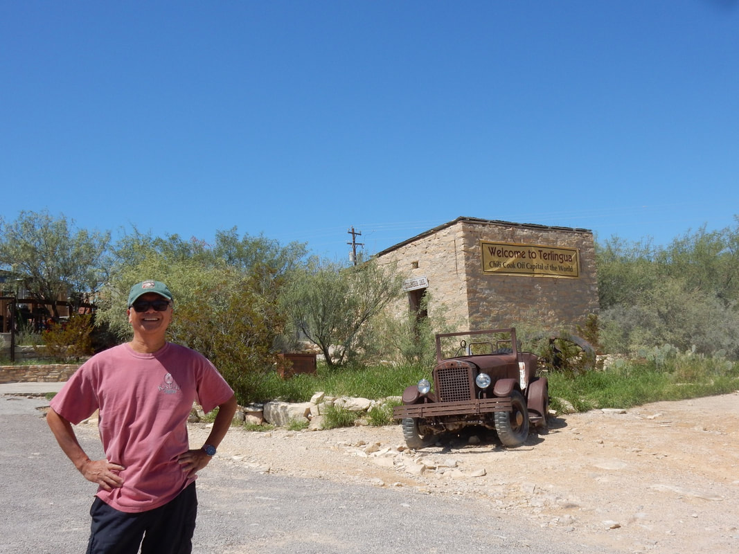
In the afternoon, we visited the Terlingua ghost town, just outside of the park to the west. This used to be a mining town of around 2000 people. After the mercury mine shut down, the town’s residences left looking for work somewhere else, thus it became a ghost town. But now, people started moving back, artists, musicians, free thinkers etc. started to call this town their home again and together they’re rebuiding the town. It was a cool place to visit in this remote part of Texas.
Driving Home
Fort Stockton to Dallas: 6 h 28 min (453.4 mi) via I-20 E
We stayed in Fort Stockton, TX and leisurely driving home the next day. It was quite an awesome trip as it reminded us how much more of the US that we have not seen.
